Videos of the inbound upper ridge and the death of the North Pacific High then its rebirth next Friday.
by Mike Godsey, mike@iwindsurf.com
The next couple of days as you enjoy the warmth you will be reading forecast text about the heat producing upper ridge and the lack of a North Pacific High and its NW
wind. So to help you understand what will be weakening our wind let’s look at some satellite imagery first.
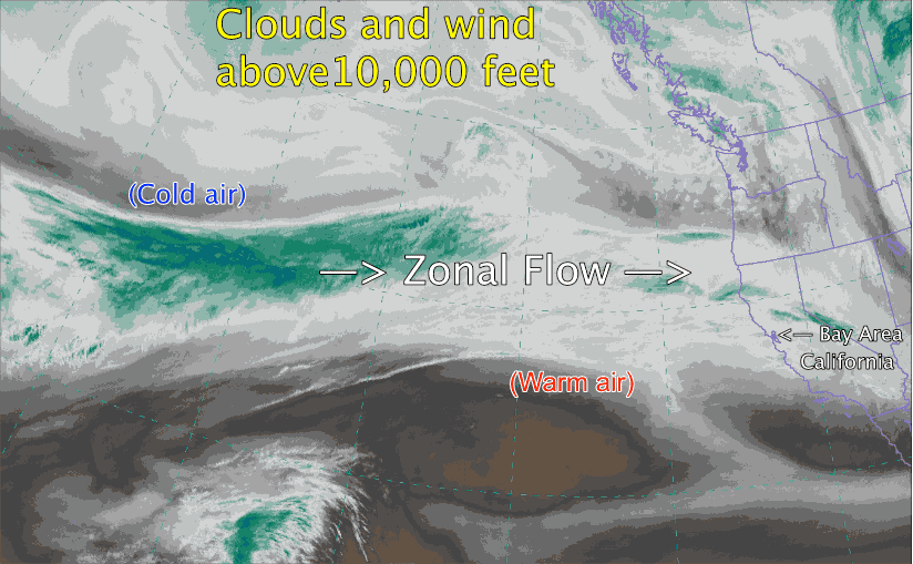
This first video is for the water vapor satellite image which shows the clouds and water vapor above 10,000 ft. It is useful because it allows us to visualize the wind and upper trough and upper ridges at about ≈ 18,000 ft. feet that guide the surface low and high pressure.
First get oriented by finding California and the Bay Area.
Now notice that at the beginning of the video notice that the upper level winds flow almost as a straight line from West to East. This is caused “Zonal” flow and really does not bring any major change in the surface weather. Notice over the next 24 hours how the upper level wind flow loops northward just west of California. This loop ofwarm air is called an “Upper Ridge” in this area is warm descending air.
As this Upper Ridge travels eastward it will settle over the west coast. This warm dry air brings on a heat wave and the surface air heats and expands. Which means that at the surface the Central Valley thermal low expands over the coast so the SFO-SAC pressure gradient fades to near zero. So the Bay Area loses its famous thermal winds to the Central Valley.
At the surface the upper ridge also allows the surface North Pacific High to move into the Pacific Northwest and far Northern California. This causes the ocean NW winds to turn NNW to even NNE so the Bay Area coast is in a wind shadow and we loose NW ocean wind part of our wind machine. But by Wednesday the upper ridge is so
strong that the North Pacific High totally moves inland where all the resistance of the mountains causes the NPH to break apart and fade away.
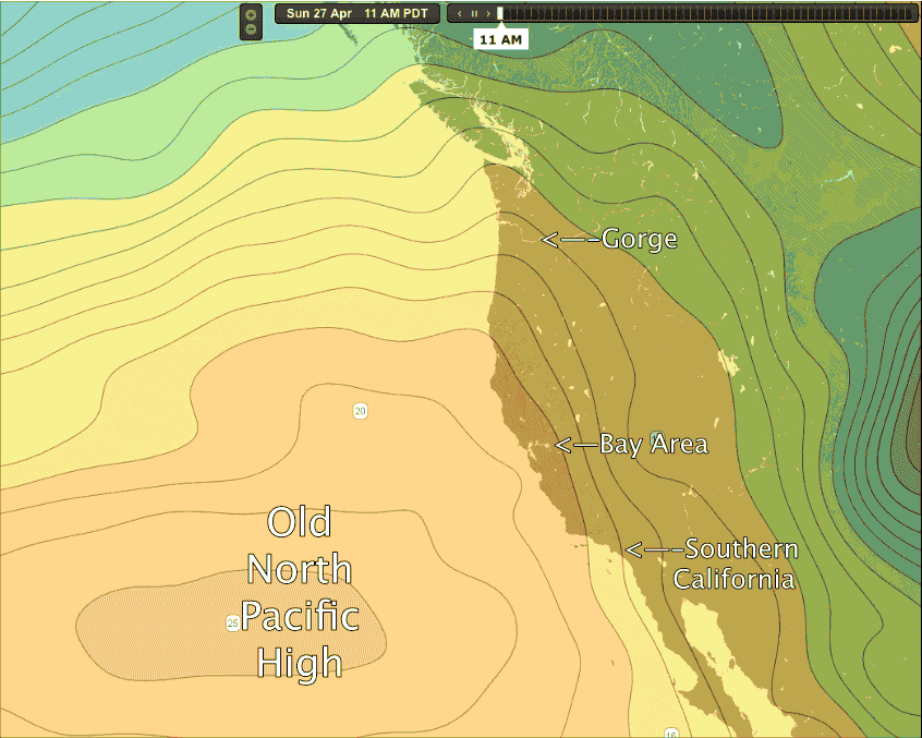
The second video is complex and you will have to watch it several times to get a handle on what you are seeing. Notice the “Old North Pacific High” It is what is creating the Southern California and Bay Area winds Monday April 28. Far above the North Pacific High the Upper ridge is moving over the west coast. In response you can see in the video the NPH pushes an extension or surface ridge into Pacific Northwest and over the Gorge. This creates dry warm weather there. But notice how the NPH’s isobars pull away from the California coast so our NW wind fades away. Watch as the NPH disappears over the Pacific Northwest.
Now notice the tightly wound isobars of the surface storm. It does not impact our wind but behind it, north of Hawaii, watch as a new North Pacific High slides in south of the storm and takes bead at the California coast. This means NW winds ramp up this coming Friday. So far these winds do not look powerful but we should see at least upper teens to low 20’s.