Marine layer deepens, SW flow increases and Sherman Island sees AM winds.
by Mike Godsey, mike at iwindsurf.com
In this video animation from the GFS model the imagery switches back and forth from the weak surface winds to the powerful 500mb wind of an 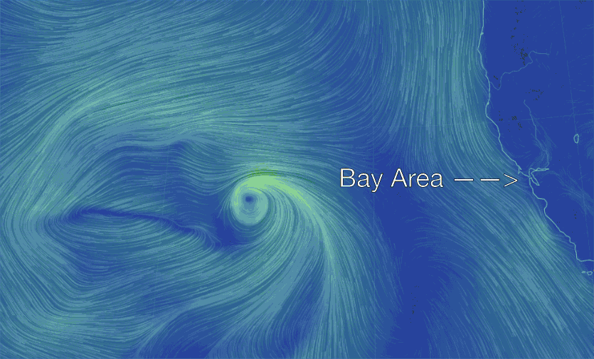 upper trough at ≈ 18,000 ft.
Looking at the weaker surface winds notice the small storm and its counter-clockwise spinning wind way out in the Pacific. Then note the weak NW winds of the North Pacific High along the Northern California coast.
In the second image note the much stronger winds of the upper trough and the upper low that are moving eastward towards California. The lower pressure aloft associated with this upper trough/low will allow the marine layer clouds to thicken while promoting SW onshore flow over Northern California. Both of these events are favorable for good Sherman Island AM winds.