by Meteorologist, Kerry Challoner Anderson

The much anticipated first major Santa Ana wind event has begun. Strong offshore winds are typical at this time each year when cold Arctic High-pressure systems move into the Great Basin. This event is very strong. The Tonopah to Los Angeles gradients dropped this morning to -15mb and stays this low through Friday morning. However, this event is getting more media attention due to the anticipated pre-planned power outages to lower the risk of wildfires. Last year’s wetter than normal winter brought stunningly green and lush foliage to the area in May. But that beauty has now turned to be a potential fire hazard after our long dry summer. Adding to the concern is just how low the relative humidity falls when the air descends from the Great Basin and dries due to compressional heating. Overnight the dewpoint at Opal Mountain sunk from 30 F to – 19 F leaving the relative humidity at an ultra-low 3%.
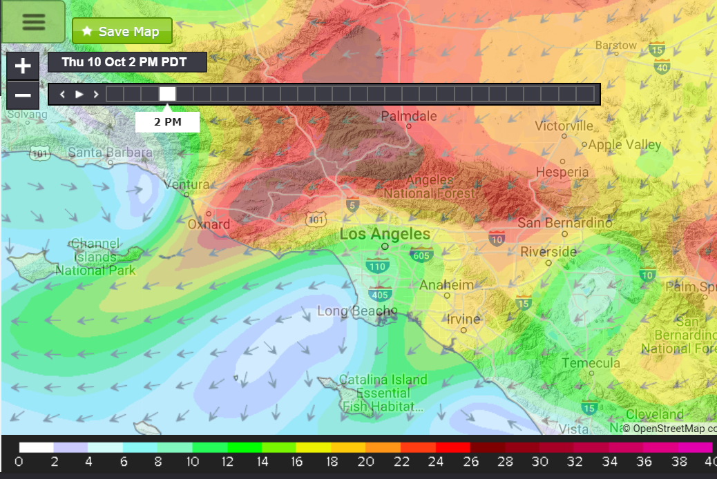
While we usually focus the attention of our models on the interaction with the ocean you will find that you can use Weatherflow’s Wf-Wrf model to help follow the winds. We watch how this model performs carefully to see how it responds to different weather scenarios and our modeling team dials in the forecasting parameters to fine-tune the model for the area. The Wf-Wrf is run on both a 3 km and a smaller version on a 1 km grid. The smaller grid allows us to forecast finer features which is vital in an area with such varied topography. It is interesting to see how vital this finer grid is when forecasting events such as this. The 12km Nam model (below) gives the general location of the strongest winds beginning first through Palmdale and finding their way through the Oxnard Plain.
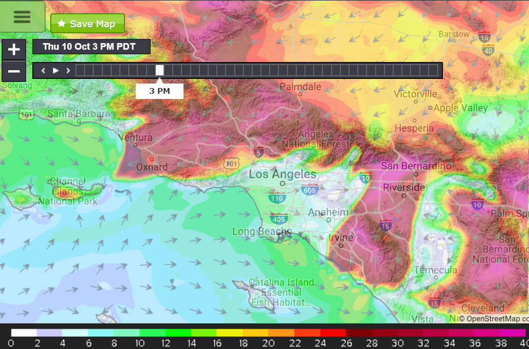
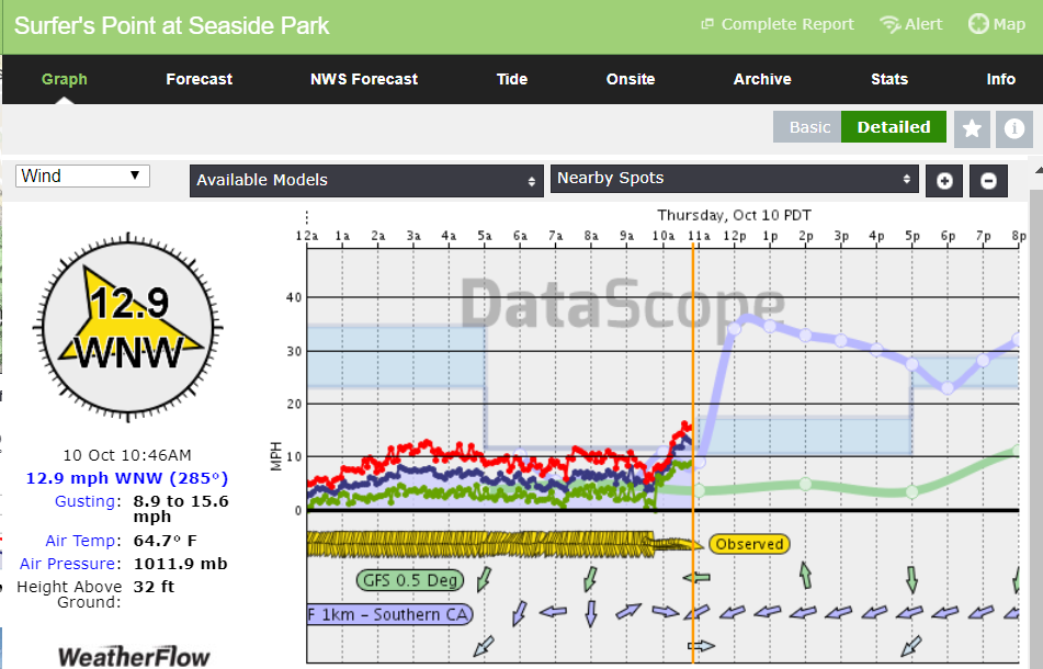
But you can see that the Wf-Wrf forecast (above) for the same time gives greater detail of the location timing and speed of the winds. It also shows the response at the beaches. These offshore events are particularly difficult to forecast. You will find us using the phrase “battle between the offshore wind and the ocean winds”. Due to the topography of the mountains coming right to the shoreline and the canyons that funnel and speed up the offshore winds we can see the winds curve back onshore. We also find that the valleys warm and sea breezes set up where the mountains shelter the beaches. Consequently the beach winds will have extreme Up and Down conditions that can be hazardous. Surfer’s Point in Ventura is just one example. You can see that despite 30 – 40 kt winds driving down the Oxnard Plain, Surfer’s still had an onshore wind in the model, though the model predicts that won’t last. We will be keeping close tabs on all the beaches and also the valleys and canyons through this event. You can use the Wf-Wrf and our network of observations to keep track of this event. Stay safe!