By WeatherFlow meteorlogist Shea Gibson.
There is a bit of a pre-season area of disturbance to be watching for in the tropical Atlantic basin…
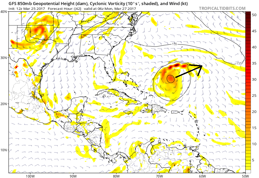
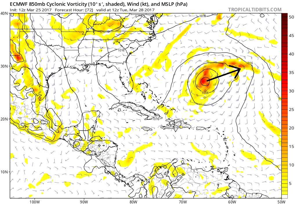
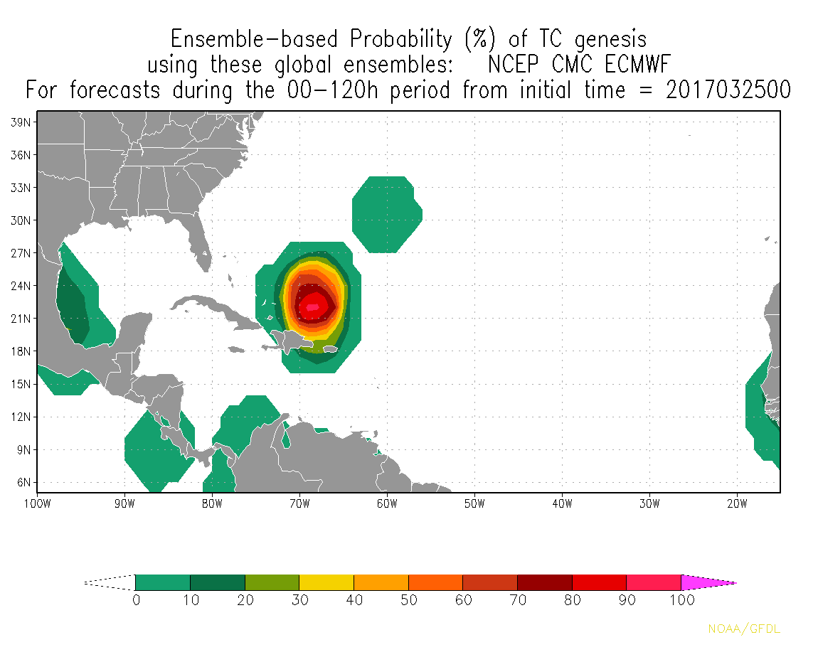
We are watching this area for Sunday through Tuesday in the western Atlantic as models are coming into more and more agreement for possible tropical activity. The area in question has a good chance at becoming a surface Low feature over warm waters, but looks to eventually move over cooler waters. This would give it a subtropical signature as the surface low develops and heads NE/ENE in time. Either way, the SE coastal region may get a small bump in swell heights and Bermuda should watch for moderate to fresh gales.
GFS forecast for Monday at 2AM.
ECMWF (Euro) forecast for Tues 8AM EDT (12PM UTC)
Cheers,
Shea Gibson
WeatherFlow Meteorologist/Wind Forecaster
Outreach & New Station Projects
SE Region/East Coast
Twitter: @WeatherFlowCHAS
Sources: NASA Sport SST, Tropical Tidbits, Hurricane Forecast Improvement Program- NOAA