Hi Mike
Hi Mike,
“The extended forecast for saturday is saying “waddell low teens”.
“Yet the computer generated AND the NWS both are showing 20+ (for October 22)”
I seem to have to use the NWS instead of the “in person” (extended forecasts) for Waddell. Of course the NWS shows winds “out at sea” and the real trick is – will those winds reach the coast or not – that is where the meteorologist could fill in the gap – but they seem to leave out an accurate the coast forecast most of the time.
You are right that there is usually one a brief mention of Waddell in the Extended forecast. This also true for all the other sites. We do this because there are no high resolution models 2-3 days out and models are increasingly inaccurate more days out. So giving a lot of forecast detail about something that is very iffy does not make sense.
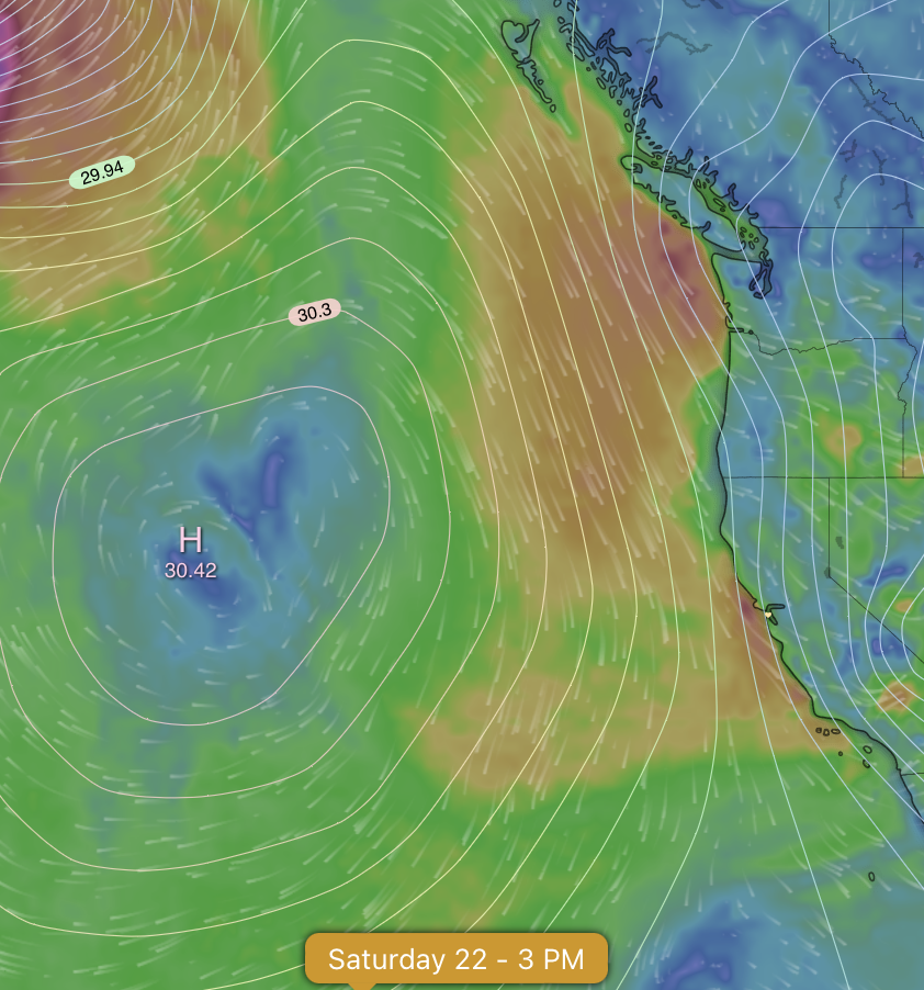
Saturday October. 22, the day you mention, this is especially an issue as you can see in the image below I created of you.
Notice how most models only have weak wind for Waddell on that day while a few have upper-teens to even low 20’s. Why such a huge variation?
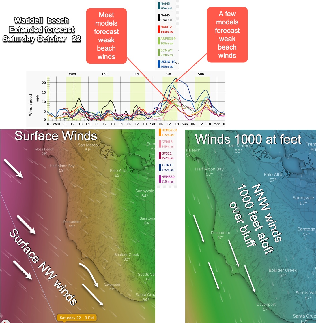
There will definitely be strong NW winds a couple of miles west of Waddell Saturday. This issue is getting those winds to the Waddell beach. Why? 1. There is a weaker pressure gradient to curve those winds to the beach this time of year as the pressure gradient to the interior fades with cooler fall temps. 2. Today, Wednesday, October 19 most models have mild NNW winds just aloft in the Waddell area and most of the Bay Area.
As you can see in my graphic these NNW winds just aloft tend to push the NW surface wind away from Waddell beach. Typically these NNW winds aloft fade mid afternoon but this late in the year that may not happen.
So I decided to go with the model consensus of only low-teens winds. Why? I have learned that hard way that when you forecast strong winds in advance and they fail to arrive people are pissed at your fail.
But if your forecast is for mild winds 3 days out but you then forecast even stronger wind as the day approaches they love that.
Normally I would have put in a warning like CHANCE STRONGER in the extended forecast but since it is for 3 days out and the models are iffy I will save that for tomorrow’s extended forecast if things look more promising.
Hope this gives you some insight into the work that goes behind those brief few words “Waddell low-teens”
UPDATE: Today, Thursday Oct. 20 it looks like the unfavorable NNW winds aloft do not develop until Oct. 23 so the Waddell forecast is much more optomistic.