Today we are seeing a massive 4000-mile-wide North Pacific High repeating last winter’s pattern.
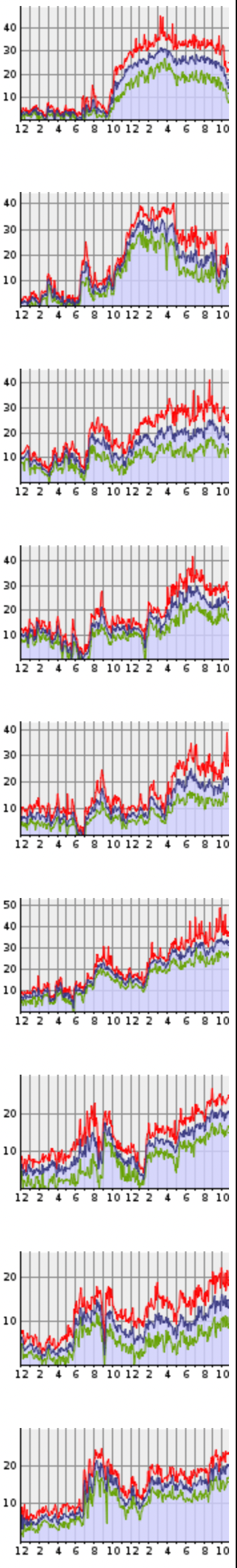
On the right margin is the Southern California wind graphs from Ventura to San Diego’s Silver Strand. What caused these strong NW winds clearing winds in November?
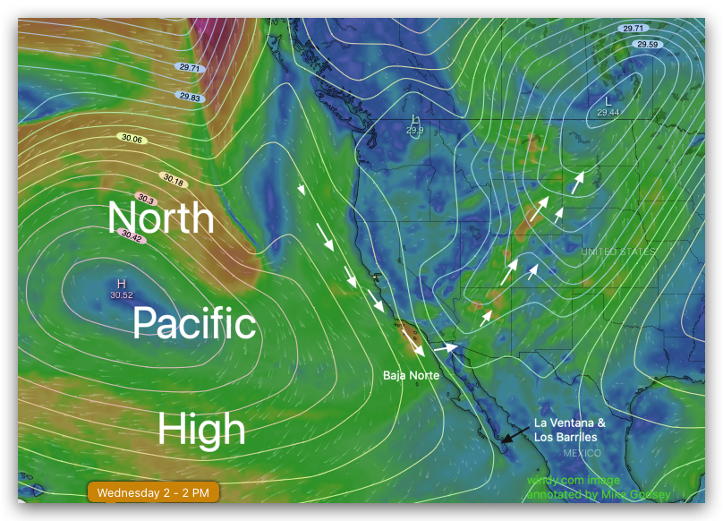
The first map image shows the North Pacific High which is located in a spring-type position centered due west of San Francisco. This weird location is partially due to our triple dip La Nina and partially due longer term changes)
Check out the building NW winds along the west coast. The question is what made those NW winds curve into Southern California so robustly.
Notice the deep low-pressure Great Basin into Canada. This low pressure made those NW ocean winds curve across the Southern California bight to the beaches as they headed over the Southern California Deserts into the Great Basin.
Today I am expecting somewhat milder winds on the Southern California. Why first notice the low pressure south of Cabo. That will divert some of the NW winds towards Baja and the Sea of Cortez.
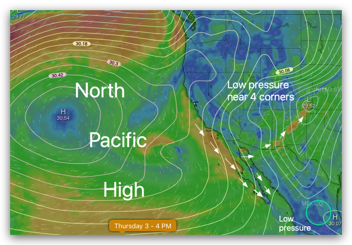
Then notice that extension of the North Pacific High moving into Northern California. That will create N to NE winds over Southern California today that will try to blow some of the ocean winds away from the beaches. I still expect strong Southern California wind but more UP and Down and weaker than yesterdays massive blow. l
Can you see why I am forecasted weak wind for Baja’s East Cape yesterday and stronger winds for today.