The main wind machine for the East Cape wind capitals of Los Barriles and La Ventana are a combo of NNE El Norte winds from the Great Basin + local sea breezes genterated by low pressure in our coastal valleys.
But in La Niña years the North Pacific High frequently moves close enough to Baja that it brings NW winds to the Pacific side of Baja.
And if there is a low pressure trough south of Cabo some of the North Pacific High’s winds come down the Sea of Cortez as NNW winds.
The issue with those winds is that they are slightly side offshore relative to our beaches. This means these winds can be moderate 1000 feet outside but unreliable near shore.
UNLESS, something makes them curve to the beach as NNE winds. And for that to happen we need a good pressure gradient towards the coastal valleys. Which in turn needs blue skies and heating inland.
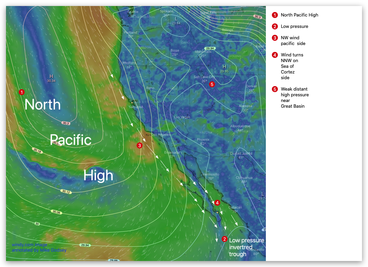
This first graphic shows how the North Pacific High delivers the NW winds to the pacific side and how they turn NNW over the Sea of Cortez
Notice how the North Pacific High’s surface NW winds are blowing down the Pacific side of California and Baja.
Also not how the North Pacific High’s isobars line up over the Sea of Cortez.
Next notice the low pressure trough south of Cabo that turns these NW winds in into NNW winds.
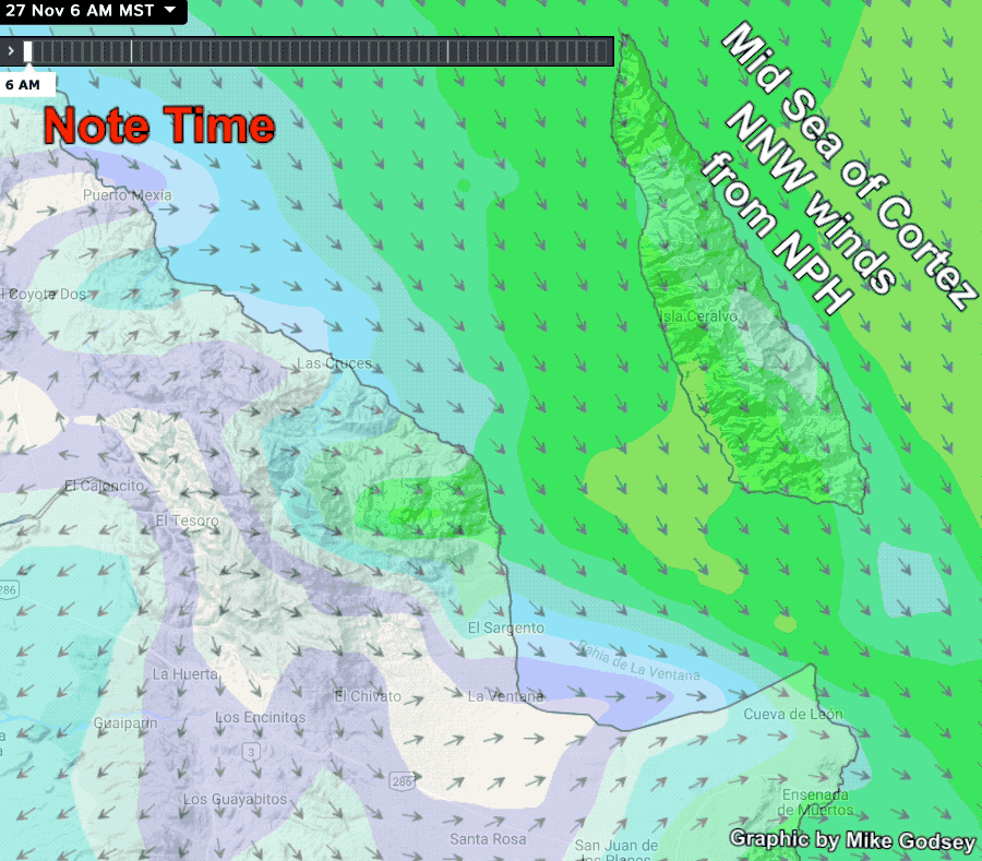
Since these NNW winds are roughly parallel to the rugged coastline it is hard for those winds to reach the beaches.
But as the coastal valleys heat the pressure gradient can curve the NNW winds in to more N to NNE winds that reaches the beaches.
All this depends on the absense of significat clouds over the valley.