Many coastal locations around the world have weak morning land breezes that blow from inland towards the ocean 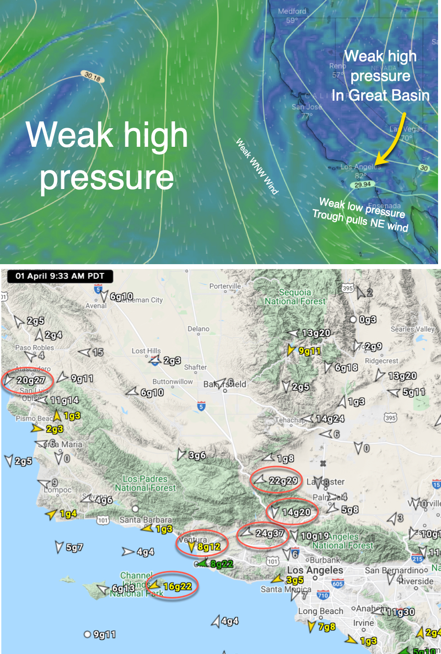 followed by local sea breezes that blow from the sea towards the land. The AM winds are caused by the land cooling overnight making for denser high-pressure air compared the warmer air over the water.
Then as the land quickly heats in the afternoon the air becomes less dense creating low-pressure inland compared to the cooler air over the water so the wind reverses and heads from the ocean towards the land.
But Southern California is unique since this wind reversal is caused by larger-scale events and involves stronger winds.
The first image shows the isobars of a weak high pressure zone west of Southern California.
This high pressure is creating weak WNW winds that accelerate in the AM way offshore as they are attracted by the low-pressure trough near shore.
There is also a high pressure zone over Great Basin and Southern California Deserts and in the AM very strong NE winds develop in Southern California as air flows from that high pressure towards the low-pressure trough.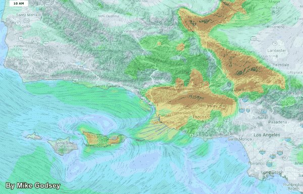
These gusty easterly AM winds are shown in the highlighted sensor readings in the second image. Note how the winds are funneled by the canyons and valleys and even reach the ocean buoys offshore.
All these NE winds heats the inland valleys creating a local low-pressure area and pressure gradient.
As this low-pressure in the inland valleys strengthens it pulls, curves and accelerates the WNW winds into W to WSW wind that reaches some Southern California beaches.
You can see all this happen in this animation.