As we go into the 3rd La Nina winter our hope is that this is a repeat of last year’s epic winds from the North Pacific High. Typically La Nina means poorer winds compared
to a Neutral Year.
But last year the North Pacific High hung closer to Baja’s west coast than normal from whence it delivered NNW winds to Baja’s East Cape. And we had lots of clear days for the valley heating to curve those winds into NNE winds that reached beaches.
Normally most of our wind is NNE winds from high pressure in the Great Basin but who is complaining.
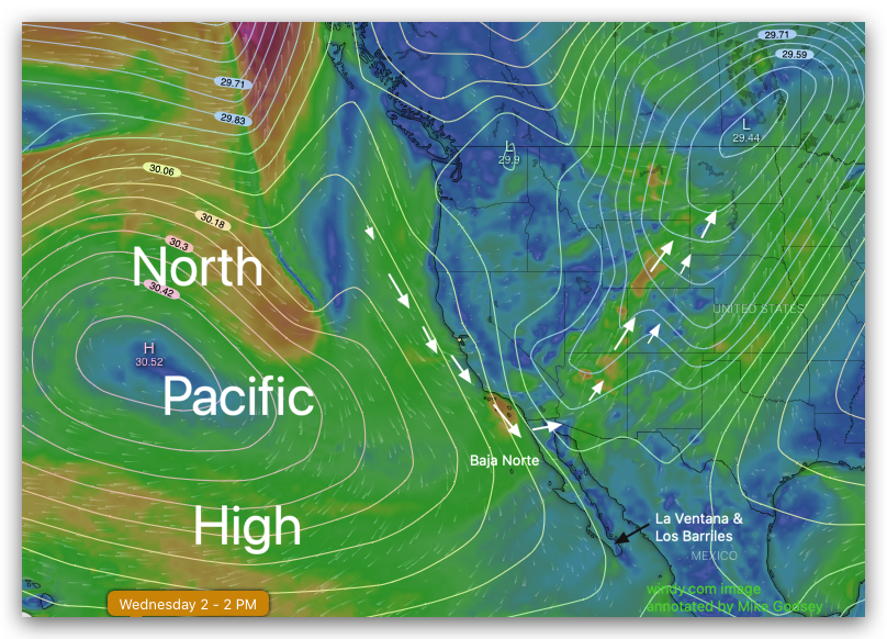
Today we are seeing a massive 4000-mile-wide North Pacific High repeating last winter’s pattern.
Notice
how today’s low pressure in the Great Basin diverts much of the North Pacific High’s surface NW winds.
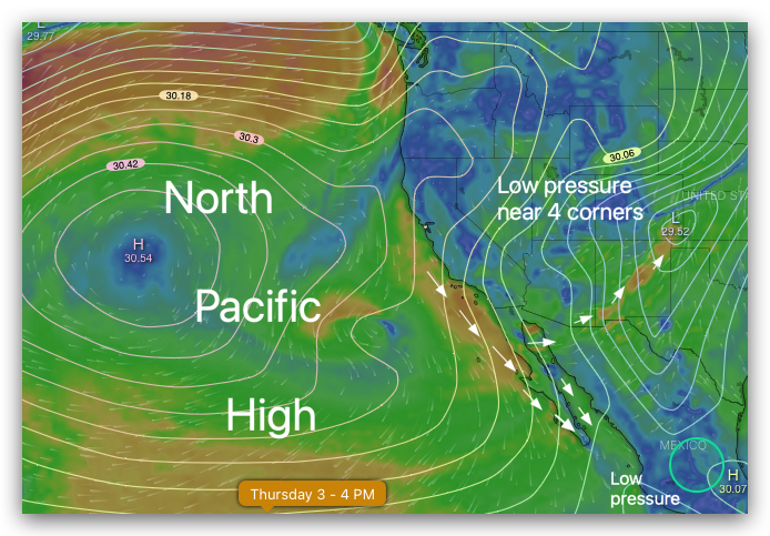
But tomorrow there is enough of a low pressure south of Cabo San Lucas to get some of that northerly
wind into the Sea of Cortez where it should curve to our beaches if we have the expected blue skies.