by Mike Godsey, mikeATiwindsurf.com
Did you notice fast the sky changed today from crystal blue to cloudy? That event is something we have been forecasting for days. Clearly, something is about to happen.
Remember the old days when it seemed that wind was just about the pressure gradient? And while the 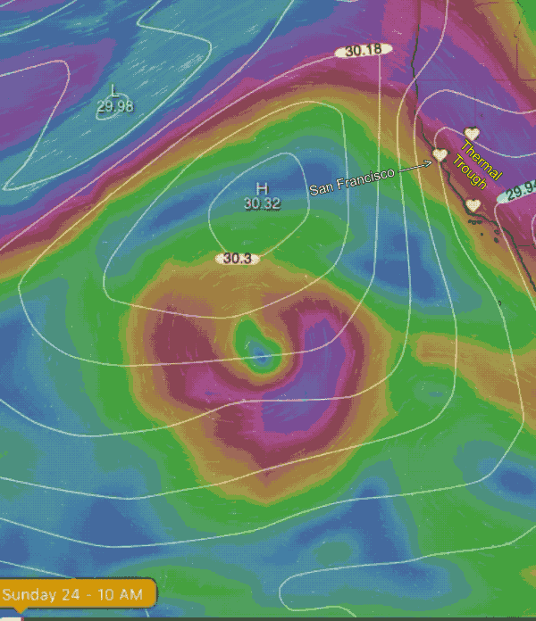 forecasts were crappy more than 12 hours out they were still amazing! We had a clue where it might blow.
Part of the reason extended forecasts have improved is that the models allow us to look further into the future for events that might impact our winds. This blog is about that time of future-gazing.
About a week ago I started watching the Cut-Off Low at ≈ 18,000 ft. between Baja and Hawaii, you see in this animation. The models suggested it would track from that latitude to the California coast and really impact the southerly winds in the San Francisco Bay Area. It also looked like it would really jazz up the Columbia Gorge winds. So I contacted our Gorge forecasters and, no surprise they were already watching this puppy.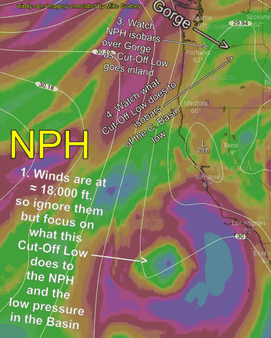
This first animation shows this Cut-Off Low tracking towards California. The colored winds are at ≈ 18,000 ft. but they impact the surface isobar white lines that represent the pressure gradient. The tight isobars you see today, Friday, are creating 30 knots winds in part of the San Francisco Bay Area.
Now, let’s watch that Cut-Off Low to see how it impacts the winds tomorrow Saturday, May 30.
1. Track the Cut-Off Low as it hits the California coast and moves towards the Columbia Basin.
2. Now find the North Pacific High or NPH which is has few isobars near the Gorge Friday.
3. Now watch as the North Pacific High’s surface isobars concentrate over the Gorge increasing the pressure gradient.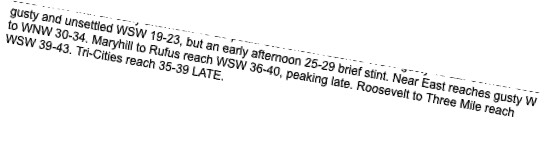
4. Next focus on the isobars out east. As the remains of the Cut-Off Low moves towards Idaho it really deepens the low pressure in the Basin creating an even stronger pressure gradient and wild winds.
Unfortunately, a Off Low is a type of storm and as such, it brings showers and up and down winds. Hence the refrain of GUSTY in the forecast.