Here is satellite and cam imagery from dawn today July 9. The imagery shows the
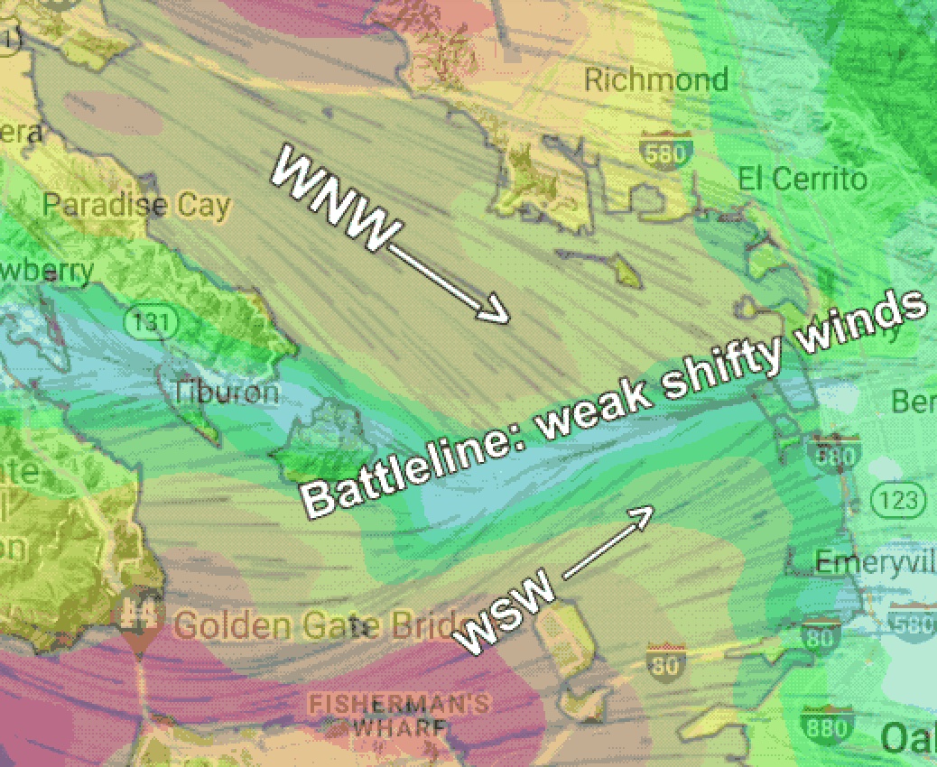
developing battle between WNW and WSW flow that will play out near 3rd. Ave. and near Pt. Isabel and Berkeley today.
When the marine layer is the perfect depth like today the NW ocean
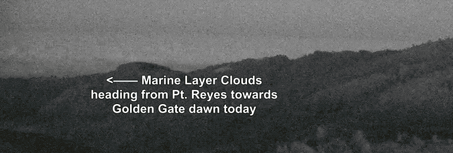
winds hitting the Pt. Reyes Peninsula and the coast range generate waves in the marine layer clouds that allow us to easily visualize the curving of the marine layer clouds as they follow the different routes to the building low pressure in the Central Valley.
Each wave cloud is an area where the wind just aloft is ascending. Each clear area between wave clouds is where air is descending. As these waves come over warming land the clouds may disappear but the motion of the winds persists. This means as it descends it impacts
the surface wind. When it rises it does not. You experience this as gusts and then lulls. BUT if the direction of the winds just aloft is different than the surface wind you also experience it as a winds shift + gusts and lulls. The “battleline” is where this activity is strongest at any given time near 3rd. Ave. and Pt. Isabel hence the issues.
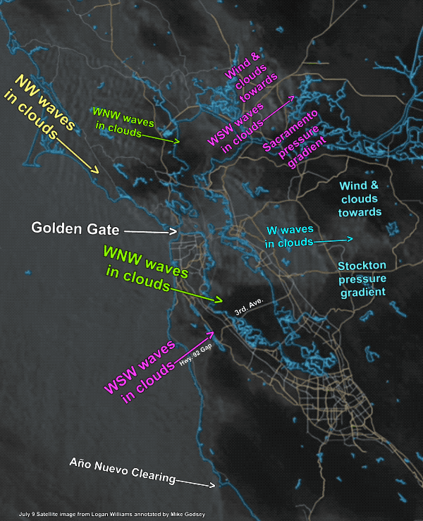
Notice that in the satellite imagery for today both 3rd. Ave. and Pt. Isabel have both WSW and WNW wave clouds headed towards them. This afternoon those clouds will not be visible but if that wavy wind flow persists then there may be gust/lull/shift issues at both sites today.
Since the Central Valley is long and narrow the area with the max low pressure varies from day to day and even hour to hour making forecasting challenging.
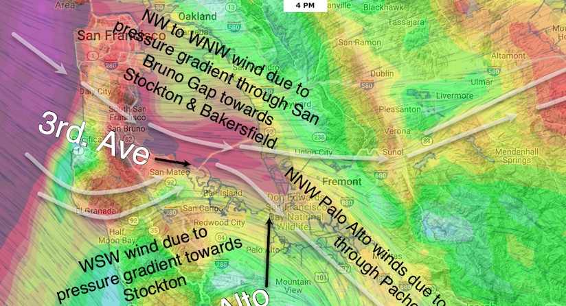
All the air that pours into the Bay Area through gaps in the coast range has to exit somewhere. Since it is dense heavy air it flow
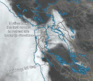
through the lowest available gaps in the coast range on the eastern side of the Bay. That is the gap near Sherman Island. The Altamont Pass and the Gap over San Jose to Pacheco Pass.
Which pathway the air takes is determined by where the max pressure gradient is located AND the depth of the marine layer. Today the max pressure gradient is more towards Stockton and Sacramento. You can see how this impacted the wind and fog flow in these animations.
Mike Godsey
Weatherflow