How can that happen?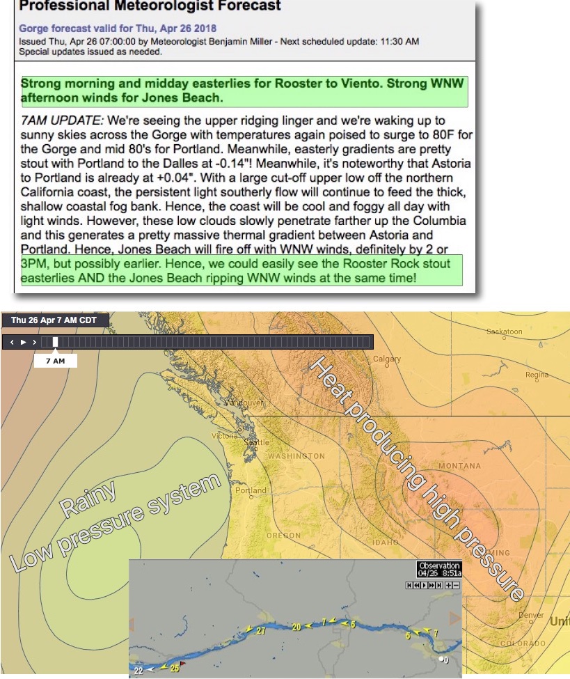
by Mike Godsey
Check out today’s Gorge forecast.
Strong Easterly and strong Westerly winds along the Columbia?
Since winds are largely driven by pressure gradients how can you have two different pressure gradients at the same time?
Looking at the isobar map you can see there is low pressure off the coast and high pressure to the east.
This pressure gradient is what creates the easterly wind you see today in the  wind map image.
This animation of model data shows these easterly winds pretty accurately.
But looking at the animation for this afternoon you can see westerly winds from the coast to near Portland.
So how do westerly winds develop from the coast to Jones Beach near Portland?
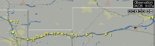
Looking at the next image from 9:07 AM today note the strong easterly winds especially at Rooster Rock.
But also notice the 13 knot WESTERLY winds already at Jones beach.
 Afterall there is low pressure to the west of Astoria.
The answer has to do with the density of air and its pressure. The low pressure storm to the west is creating southerly winds at the coast. As Ben mentions in his forecast this low pressure is creating the southerly coast winds you see in the animation above. This southerly flow pushes a lot of cool dense foggy air towards the coast and inland along the river. Cool air is denser than warm air which means it creates high pressure along the coast and up the river. Today, especially in the afternoon, this high-pressure zone creates a hefty pressure gradient for westerly winds. At the same time, the easterly winds weaken as they typically do in the afternoon. This means that starting this morning and continuing through at least early afternoon we have both E. and W. winds at opposite ends of the Columbia River.
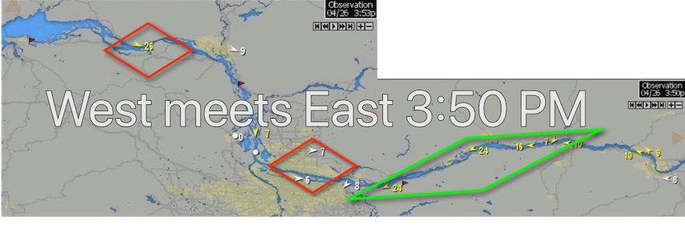
News Flash at 4PM. Since I posted this blog this morning it has become clear that Ben had a spectacular forecast. Check out this wind maps frm 3:50 PM… No words needed!