
Update 5 PM: Satellite video of eddy from 8 AM to 5 PM today
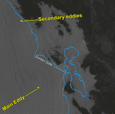
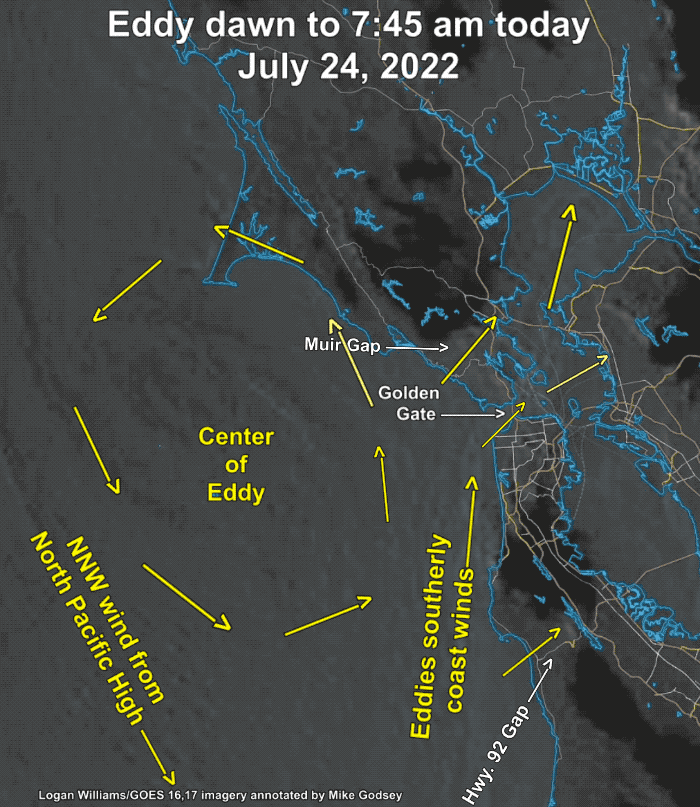
From 8 AM this morning: These satellite images from early this morning show the large eddy just off the San Francisco Bay Area. For days now I have been forecasting this event since the pattern was clearly developing. In the dim morning light, it is a bit hard to see the eddies counter-clockwise spinning winds so I have marked the flow pattern with yellow arrows in the second image.
Notice that the North Pacific High’s surface NNW-NW ocean winds are still blowing west of the eddy but we have southerly coast winds.
Also notice how the max pressure gradient towards Napa, Sacramento and Stockton is pulling those southerly ocean winds through gaps in the coast range that are open to the SW like Muir Gap, the Golden Gate and the Hwy. 92 Gap.
What causes the eddy?
The NW pattern the last month or so had the North Pacific High’s isobars roughly parallel to the California coast so we had many days of strong NW ocean winds. Starting Today things change as:
1. The NPH pushes a lobe of high pressure (aka a ridge) into
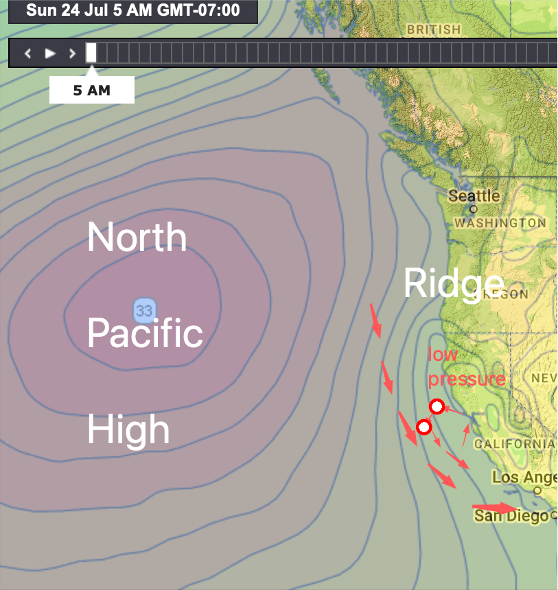
the Pacific Northwest and far Northern California.

2. This causes the isobars to angle away from the coast so the ocean winds turn from NW to NNW so they are blowing at an angle away from the coast. Meanwhile, the winds just aloft turn NNE to NE and..
3. This causes the Central Valley thermal low to expand over the coast from Marin northward.
4. This, in turn, creates a South to North pressure gradient along our coast.
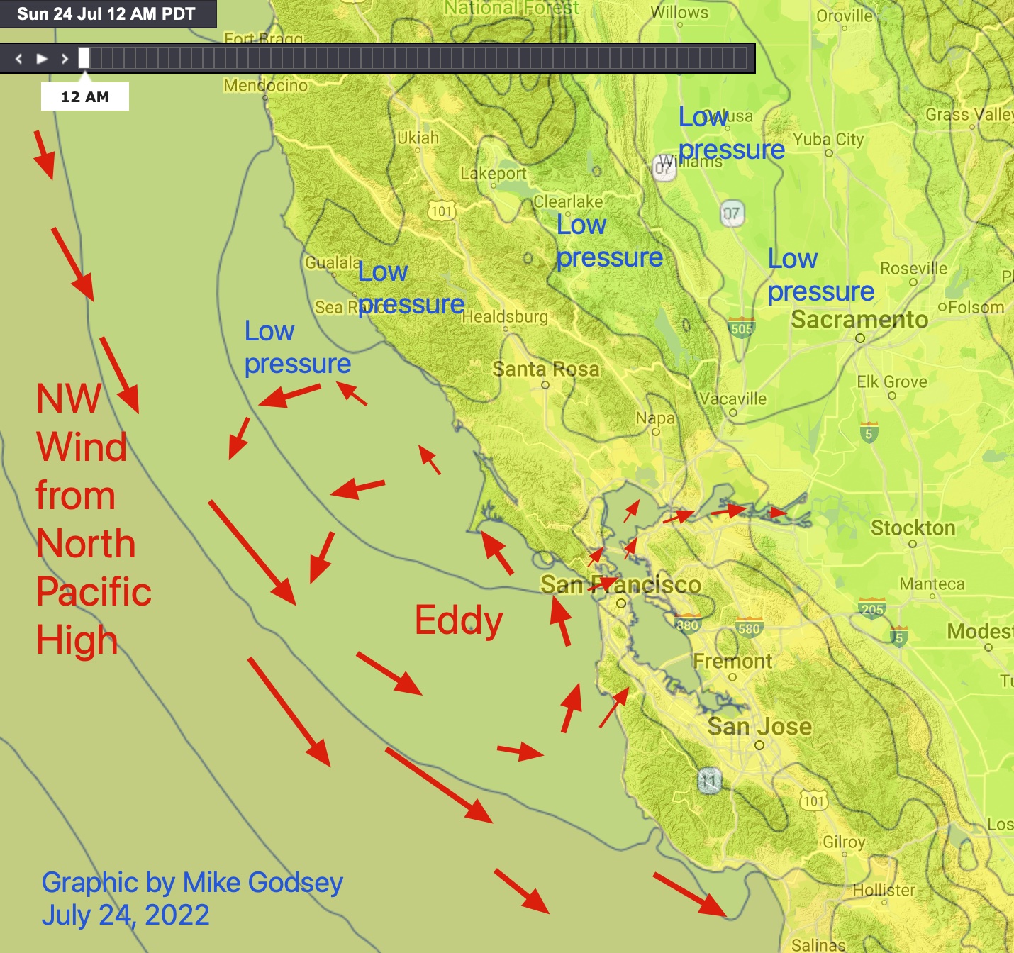
5. This causes the NNW winds out at the Farallon Islands to curve into W the SW then S winds in the Half Moon Bay to Bodega area.
6. So we end up with a counter-clockwise spinning eddy that lingers most of the day pushing over our coast range.
7. As this SW flow pushes through SW-facing gaps in the coast range the wind focuses on the north tower, Blunt Point, Larkspur, Pt. Isabel and Sherman Island.