
The graphic below shows the evolution of a tiny eddy from the largest scale down to the area near the Golden Gate.
The long graphic below show the evolution of a tiny eddy from the largest scale down to the area near the Golden Gate.
The animation at the bottom shows the eddy dying about 2 PM

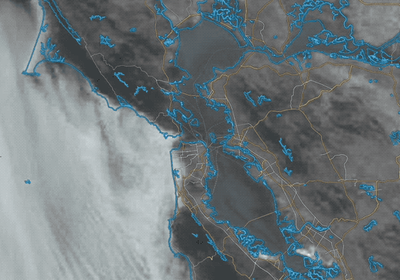
Today we transition into a mild eddy pattern. As you can see in the satellite image this type of eddy is ill-defined whereas big eddies off the Bay Area look like miniature hurricanes even with an eye.
Major eddy patterns create really strong winds in the north tower to Pt. Isabel corridor while killing the coast and messing up the winds inside at 3rd. Ave.
But tiny eddies like the one you see in today’s wind map and satellite image below usually die early as the NW winds destroy the eddy.
Then the NW winds curve into the Bay following whichever pressure gradient pathway prevails. So 3rd. should be OK inside and Pt. Isabel has mild winds.
day we transition into a mild eddy pattern. Major eddy patterns create really strong winds in the north