by Mike Godsey,mikeATiwindsurf.com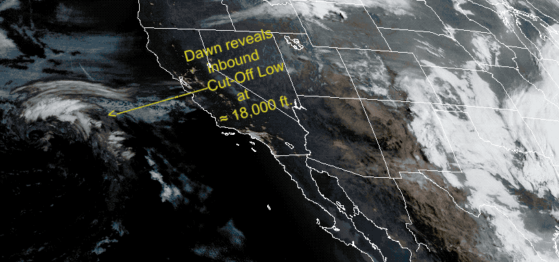
For several weeks now our forecast team has been struggling with San Francisco Bay Area forecasting during a surface eddy pattern that is unprecedented in its duration and longevity. Now we have to add a Cut-Off Low up at ≈ 18,000 ft. to the mix. And there is a reason for the old rhyme “Cut-Off Low… weatherman’s woe” These beasts are hard to predict since they are cut off from the upper-level winds so they can wobble around randomly.
This animation below shows both the eddy at the surface and the Cut-Off Low at ≈ 18,000 ft:
If you have ever watched any eddy, from a dust devil to a tornado, you know they move around and gain and lose strength randomly as you can see in this video. Imagine trying to this:
https://www.youtube.com/watch?v=AwKc7H5gIWo 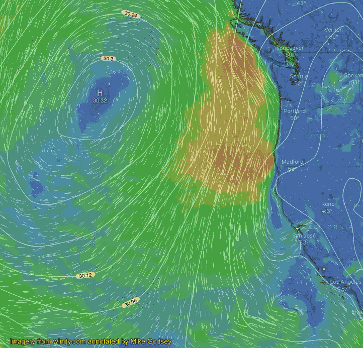
Our eddies are far larger and slower moving than a dust devil but they have still been making forecasting very difficult since a change in location and strength of the eddy midday can change the winds for each site especially near shore. And frequently we have had more than one eddy this season. So we are struggling to do the best forecasts possible.
If you are a newcomer to the Bay Area you should be aware that until recent years we and all the models were completely unable to even forecast the development of these eddies. This often led to wildly inaccurate forecasts where fog and SW winds would “magically” appear overnight shutting down the coast and parts of the Peninsula while bringing unexpected strong wind to sites north of the Bay Bridge. Now, it is rare for us to miss an eddy and slowly we are improving our forecasts during eddies.
So anytime you see the word eddy in a forecast you should use your knowledge of local fog patterns mid-afternoon to fine-tune the forecast especially for the winds near shore since the eddy may have moved since our 11:30 update.