For most of this summer, we have had a North Pacific High

that has 2 standard deviations from the norm in terms of size and position. That is geek talk meaning the North Pacific High’s surface NW ocean winds have been weirdly stronger than normal. This has made forecasting much more complicated and impacted many sites that rely on WSW wind. The ultimate cause for this is the almost unprecedented double La Niña.
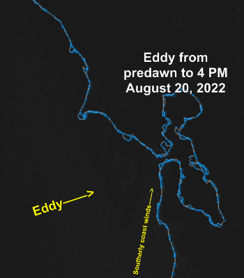
But today, with the North Pacific High fragmented by wintry rainy storms to the NW the counter-clockwise spinning eddy has returned to the scene and grabbed the steering wheel of our wind machine.
The Bodega and Half Moon Bay ocean buoys are gusting over 30 from the NW. La Niña is keeping the North Pacific High in a position you would expect in spring hence the atypically strong NW winds.
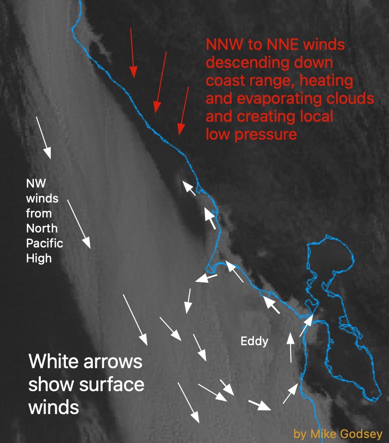
The NPH has also pushed a ridge into far Northern California so the
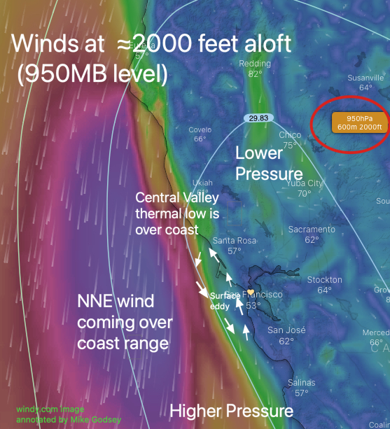
Central Valley thermal low has expanded over the coast especially north of the Golden Gate as strong NNW winds blow over the coast range.
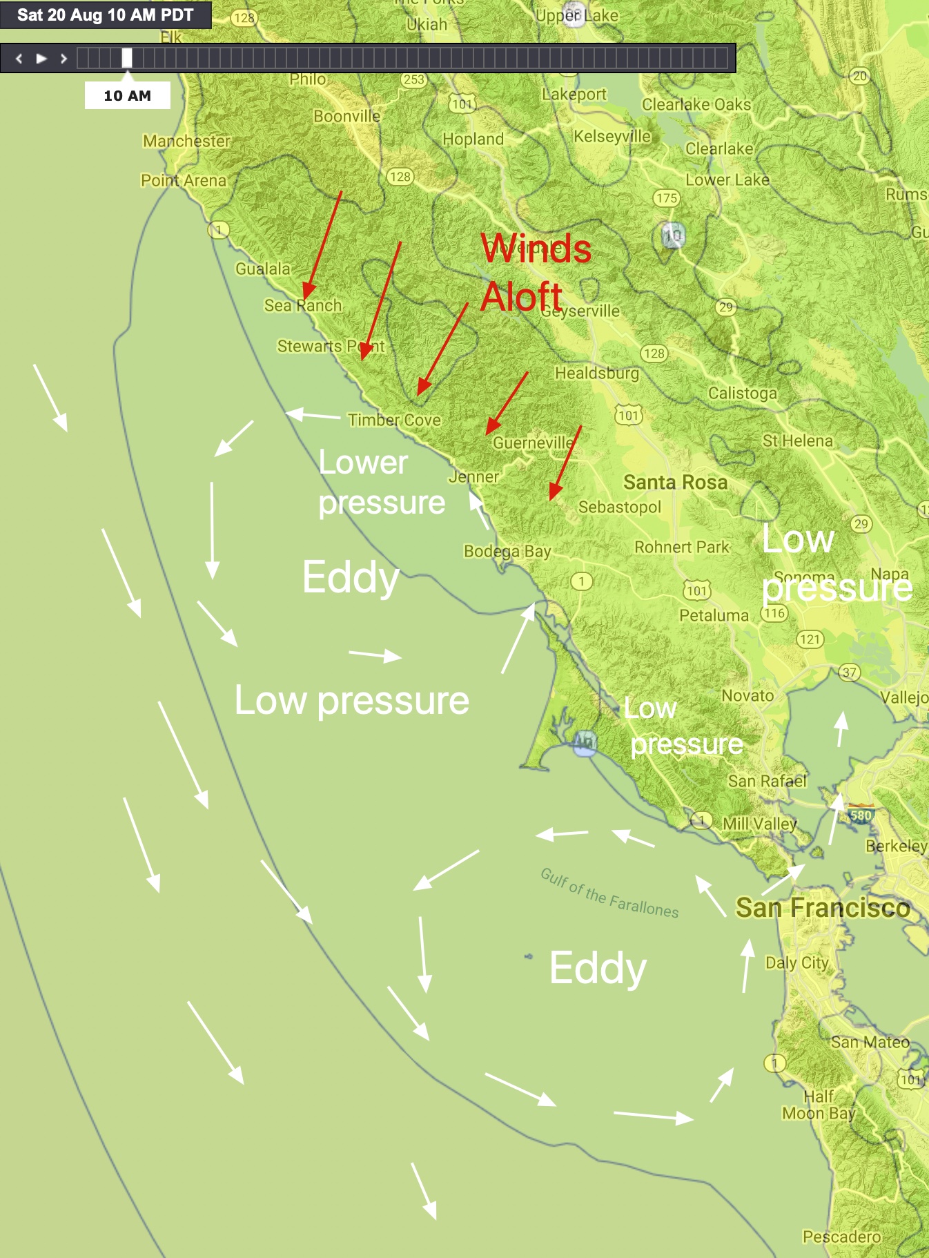
The combo is making a SOUTH to NORTH pressure gradient along the
coast producing a narrow counter-clockwise spinning eddy so we are seeing southerly coast winds from Año Nuevo to Bodega. The eddy dies in the afternoon but residual SW winds come through gaps in the coast range.
The pressure gradient is pretty evenly split between Napa, Sacramento, Stockton and towards Bakersfield with the latter gradient really helping the WNW winds at Coyote and 3rd. Ave. outside.

At this time it looks like WSW flow from the Hwy. 92 Gap messes with the 3rd. Ave. launch winds despite strong WNW winds in the channel.
The Napa gradient benefits Larkspur but causes the Olympic Circle winds to be more SSW so Berkeley has light winds, Pt. Isabel is UP and Down with the strong winds towards Point Potrero.