How to use our NEW RASTA BEACH SENSOR north of El Sargento!
Common sense would suggest that after such strong northerly wind Friday today would be at least a moderate northerly day. As usual common sense is wrong. Instead, we are likely to see mild SE winds.
In science, it often helps to talk about proximal vs. ultimate causation.
Proximal causation:
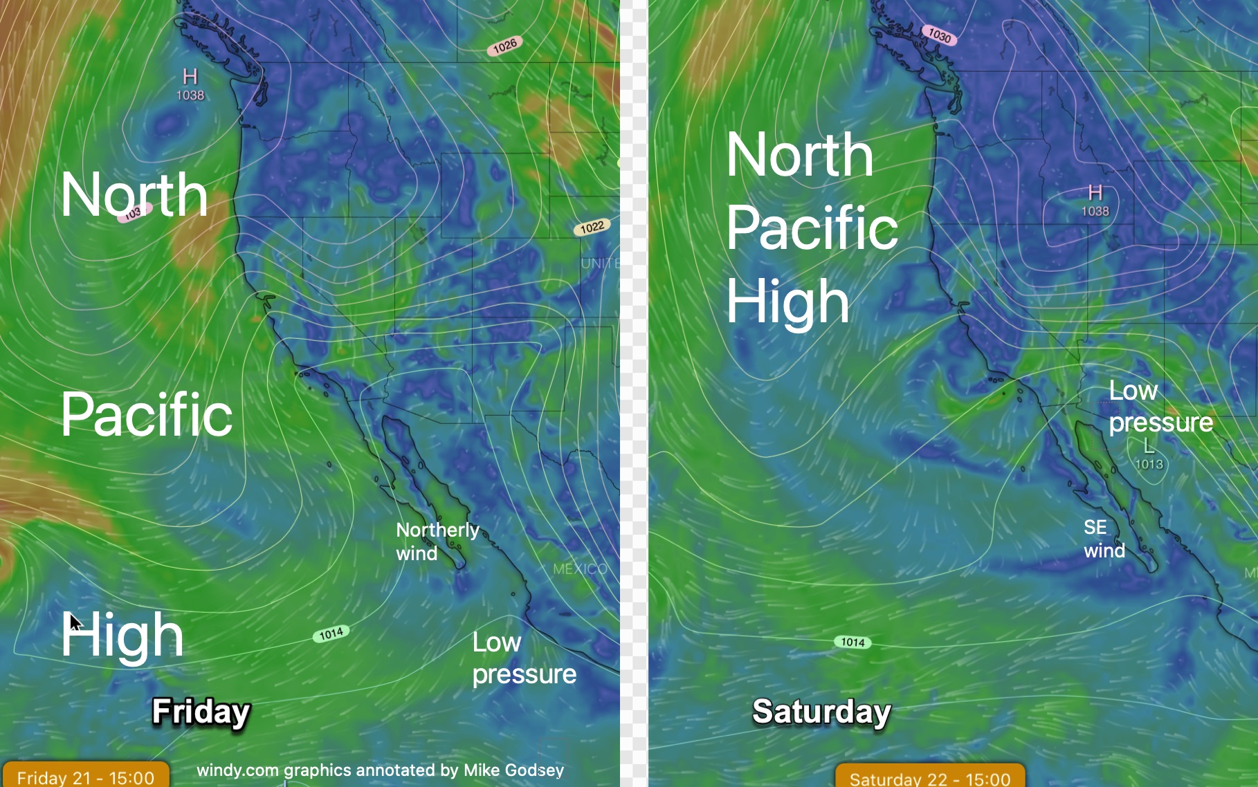
In this case, the proximal cause of today’s weaker SE winds is simple. Yesterday, the North Pacific High, which was NW of Baja and sent NNW winds down the Sea of Cortez towards low pressure south of Cabo. Some of that winds was curved to the Los Barriles and La Ventana beaches by a strong pressure gradient to the inland valleys. You can see this in the left image below.
Today, as the right image shows, the North Pacific High is far from Baja so we lose the NNW. Worse, the low pressure moves north of Baja creating SE pressure gradient. So of course we have SE winds.
End of story! Unless you never grew up and never stopped asking that childish question…Why.
So if you are an adult stop reading now. If you should have been a scientist keep reading.
Ultimate causation:
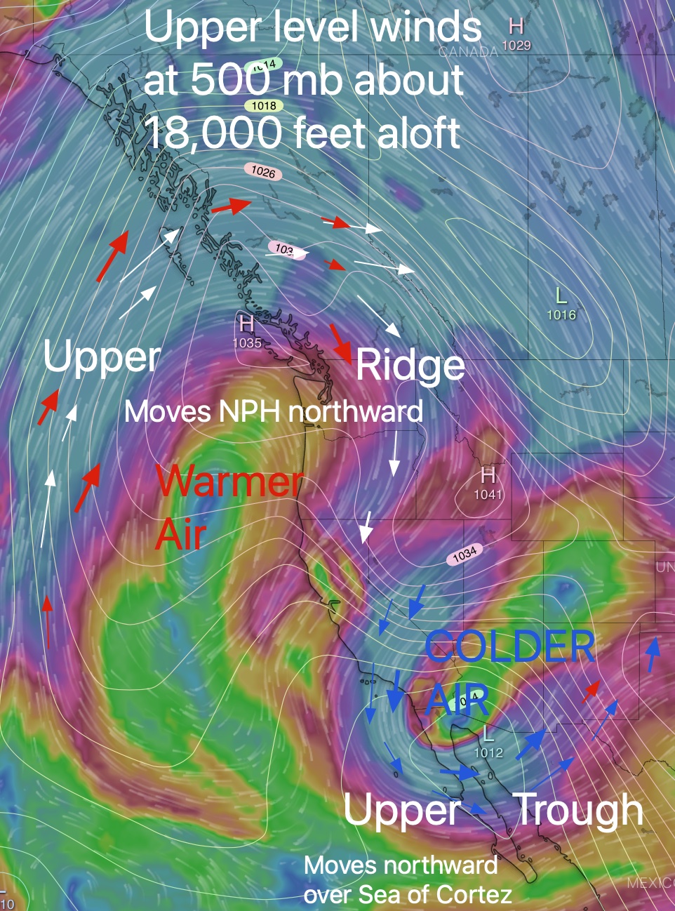
The reason the North Pacific High and the low pressure danced around overnight is found far aloft. But here is one hint. did you notice how much cooler it was last night? Check out this graphic to learn…WHY!
Overnight the upper-level winds looped northward over the West Coast bring warmer weather. This also caused the North Pacific High to lunge northward so it is now west of the USA’s Pacific Northwest.
At the same time, a loop of upper-level winds from towards the N. pole dropped over the desert SW and Baja bringing cooler air and causing the surface low pressure to move to our north. That gives use a pressure gradient at surface that promotes mild SW winds.
Now if you are really childish you would ask… Why.