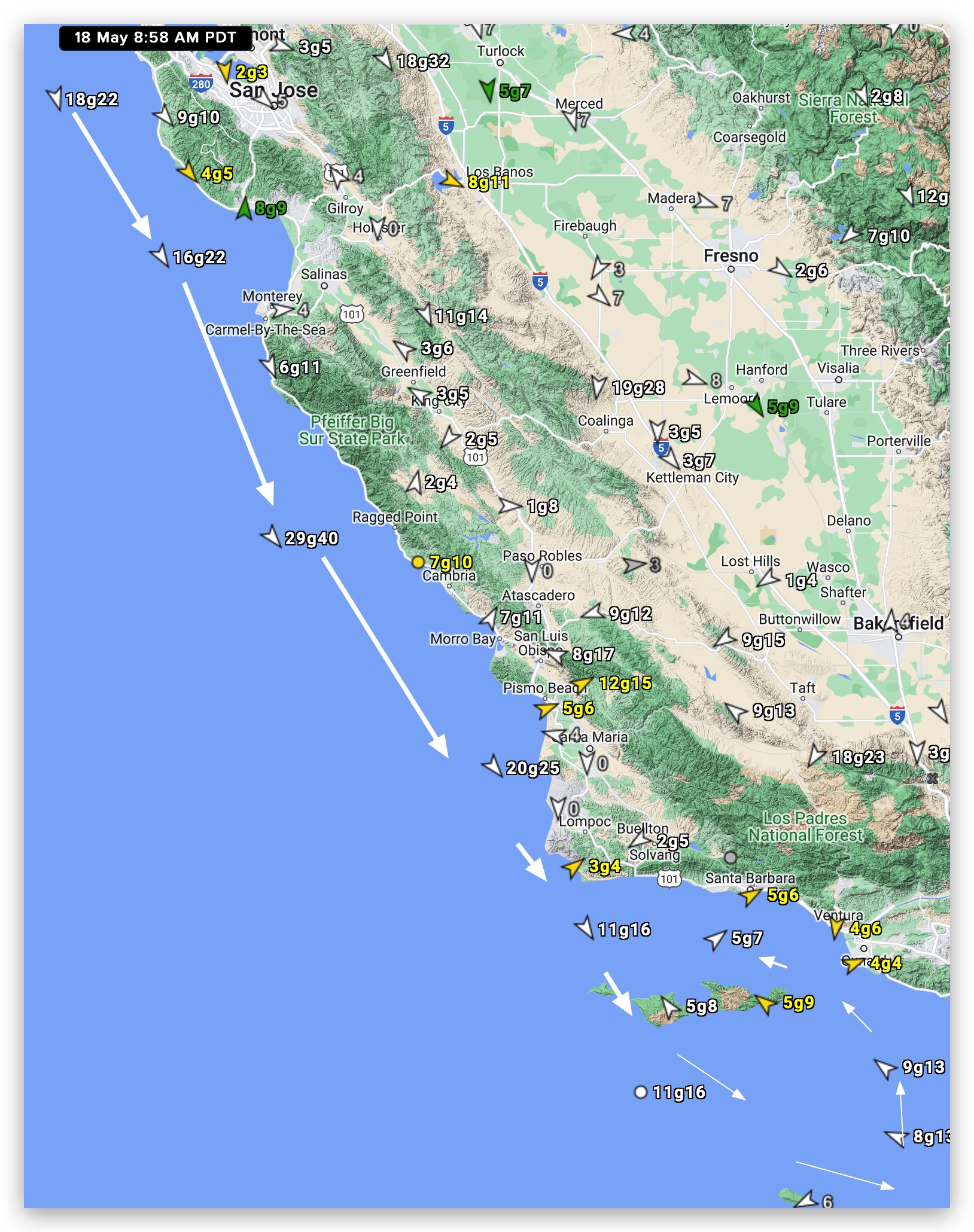
 In this first image, you can see that the North Pacific High’s surface NW winds are roaring down the Northern California and Central California coasts this morning.
But notice how all this wind bypasses Southern California waters and there are actually SE winds in the Southern California bight.
Where is all this NW going?
And why am I forecasting it to bypass most of the Southern California coast this afternoon rather than curving to the coast as the eddy dies?
Often when we have strong NW wind on the Central California coast it curves to the Southern California beaches due to low pressure somewhere east of Southern California.
Sometimes that low pressure is simply caused by low pressure in the nearby inland valleys.
Other times it is low pressure in the Southern California Deserts.
And other times it is low pressure somewhere towards the Great Basin.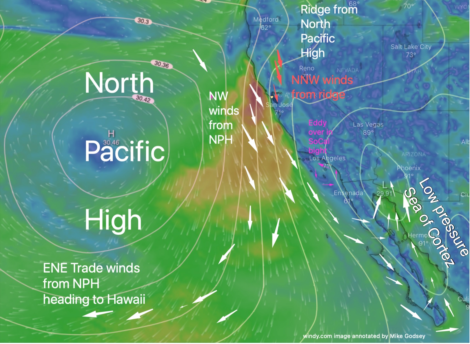
In all those cases low pressure east of the Southern California coast makes the NW wind accelerate on the Central California
coast and then curve to the Southern California coast as WNW to WSW wind.
But today the low pressure is mostly located over the Sea of Cortez into Arizona.
And, as you can see in the second graphic that tends to cause the NW wind to rush southward so it barely enters the Southern California bight much less curve to the beaches.
One worry for the Central California coast is that a pressure gradient Sea of Cortez does not pull the winds to the coast as well as a gradient to the Great Basin or Southern California Deserts.
Notice this pressure gradient setup even causes the NW winds to miss part of the Baja Norte. Plus some of that wind even reaches the Sea of Cortez and turns into southerly winds.
Lastly… notice how the North Pacific High also creates ENE trade winds for Maui.