
So how can we have 2 days with very strong El Norte winds on Feb. 7 and 8th then have Saturday Feb. 9 have such a weak wind forecast?
Remember that weather generally moves from the west to the east. And on Saturday a strong low pressure storm system crashes into the Northern California to Canada coast. Also recollect that wind is stongest where the isobars are stacked tightest since that reflects a strong pressure gradient.
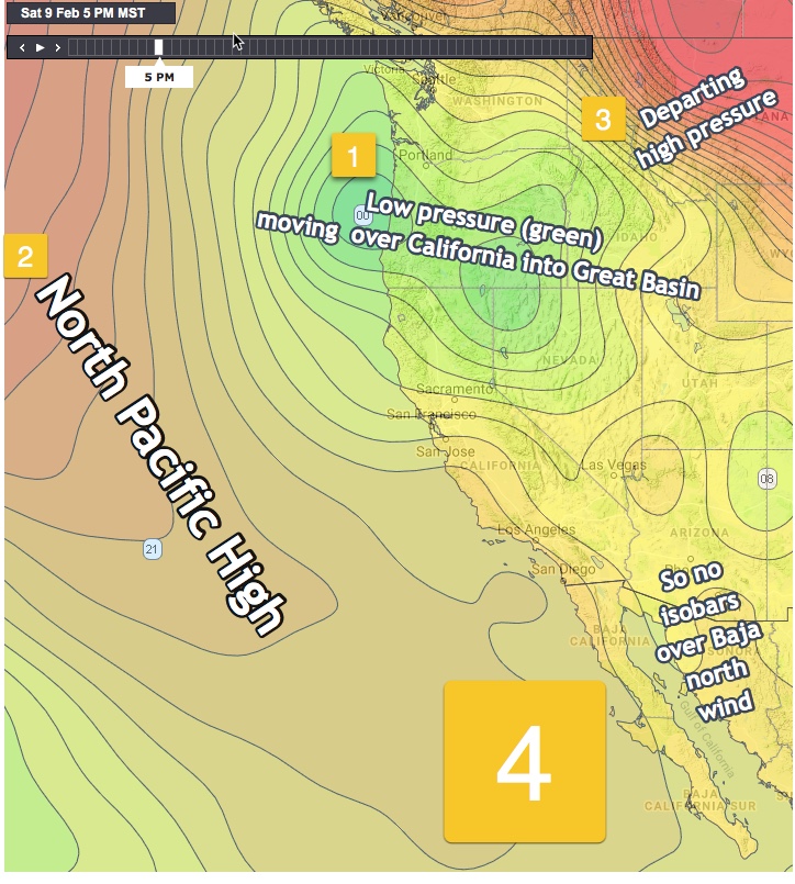
You can see this in this image by looking at the pressure isobars around the low pressure in green #1.
This low pressure system distorts the North Pacific High #2 (in orange) and shoves its isobars far from Baja so we lose that part of our wind machine.
As the low pressure, in green, shoves into the Great Basin it helps push the high pressure out of the Great Basin and to the NE. So we lose that part of our wind machine.
But wait, don’t we still have our mild but delightful local thermal winds? We those winds are created by heating in our inland valleys. And the satellite imagery and the models suggest that clouds begin to thicken tomorrow. So our wind forecast suggest mild low to weak mid teen thermal winds. But remember mid week when a hole appeared in the clouds and saved the day? One can always hope!