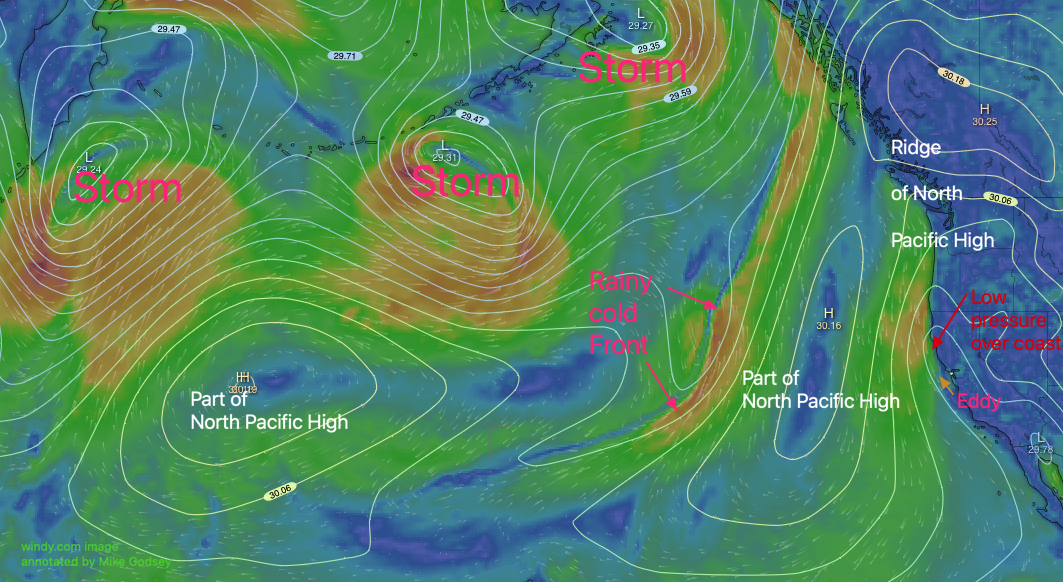
The North Pacific High is being battered by the continued La Niña pattern with 3 rainy storms in the Gulf of Alaska keeping atypically strong NW out at 50 miles west of the Golden Gate. However, the NPH has pushed a ridge of high pressure into the Pacific Northwest causing Central
Valley thermal low to bulge way out to see north of the Bay Area. This creates southerly ocean winds on the coast as a large counter-clockwise eddy spins from Big Sur to Pt. Arena. Since this eddy has support all the way up to ≈6400 feet it NEVER dies today. SW flow + the max pressure gradient towards Sacramento and Stockton keeps the strongest winds in the mid Golden Gate to Blunt Point to Larkspur to Brooks Island zone. A strong very local gradient towards Napa favors Larkspur AND PROBABLY diverts the winds away from Pt. Isabel and especially Berkeley.