 Long long ago, before Call of the Wind and later windsurf, windsurfers in the know monitored Ken Poulton’s weather page for real time informaiton. Back then the key of information you could derive from his page was the current pressure reading for Sacramento in the Central Valley. We all knew that the stronger the SFO-Sacramento pressure gradient the stronger the Bay Area winds… somewhere.
These days the San Francisco Bay Area is different place weather and culturally and our board types are radically diverse. So it is fitting that our wind patterns have become far more complex.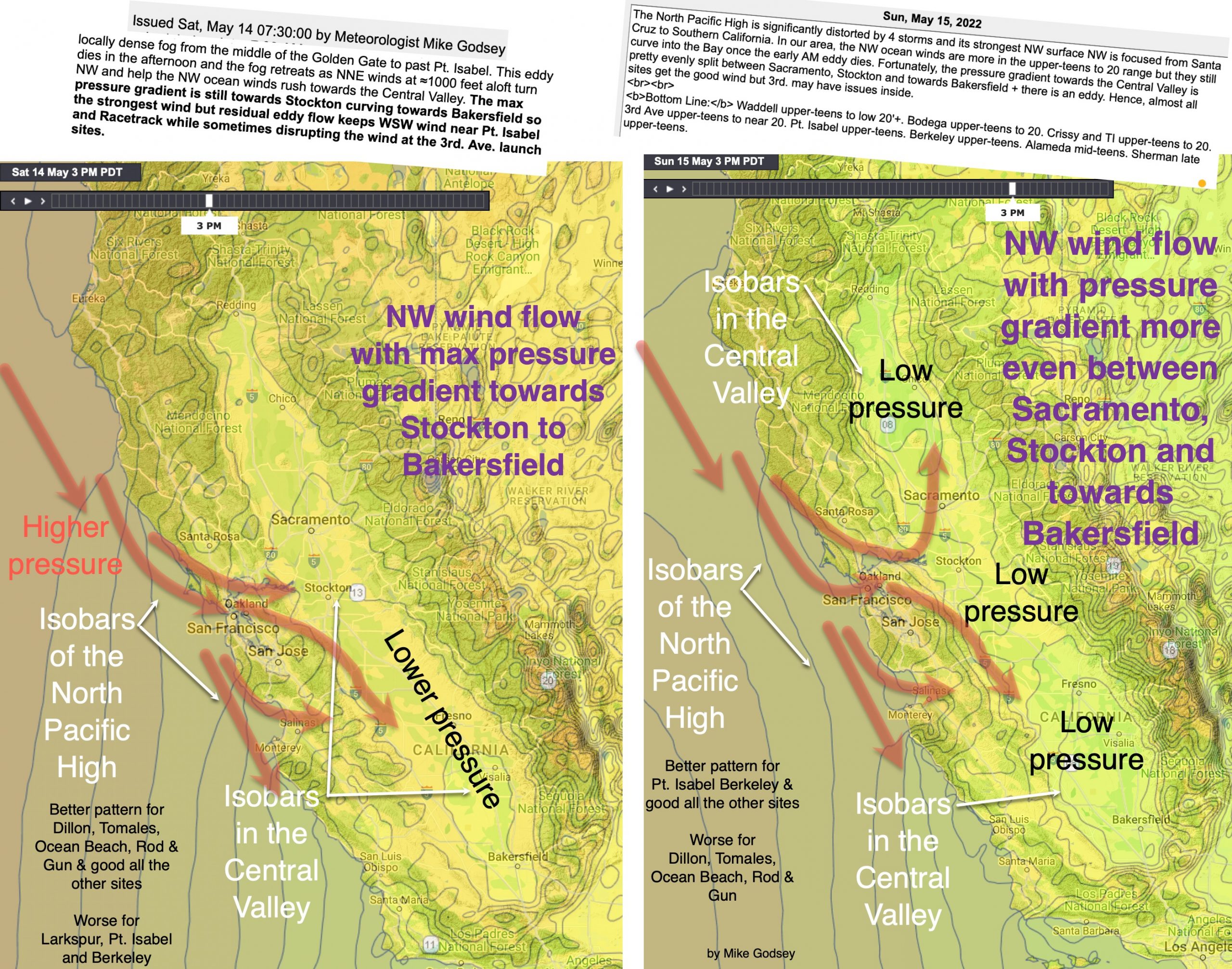
So while the pressure gradient to the Central Valley is still a critical factor………
concept is that when the NW ocean wind reaches the coast it flows through gaps that are the easiest pathway towards the maximum pressure gradient in the Central Valley.
Since the Central Valley has a huge N-S range so the pressure gradient is sometimes unevenly distributed. So if the max pressure gradient is towards Bakersfield the wind curves through the Bay hitting certain sites.
If the max pressure gradient is towards Sacramento to Redding then the NW curves to hit other sites.
Of course, if the ocean winds are more SW, like when we have an eddy to a marine surge after a heatwave, the wind flow is very different than in these graphics.