by Mike Godsey
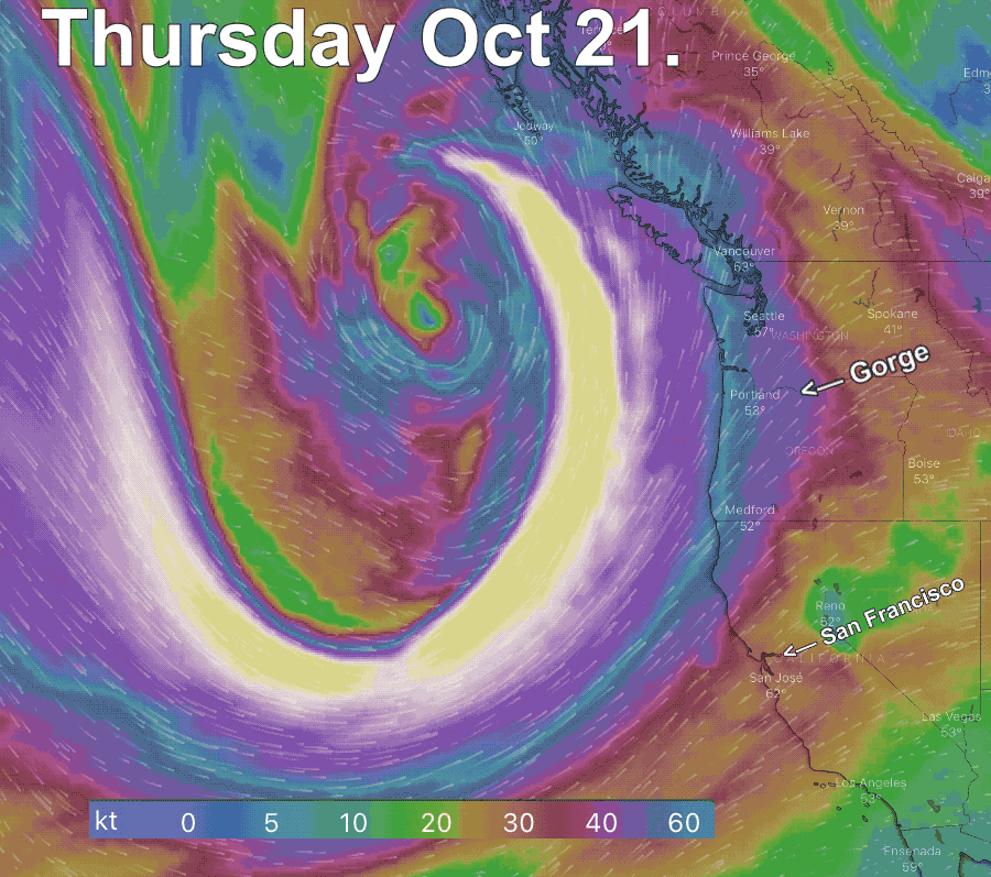
Matt is right about the pattern of inbound storms. The water vapor satellite imagery and models over the past 24 hours show one of the most impressive cyclogenesis events in history off the California and Pacific Northwest coasts.
At the surface, this first of a series of storms is 1500 miles wide and extends from southern Alaska to about Big Sur south of Monterey.
The scary part of this system is the intense upper trough at ≈18,000 feet (500Mb) creating this bomb. The wind up there is over 100 mph.
The Bay Area is 900 miles from the center of the storm but Mt. Diablo is already seeing southerly gusts to 32 and our ocean buoys are modeled to see SSE winds in the low 30’s predawn tomorrow.
So why are these inbound storms so strong?
Let’s take a look at the first animation. Notice the extreme winds in the upper trough at ≈18,000 feet (500Mb). Note that the wind in the white area is even off the windy.com scale that only goes to 60 knots. So how do these winds impact the surface storm and storm winds at the surface?
The key is in the area labeled “Divergence zone” Looking at the surface winds of the animation notice how all the wind spiraling into the low-pressure center of the storm. So with thousands of cubic miles of air flowing into the low pressure you would expect the low pressure fade away as the pressure equalized. And that is exactly what happens to many storms. They fill in and die.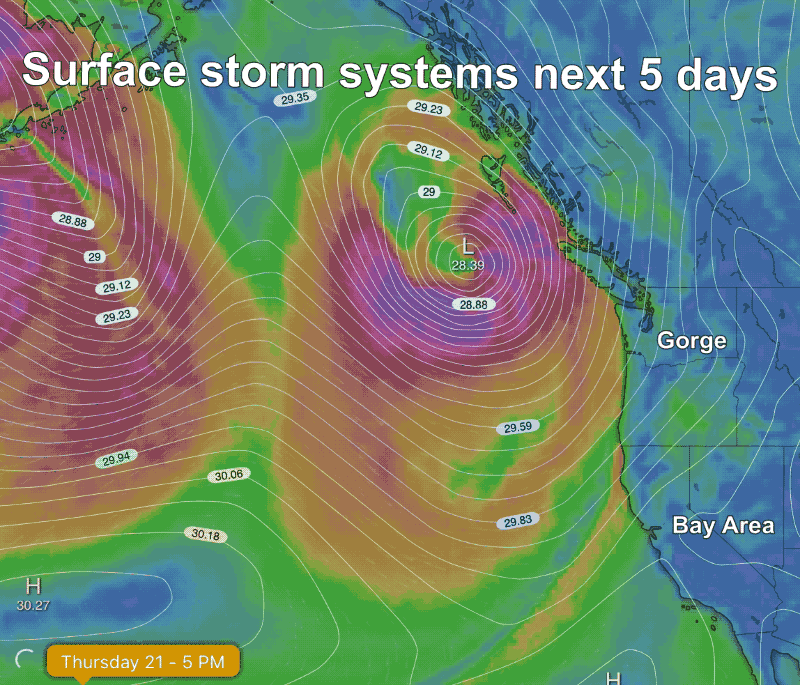
But look again at that divergence zone for this storm. All that air at the beginning of the “Divergence zone” at ≈18,000 feet spreads over a much larger area as it flows towards the Pacific Northwest. This creates a low-pressure zone up at ≈18,000 feet aloft over the edge of the surface storm. So now all that air spiraling into the surface low pressure has somewhere to go. This deepens the low pressure which increases the pressure gradient which is reflected in the unusually tight isobars you see around the storm. And as always, the tighter the isobars the stronger the pressure gradient and the stronger the surface winds.
This process keeps on occurring for the next couple of days as you can see in this next animation. Note how far south the North Pacific High is during this ongoing event.