 by Mike Godsey
A very atypical situation today as a storm tracks from the south through the interior of Oregon and Northern California. At 6AM the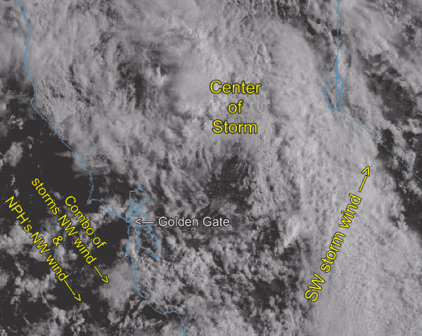 storm is centered just north of the Bay Area. Normally our storms approach from a westerly direction so the counter-clockwise spinning winds of the storm provide southerly storm winds and rain then NW clearing wind as storm exits to the east.
But this storm is approaching from the NORTH so we are on the “backside” of the storm as it passes over us heading towards Southern California. This is why Bay area sites are seeing upper-teens to mid 20’s morning winds from the NW to W. as the storm’s winds and some showers combine with the North Pacific High’s surface NW winds.
Since this is very unstable air aloft expect very UP AND DOWN winds. This wind does NOT just funnel through the gaps in the coast range like our normal wind but also blasts over the mountains making for turbulent winds. Hence the low 30’s to upper 40’s gusts raking the hilltops at dawn.