by Mike Godsey, mike@iwindsurf.com
Forecasting for Pismo winds in the summer is very tricky and we are slowly learning the complexities of this area. Here are some of our baby steps up the Pismo forecasting learning curve.
The marine layer clouds are often way inland in the morning in the Pismo area. But despite the clouds forecasters can see the potential for a strong NW to SE pressure gradient in the afternoon favoring Pismo winds.
Typically the clouds burn back to easily to about a mile inland of the coast. But to get strong wind we need clearing beyond the coast. And that is often very hard to forecast.
The following images show these issues.
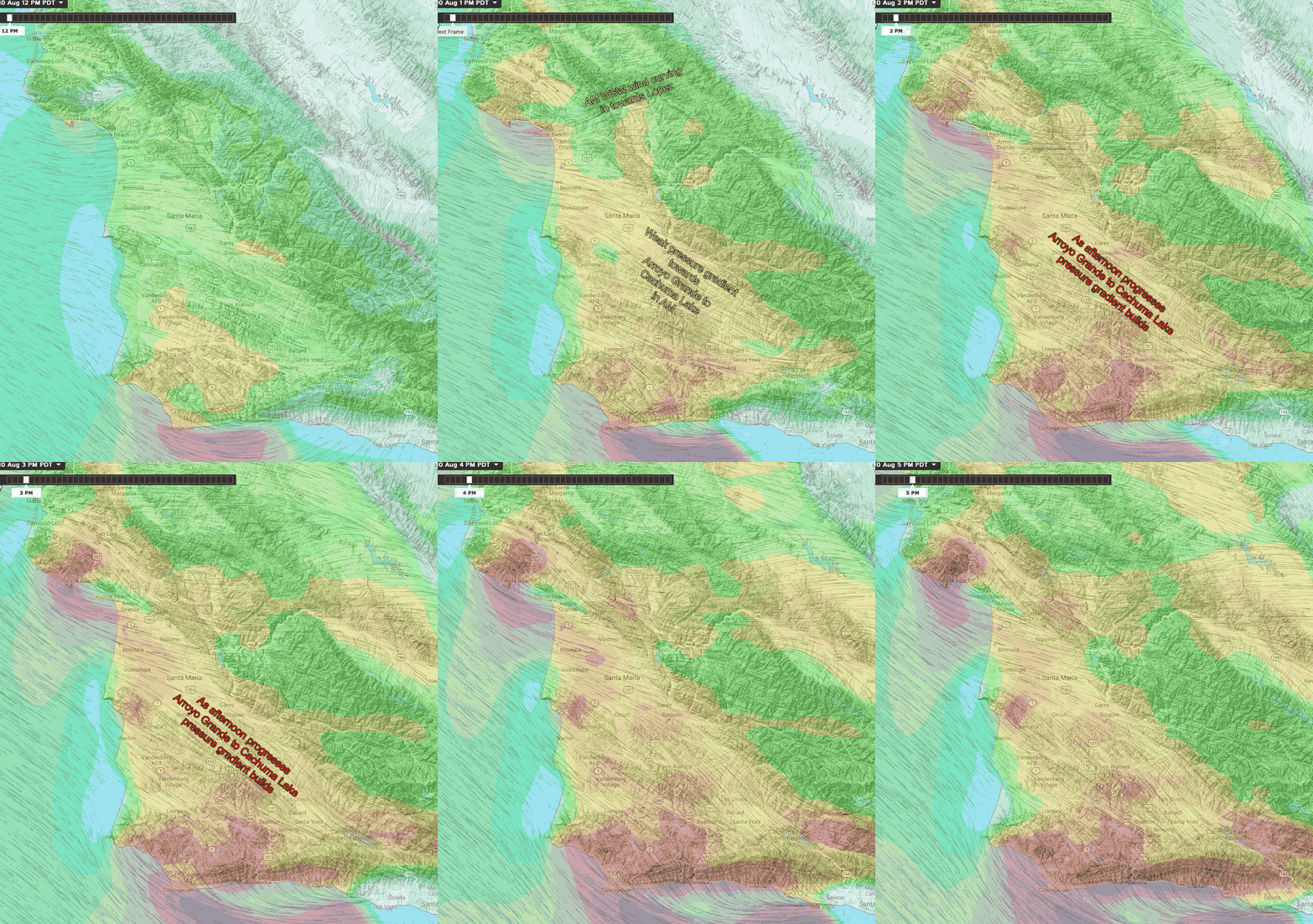
In the first image forecasting, Pismo winds look easy.
You can see the ocean winds in the AM are mild along the beaches and Lopez has stronger winds due to the local venturi.
Then in the afternoon as the inland valleys heat up and wind accelerates near Gaviota the pressure gradient goes up and the wind is sucked over Pismo. Now for some reality.
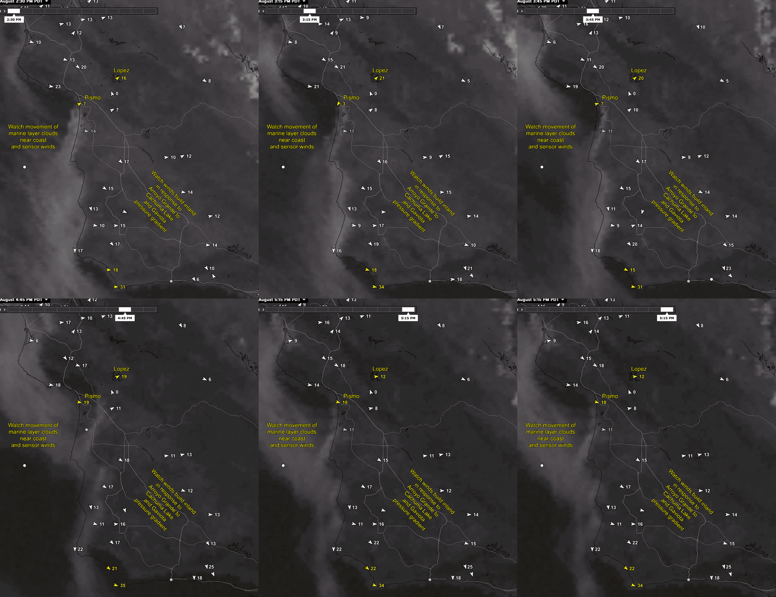
Unfortunately, the marine layer clouds are also an issue. Each time an upper trough at ≈ 18,000 ft. passes near Southern California the marine layer deepens and slides over the coast in the AM.
Then as the land heats the clouds burn back but the pressure gradient towards Lopez encourages the fog to stay over Pismo keeping the winds light unless the clouds burn back over the coast.
This second image shows how critical the marine layer location is for Pismo.
The models do a great job forecasting how deep the marine layer will be each day and give some hint of its retreat. But they can not forecast marine layer burn off with enough accuracy for us to accurately forecast that last mile of clouds on the Pismo coastline.
But what we can do is forecast the presence of good Arroyo Grande to Cachuma Lake pressure gradient and give you a feeling for the chances of clearing. From that, you can use your window or cams to see if the last mile clears.

