You know the melody by heart. On the California coast, spring means mild winds and gentle weather. Then a storm hits, passes, then departs. And as the rain ends, clouds thin and strong NW clearing winds rake the coast and curve in the San Francisco Bay. They are strongest the first day, mellower the second then we go back to milder winds.
This spring has been radically different. For most of the season, there have been strong NW winds at our ocean buoys and frequently those winds curved into the Bay as GUSTY winds with sometimes uncommon directions.
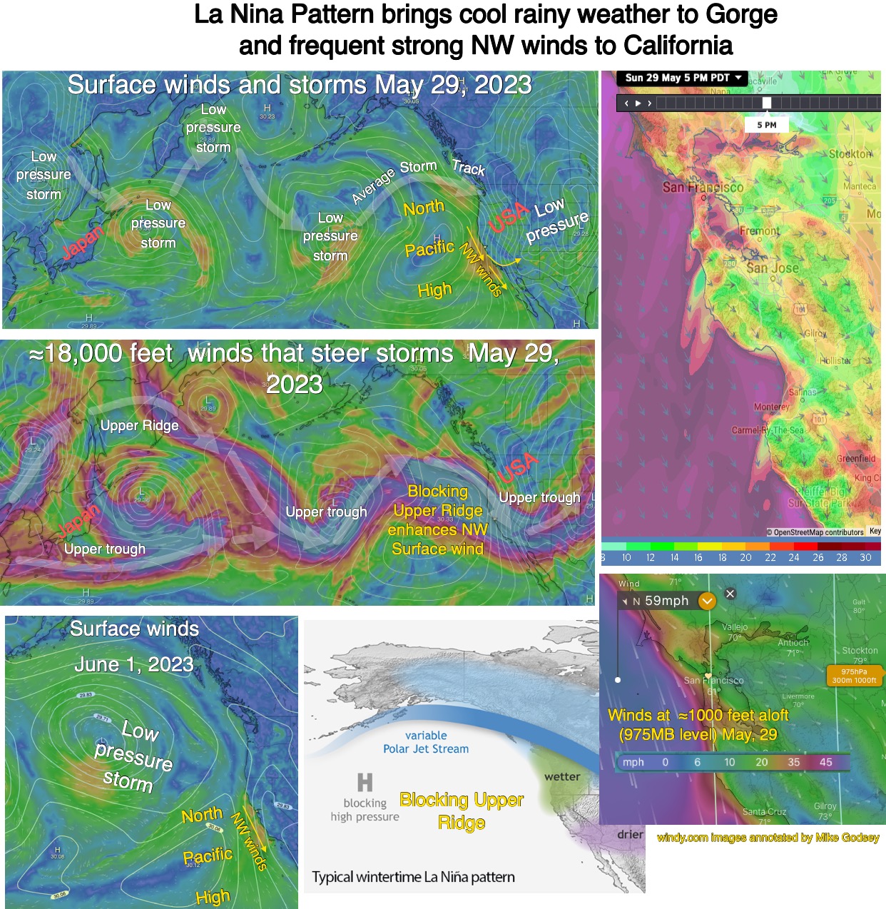
The complex infographic below tells the story in pictures.
But basically, we seem to be going into an unprecedented 3rd. year of a La Nina pattern. La Nina patterns are highly variable but one common feature for the west coast is a “blocking” upper-level ridge. Upper-level ridges and troughs are waves in the winds from about 18,000 feet and above. The northward extending waves are called ridges while the southward waves are called troughs. Normally these waves travel meander around the globe from west to east in a fairly predictable fashion. And this movement steers and enhances the surface storms and high-pressure areas that make our weather.
But, in a La Nina pattern, it is common for a huge upper ridge to become quasistationary of the USA’s western coast. This does several things. 1. It steers storms inbound from the west away from California and towards the Pacific Northwest so they have a very rainy cool spring while California is very dry. 2. The upper ridge tends to hold the surface North Pacific High in a position near California so it does not move away from California after a passing storm so NW ocean winds are more common. 3. The position of the upper ridge often brings strong northerly winds over the coast which can make the surface winds more gusty and shifty.
So with this background, you are set to study this graphic.