
by Mike Godsey, mikeATiwindsurf.com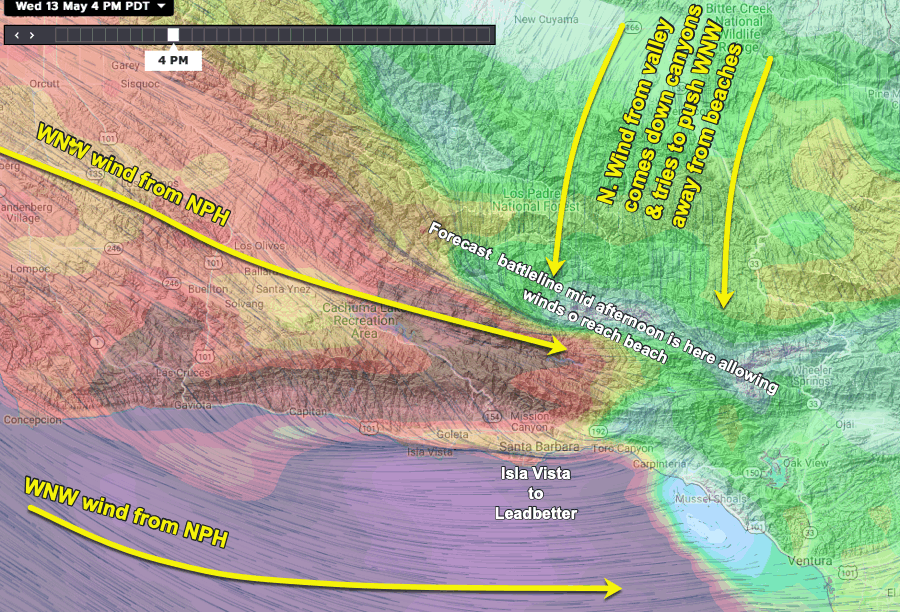
Anytime you read in the forecast about the North Pacific High pushing a ridge into California north of Pismo you are likely to also read about NNW ocean winds along the Central California coast. And also a mention of northerly wind coming over the ridges and canyons in the area from Pismo to Ventura in the PM.
Coastal kiters and sailors need those NNW winds to curve into more westerly winds in the PM for strong winds to fill into the beaches.
However, for that to happen the northerly winds in the canyons have to subside. If these winds keep blowing into the late afternoon the strong ocean westerly wind never reaches the beaches.
This means there will be a battle line between the 2 winds.
If that battle line is way inland 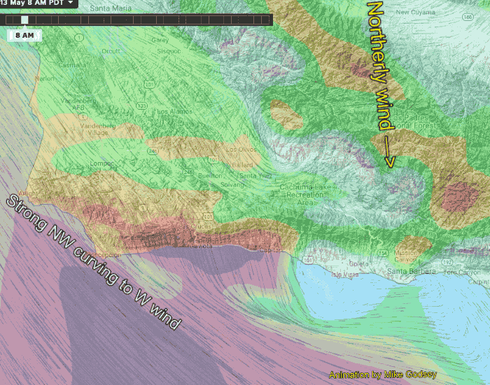 then we see strong westerly beach winds. This graphic shows what I expect to happen today mid-afternoon as the strong ocean wind hits the beaches with the battle line way to the north.
This looks easy to forecast at 4 PM but 6-7 AM when I am doing the forecast the outcome of the battle is far less clear as you can see in this animation.
Looking carefully can you see why I am forecasting up and down and perhaps shift beach wind in the Isla Vista to Leadbetter zone? And hopefully, you can see why this is a tricky forecast. An afternoon shift of that wind battle line of a few miles is the difference between a strong wind day and weak beach winds.