by Mike Godsey
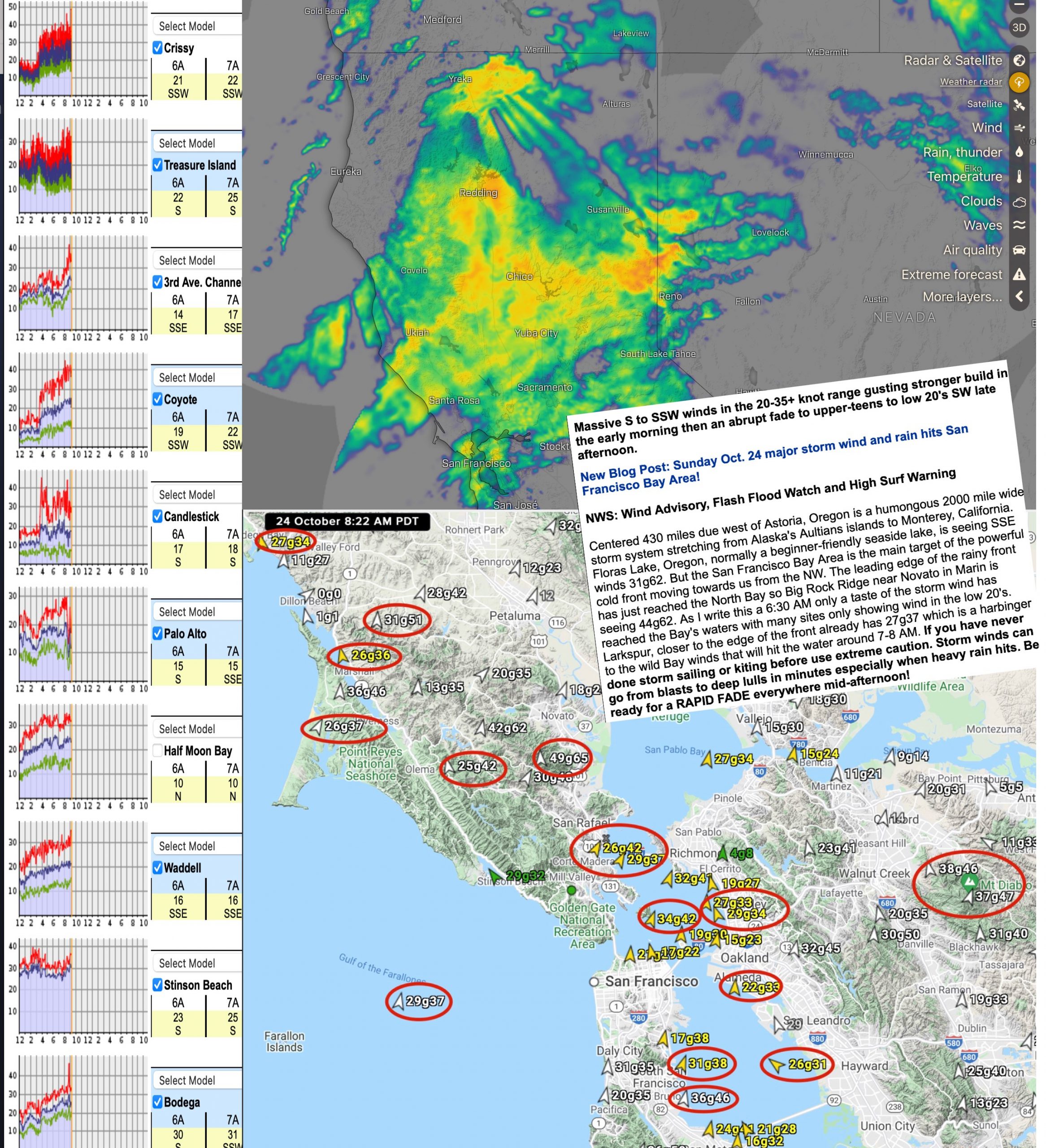
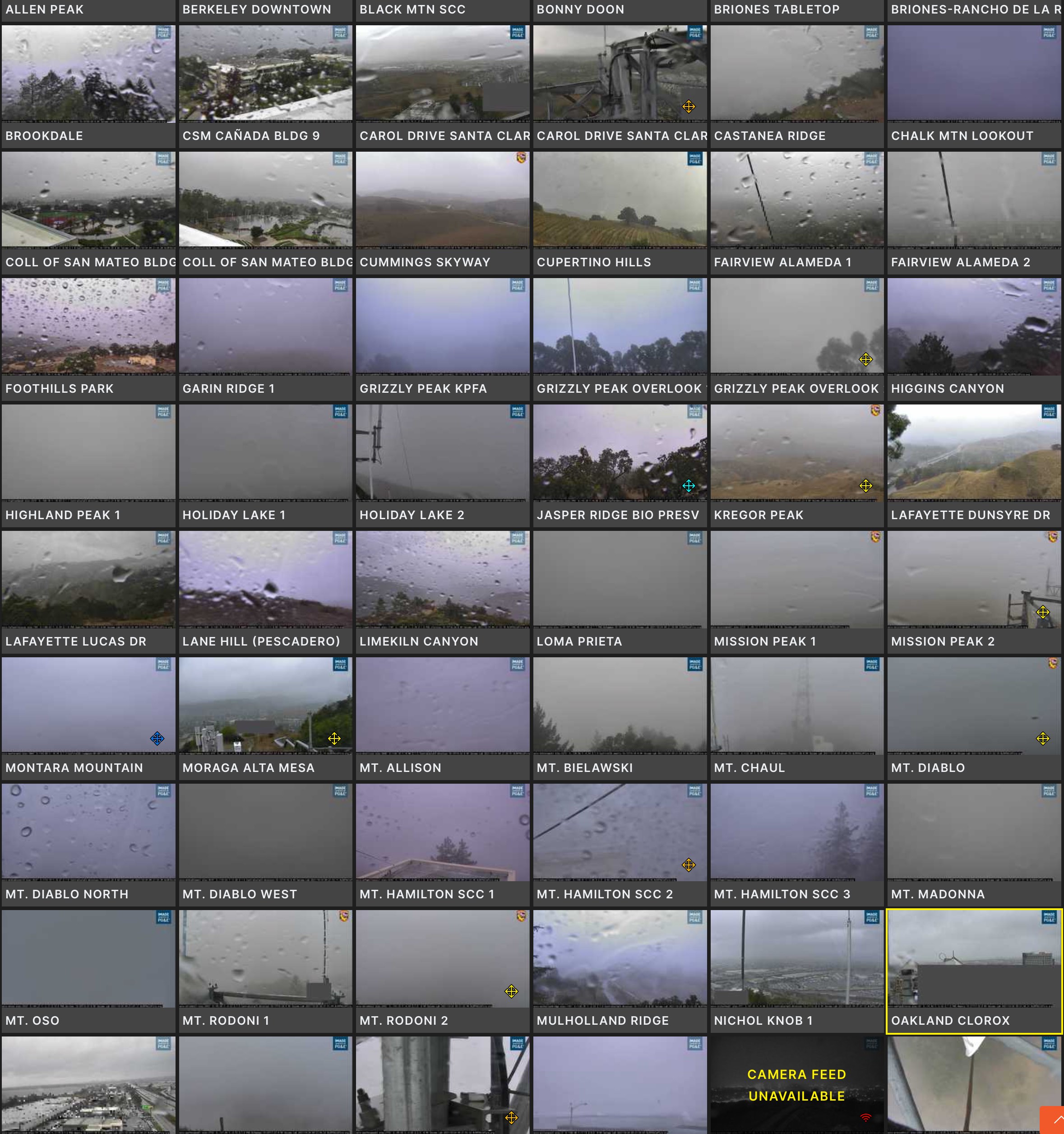
Check out this imagery. First, notice that almost every sensor in the greater Bay Area is being hit by powerful winds. And in the wind graphs notice the extreme Up and Down conditions as mentioned in my forecast. Also notice how the radar imagery shows heavy rain all the way from our ocean buoys to past Reno, Nevada. Lastly notice how all the cams are showing rain drops on the lens even though the cams are protected by hoods. This means the winds are strong and turbulent.