A teleconnection is jargon for a series of events that link a weather event in one part of the world to
another weather event in a distant part of the world. Sometimes teleconnections last months or even years but this rain-delivering teleconnection is a brief event.
In this case, Typhoon Merbok, east of Japan, indirectly causes a winter-type storm to bring rare September rain to the San Francisco Bay Area this Sunday.
Let’s look at how this teleconnection is modeled to play out.
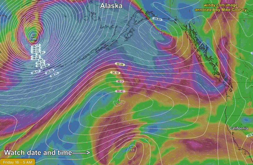
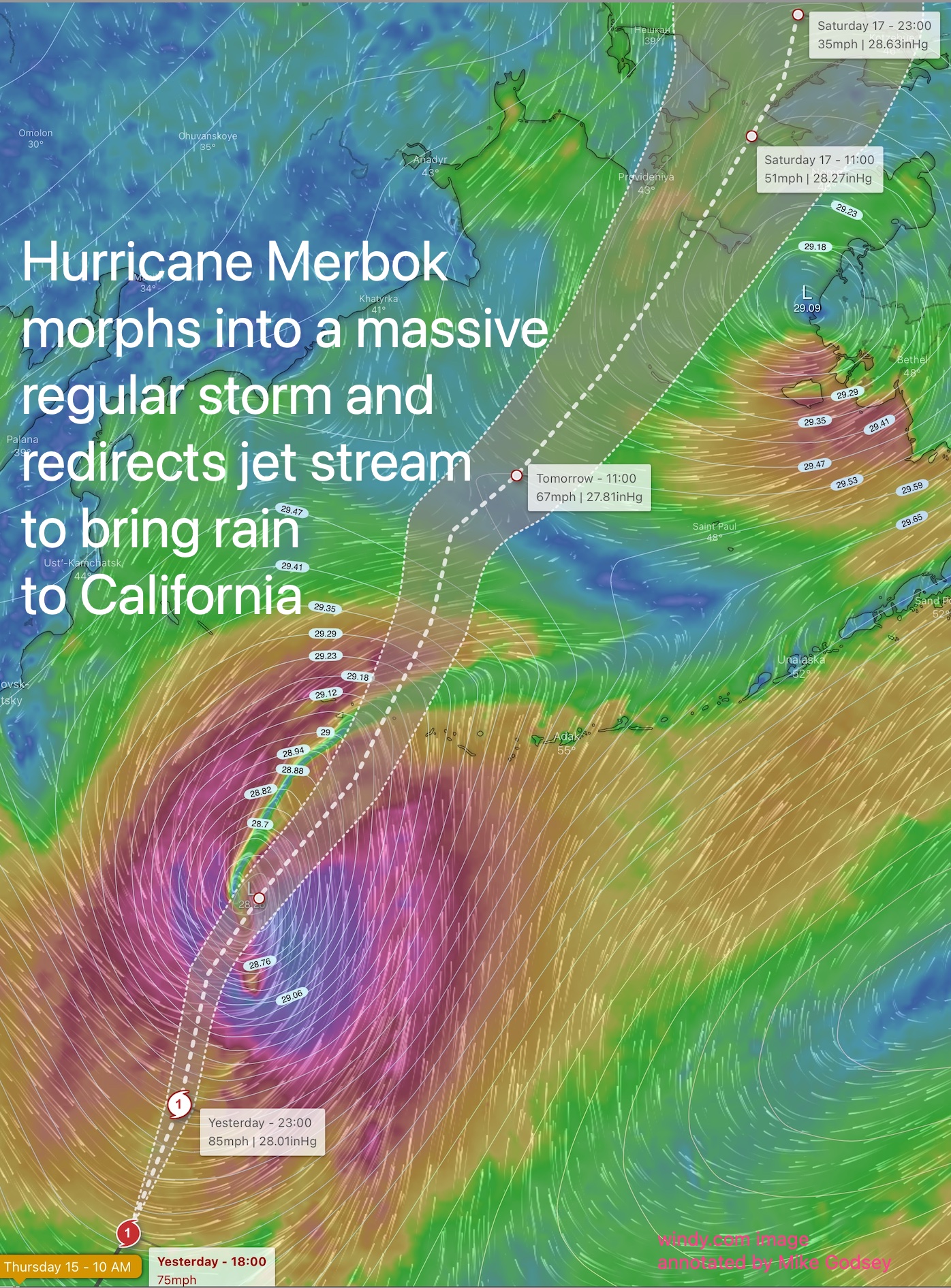
The first image shows the trajectory of Typhoon Merbok as it turns into a huge non-tropical storm in the Bering Sea between Russia and Alaska.
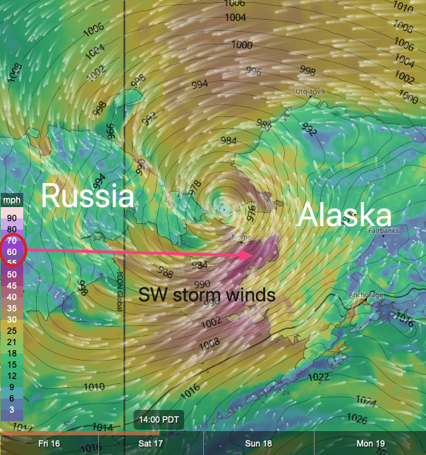
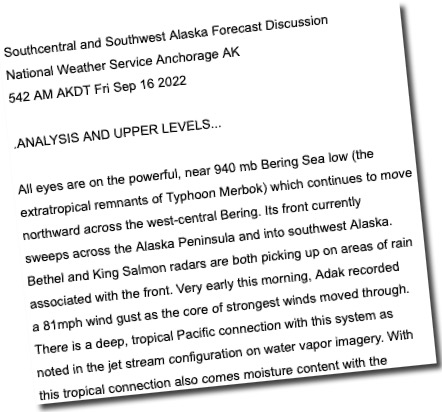
This 1800-mile-wide storm then moves into the Arctic Ocean bringing crazy strong winds to Alaska as you can read in this NWS discussion.
So, why should you, living in Northern California, care about a storm hitting Russia and Alaska?
Ahh, that is where a teleconnection comes in.
As the storm from former Typhoon Merbok moves northward its winds will get drawn into the wavy jet
stream winds. This energy from the storm interacts with the jet stream and distorts its shape so that its waves become amplified.
This means that its northward extending waves of wind, known as upper ridges, move further northward.
While its southward extending wind waves, known as upper troughs, move even further south into Northern California waters.
One of these upper troughs drops southward and encounters a surface storm in the Gulf of Alaska. The upper trough enhances the surface storm and steers it towards the California coast.
At the same time, the upper trough turns into a Cut-Off or Closed upper low. That means it, and the surface storm, are disconnected from the upper-level winds that normally steer weather from west to east. So the storm is likely to linger for a couple of days bringing much-needed rain to Northern California.
That storm is modeled to reach the ocean waters off San Francisco North Bay this Saturday evening. And by Sunday the entire region sees significant rain.
You can see this happening in this animation: