
It was HOT this

Labor Day.
The media is talking non-stop about the enduring heat wave and how is is caused by a “Heat
Dome.
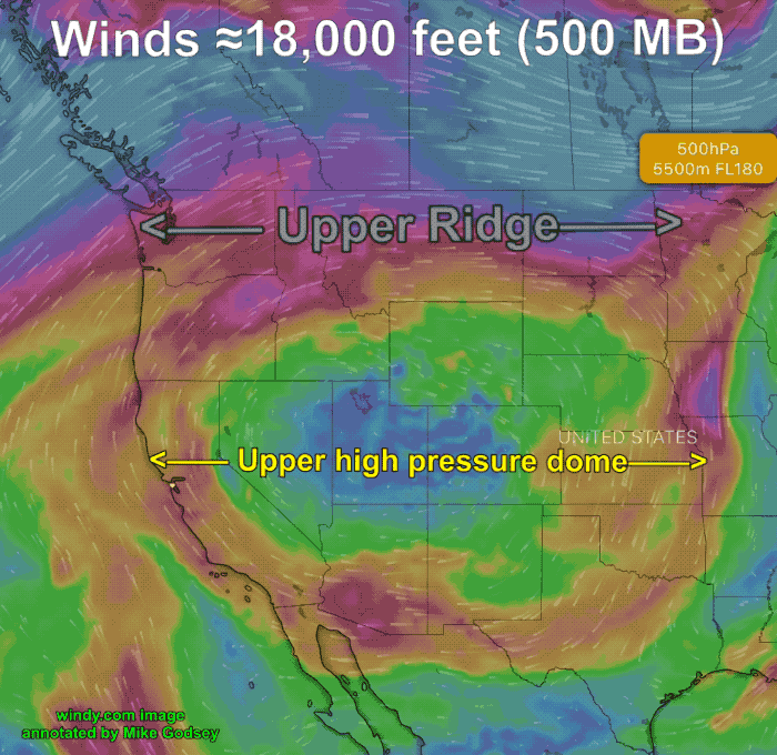
The first two images show you:
- What causes the heat dome.
- What the heat dome looks like from a 3D perspective.
- And the basic mechanisms that create all the heating.
Notice the 91 degrees near Waddell and 93 not to far from Long Beach.
Notice how much cooler it was
right near the coast
This was because there was still enough NW
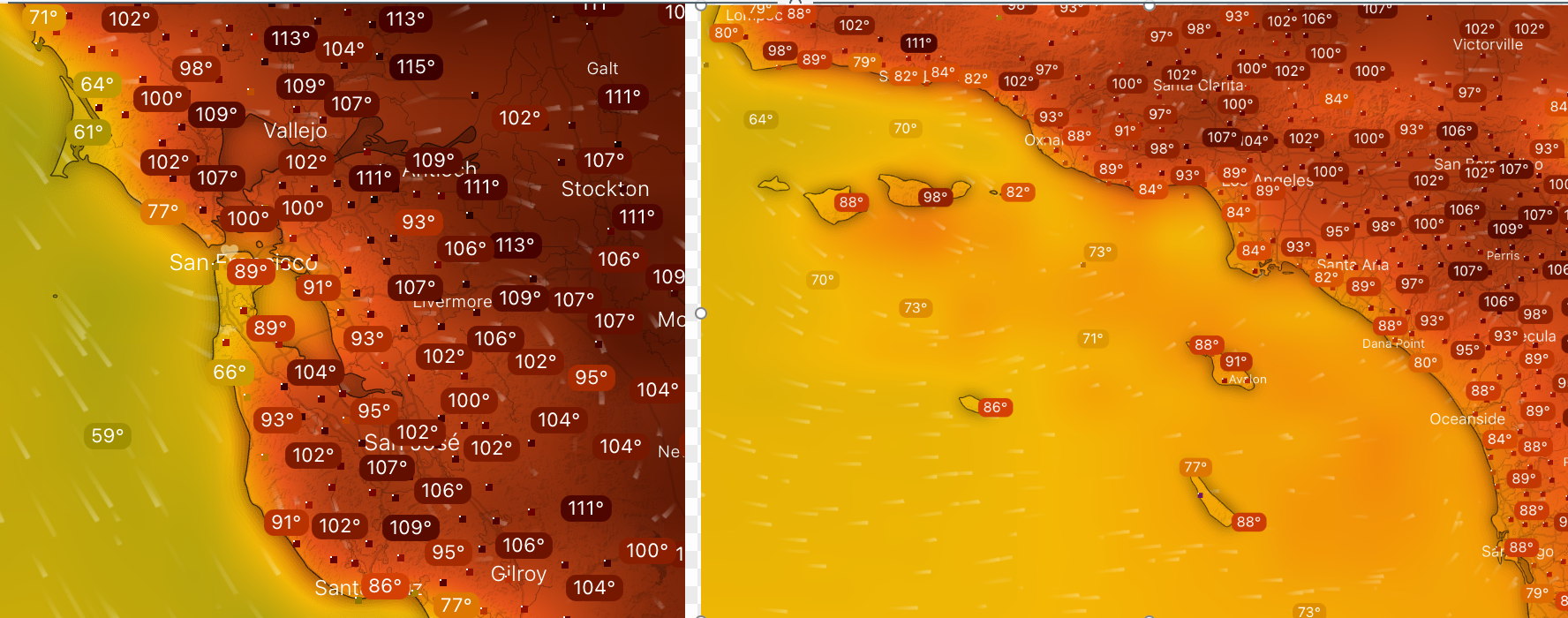
ocean winds to push the marine
layer to the coast.
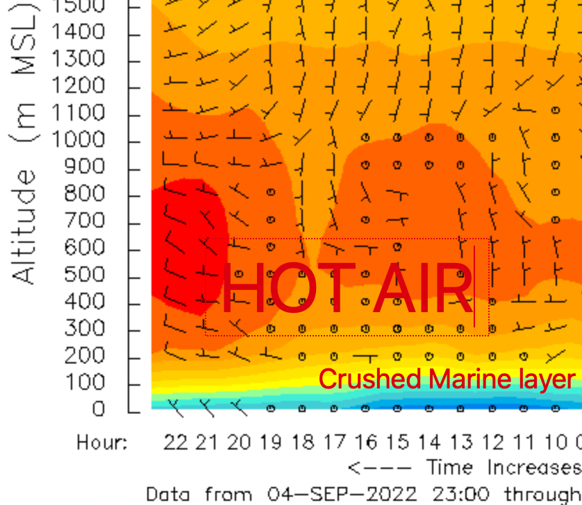
Nary a trace of fog since the air was too dry for fog to form. But there was still a
cool layer of air right near the coast as we can see in this profiler image from Bodega.
If you are a person who looks for winds you have to be very picky during a heat dome. All the heat at the surface forms a low-pressure area that balloons over much of the Southern California and San Francisco Bay Area.
If that low pressure comes over your site then expect only faint wind. I
f the edge of the low pressure is over your site expect very UP AND DOWN winds.
But, if you are a few miles away from the low pressure, probably near the coast, you will still find useful wind.
Matt Souders added:
The big upper-ridge has two causes:
- active La Nina jet already started but, with seasonal differences, all the storm action is over Alaska with wave breaks continuously adding more heat to the ridge
- self-sustaining mechanisms – basically, it makes its own weather
Sorry this blog is so short on text. It is just too hot to type.