 by Mike Godsey
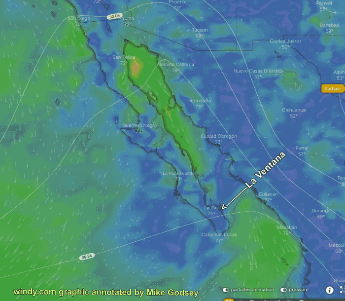
We are moving into a weird pattern starting late Thursday or more likely Friday.
Looking at the Surface Winds Friday you will notice that there are strong El Norte winds for the northern Sea of Cortez and also in the Cabo area south. But there is a suspicious “Weak Wind Zone on both sides of Baja at about the latitude of La Ventana.
When a meteorologist sees something like this at the surface they immediately suspect something is going on aloft.
So now look at the Winds at ≈18,000 feet.
Note the counterclockwise spinning air mass centered over Guerrero Negro north of La Ventana.
This puppy is a Cut-Off low. This type of upper storm has lost its connection with the upper level winds that loop around the planet.
Having lost that connection it is very hard to forecast exactly where the Cut-Off low will be located Friday.
 That is why my forecasts have been so iffy about the end of the week. It is also why the rain forecasts are all over the place for Baja’s East Cape.
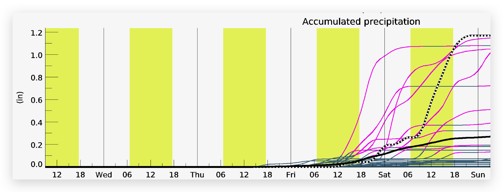
Take a look at the total amount of rain forecast by a large group of models.
Notice that the bulk of the models forecast scant rain which will probably be the case but if you are camped in an arroyo you might note that the outlier models have very heavy rain forecast. So keep a weather eye towards the mountains and if you see ominous clouds there Thursday night be ready just in case.