The wind situation looked pretty dismal but looking aloft or at the satellite imagery as clouds streamed overhead.
Find Isla Cerralvo and then the curve of La Ventana Bay at the start of this Wednesday satellite video.
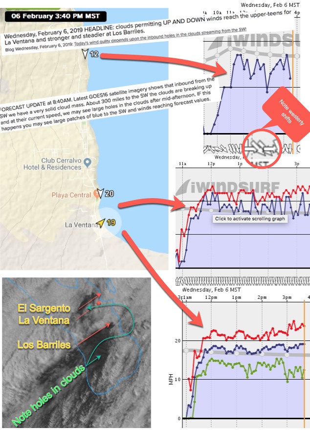
You can see the massive clouds streaming from the SW. So why did I forecast up and down upper-teens winds for the region?
Basically the NNW to WNW winds were largely from the North Pacific High rather than N. winds from 4 corners as in a classic El Norte event. To get these more westerly winds to curve into the beaches we needed some inland heating to create a local pressure gradient. And looking at the inbound clouds I noticed the speed of trajectory of the holes in the clouds and took a guess that those holes would be over our inland valleys in the afternoon. Turns out I was mostly right and we got enough clearing to allow the winds at south beach La Ventana and at the campground sensors to reach the UP AND DOWN upper-teens.
In they imagery below notice how El Sargento had much poorer quality winds with big shifts and lulls since it was farther from the steading impact of the warming.