When forecasting for more that a dozen sites and almost 200 wind/direction/time slots you are always going to have some major blown forecasts. But today Pt. Isabel and Berkeley forecasts were especially bad. Worse, not a single model forecast the normal WSW winds to turn almost SSE, accelerate and mostly bypass Pt. Isabel and Berkeley.
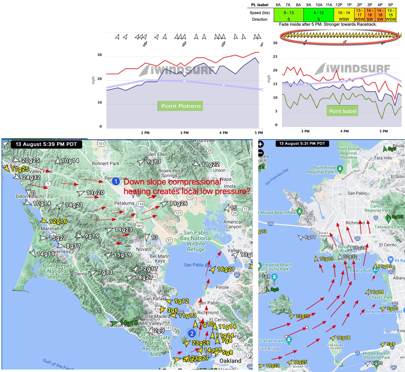
Looking at the wind map in the lower right of this image collage note that sensors near Point Richmond were seeing SSE winds as high as 30G32 at 5:31 PM. Clearly something weird happened. I as still looking at the data but so far it looks like very strong WSW winds were blowing from the Bodega area towards the Napa Valley. My hypothesis is that as these winds descended the eastern side of Marin’s coast range the compressional heating created a local low pressure area. This would turn the WSW winds in the Slot between Blunt Point and Treasure Island towards the Napa low pressure rather than the gradient towards Sacramento and Stockton so there would be S to SSE winds.
To verify this idea I will have to look at all the barometers in that area to see if this is what happened. Models can not pick up such tiny low pressure areas.