Poorly positioned high pressure at the surface and an upper trough aloft means mild winds.
by Mike Godsey, mail: MikeATiwindsurf.com
Looking at the model animation below note that in part one we are seeing the surface winds while in part 2 we are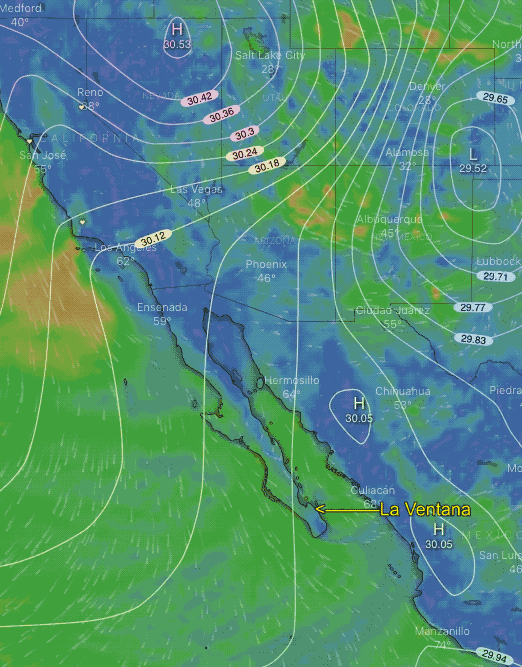 seeing the winds of an upper trough at about 18,000 ft.
The surface animation shows there is up high pressure moving towards the Great Basin but it is a little too far away to help our wind until tomorrow. The real wind killer is the southward extending loop of high speed wind you see in red and blue. This upper trough is at ≈ 18,000 ft. and brings cooler air over Baja and an increasing chance of clouds.
The combo of these events means mild wind today. Tomorrow the upper trough moves eastward and the high pressure drops southward and we see solid wind.