After experiencing strong NW winds from a massive 2500-mile-wide North Pacific High along the coast on Saturday, Sunday, and Monday, it may seem peculiar to read about weak southerly winds for a storm system on Tuesday. However, this sudden shift in wind patterns is not uncommon and can be explained by weather phenomena that are discussed in the forecast
So, how does a 2500-mile-wide wind machine disappear?
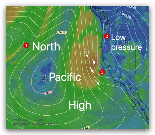
First notice the huge North Pacific High and its NW winds near the California coast west of San Francisco.
Now notice the low pressure in the Great Basin. Normally this is a recipe for strong winds in the San Francisco Bay Area. And, this is the cause of the recent strong winds.
But look closely at #3. See that tiny distortion in the isobars of both the NPH and the Great Basin High Pressure? Let’s look at that area more carefully.
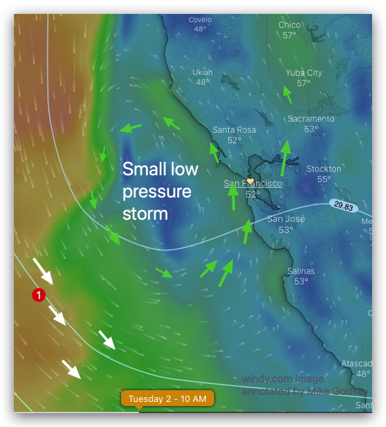
Notice the counter-clockwise winds spiralling out from this tiny storm. The question is… how can such a tiny storm bully the huge North Pacific High and it’s NW winds away from our coast?
The answer is way aloft at the 500 MB level of the atmosphere at ≈18,000 feet. Let’s take zoomed-out look at the winds at that level.
This 3rd image shows both the winds at ≈18,000 feet and the surface isobars of the surface North Pacific High and the Great Basin High Pressure.
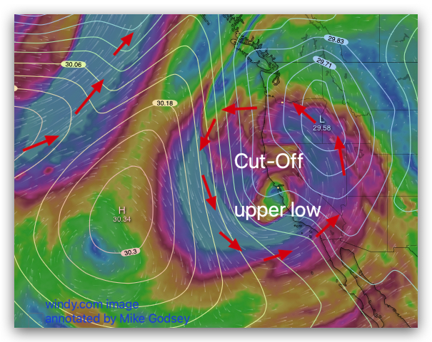
Focus on the bright red, magenta and orange colors representing the winds up at ≈18,000 feet. Notice how these counter-clockwise spinning winds are not connected to any of the other strong upper winds in the image. This means we have a 900 mile wide Cut-Off upper low centered over the San Francisco. This feature is what is inducing the tiny surface storm near the Bay Area. And, more importantly, it is what is stopping the North Pacific High’s surface NW winds from reaching our coast.
Since Cut-Off upper lows are cut off from the surrounding upper wind flow they tend to linger and are very unpredictable. So it may be a while until the mighty North Pacific High returns NW winds to the Bay Area.