by Mike Godsey, mikeATiwindsurf.com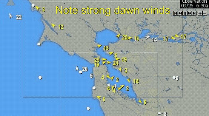
Did you get wildly excited early this morning when you saw San Francisco’s Point Blunt winds averaging 28 and Berkeley already 22 while Crissy was 23? It looked like the classic Bay Area marine surge end of a heatwave. But by 8AM the wind had faded away at most sites. I forecast a major fade mid morning but not to this extent. What happened?
Watch the animation above from 6:30AM to 9:14 AM. Focus on Crissy and note the amazing drop off of wind from dawn’s 23 knots to 3 knots at 9:14 AM.
Now study this satellite animation and you can see the problem. A normal marine surge after a heatwave is comprised of fog and wind running parallel to the coast due to a N.-S. pressure gradient. And when the surge nears the Bay it is sucked through the Golden Gate and we have strong southerly winds all day.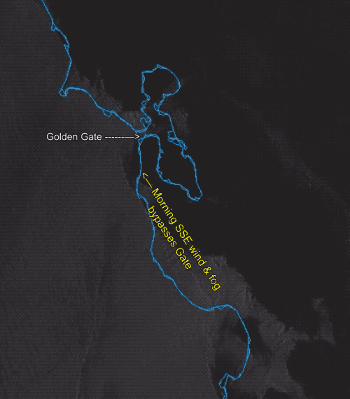
But today’s marine surge is largely caused by a counter-clockwise spinning low pressure just NW of the Golden Gate and that is promoting large scale SSW to SSE winds. And as you can see in this satellite animation the wind in the morning became too SSE mid-morning to curve into the Bay. So the winds dropped fast at Crissy.
I expect the fog and winds to pick up later today as the pressure gradient becomes strong enough to curve even SSW winds into the Bay Area.