This winter we have seen the third year of a La Niña climate pattern. Indirectly this has often caused the average size and location of the North Pacific High to be atypical.
Much of the winter the NPH has been larger, further northward and closer to Baja California than average.
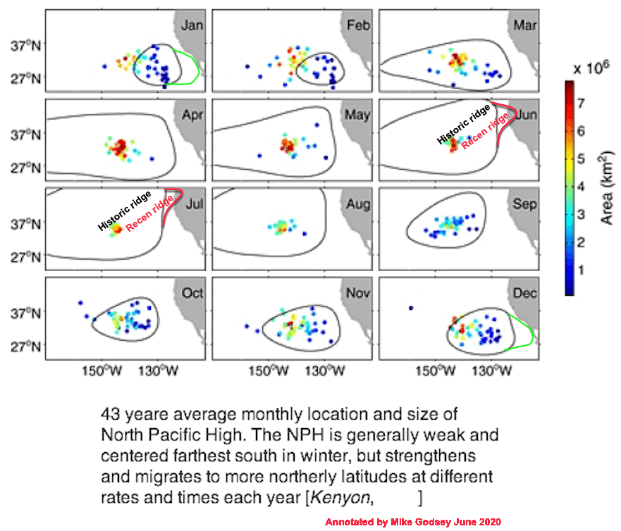
This first image shows the average size and location and size North Pacific High during the recent 43 years. Note how small the NPH is during the winter months and and far
south it is located on average.
For the second year in a row the pacific side of Baja and Baja’s Sea of Cortez have had an exceptionally windy winter season. This is largely due to the unusual location and size of the North Pacific High. In a typical year most of the large scale winds for Baja’s East Cape comes from Great Basin High Pressure.
Likewise, the California coast has had more frequent strong NW winds at the ocean buoys than normal
during the winter.
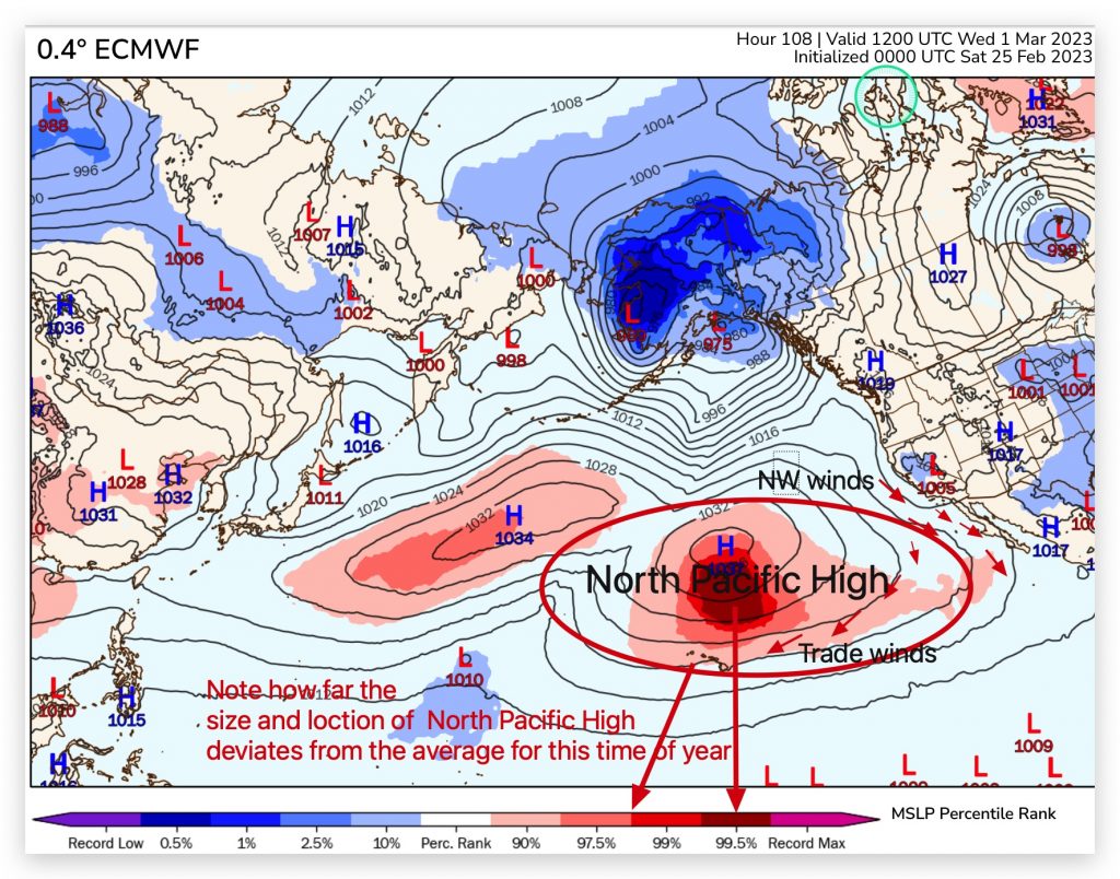
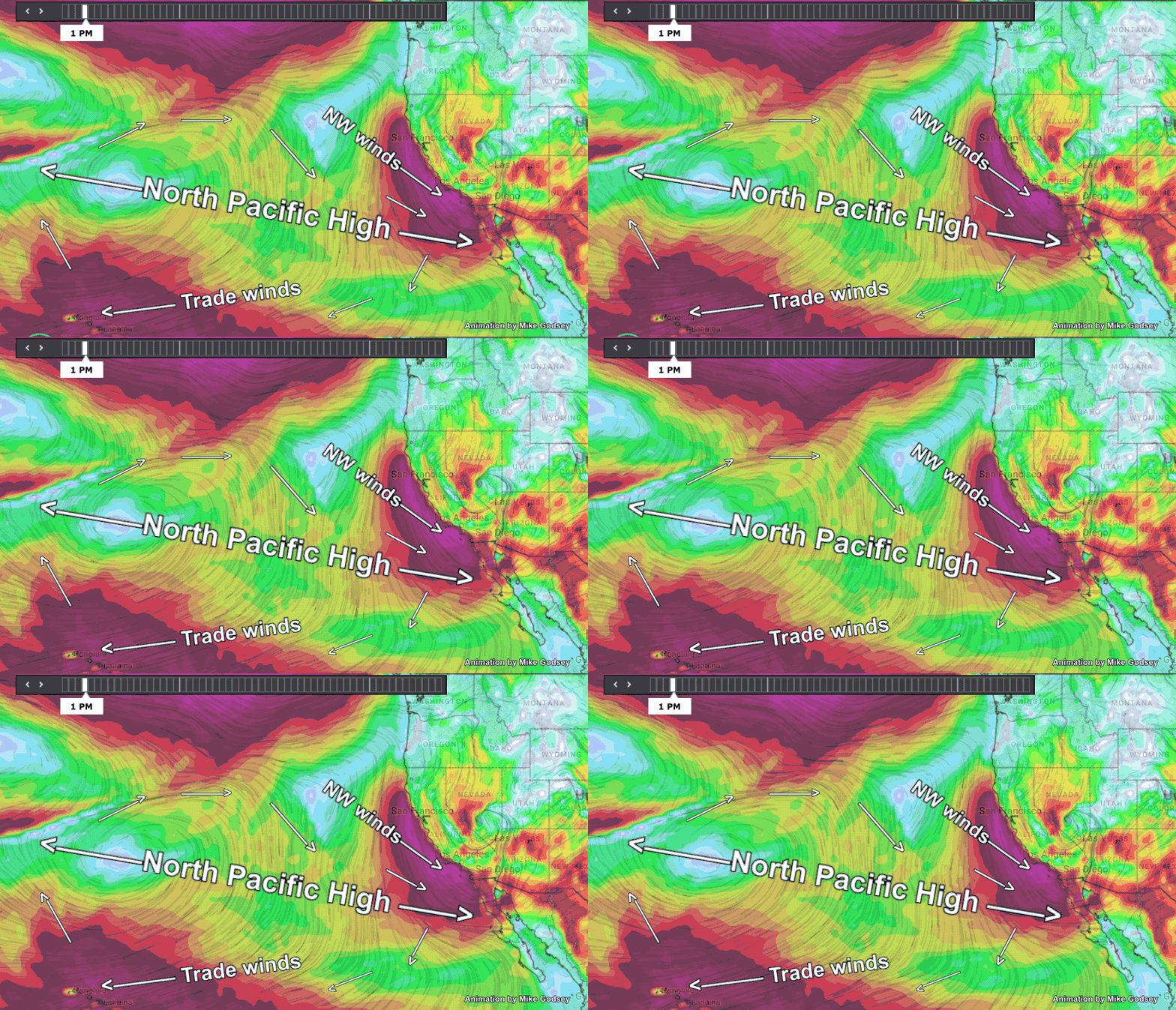
This next image shows how unusual the location of the North Pacific High is today March 1.
Both the size and location of the NPH are anomalous today as has been the case much of the winter.
The next image shows how large the North Pacific High is today March 1.
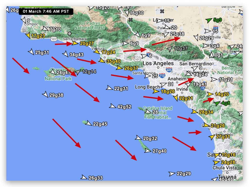
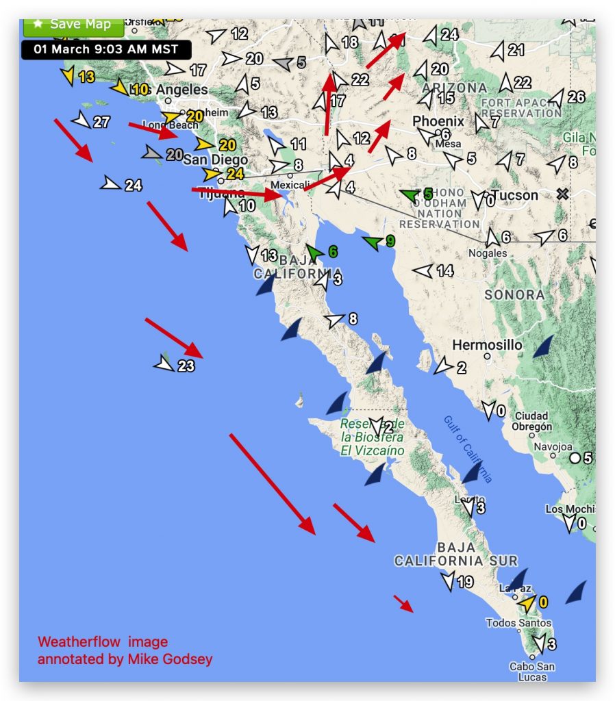
Notice the strong winds along the California and Baja
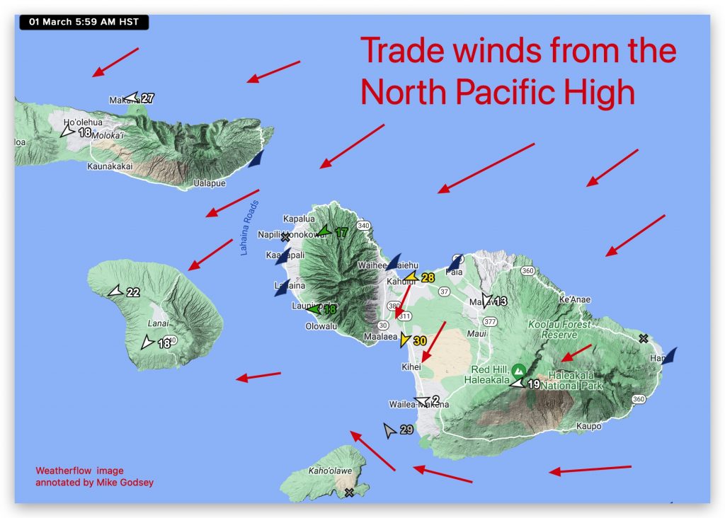
Norte coasts and Hawaiian waters.
The next several images show how this location and size is impacting the winds at our Weatherflow sensors in Southern California, San Francisco, Hawaii and Baja today.
