A visual guide: What’s with those dirty thin clouds above the marine layer clouds.
by Mike Godsey, mikeATiwindsurf.com
Yesterday Ben did a great job showing the impact of the current monsoonal pattern on Southern California so today I will cover the Bay Area.
As the marine layer clouds burn back today you will notice 2 things.
First looking upward you will notice thin hazy monsoonal clouds far aloft.
Then looking at your device you will notice my wishy-washy wind forecast with vague mumblings about monsoonal clouds making for an iffy forecast.
So lets look at these monsoonal clouds and figure out how they come to be over California today.
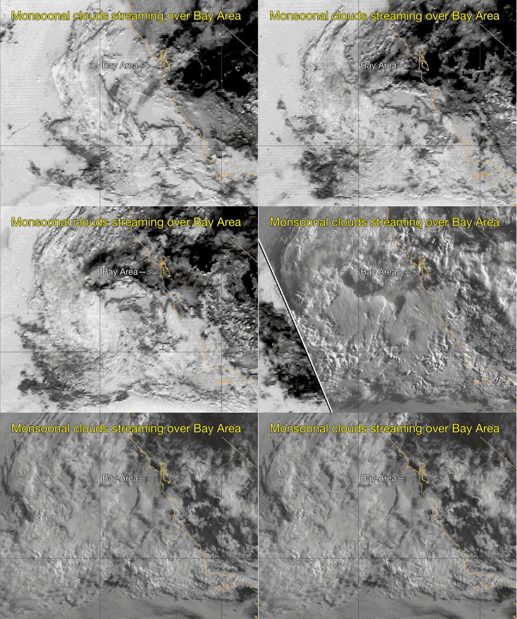
The first satellite animation from predawn to about 9AM today shows these mid to upper level clouds as they stream from the SE over the Bay Area. The same cloud flow is happening over Southern California today. Looking carefully can you see why the Gorge is finally free from monsoonal clouds today.
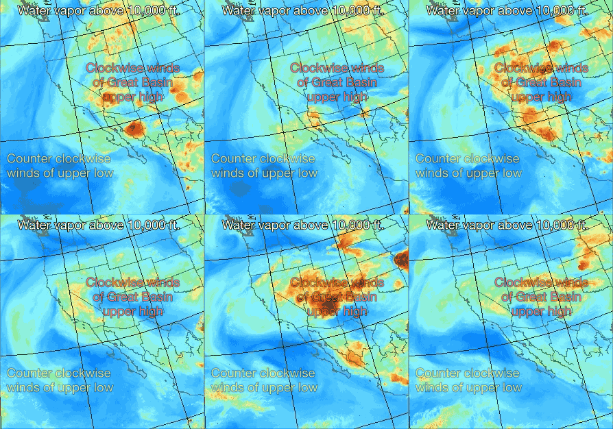
 The second animation shows the flow of water vapor above 10,000 feet. Watch carefully the rotation of the water vapor since we will come back to that.
As these clouds come over us their winds do not directly impact our surface winds since the SE winds are 10K to 18K above the surface. But they can impact the surface winds indirectly in 3 major ways:
1. Shadows from these clouds can partially shade the surface which decreases surface heating and the 
pressure gradient. Unfortunately the where and now much of this effect is impossible to forecast in advance.
2. As the most air in these clouds comes over mountains they can create brief showers and even
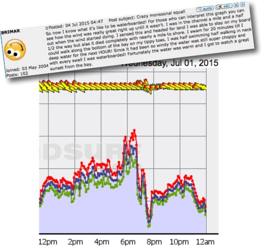
thunderstorms that very briefly produce strong local winds. For example parts of San Diego saw very brief winds to over 40 knots yesterday. The exact location of these convective events is also difficult to predict in advance. And check out this wind graph from 3rd. Ave
3. And lastly the monsoonal clouds can cause the marine layer clouds to mix out which can influence the wind distribution.
So what generates these monsoonal clouds and wind?
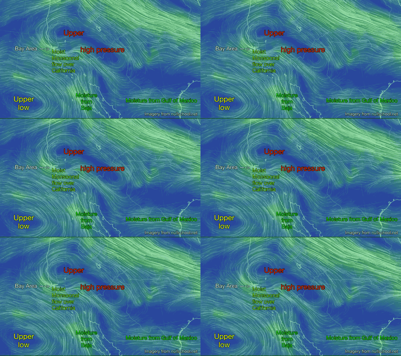
Looking at this 3rd animation first find the upper high over the Great Basin and note the clockwise rotation of winds around this high. Now find the upper low pressure west of Baja and note the counter clockwise winds spiraling from the low. Next notice how these two flows converge over California.
This convergence means that we have SE upper flow over most of California at the 10,000 to 18,000 foot level. Now look carefully and you will notice that these winds are pulling in moist warm air from the Gulf of Mexico and from the waters near Baja.
As this moisture partially condenses in the cooler upper levels it forms thin clouds that you see overhead. And when conditions are right this moisture can form thicker masses of clouds near the surface, showers and even thunder storms.
Lastly look to north of the Great Basin and note the northward jog in the upper level winds. That puppy is called an upper ridge and it is responsible for the warmer than typical conditions today. So when will this monsoonal pattern subside? As soon as the Great Basin upper high moves east of the Sierra.
