By WeatherFlow meteorologist Shea Gibson 10/31/2015
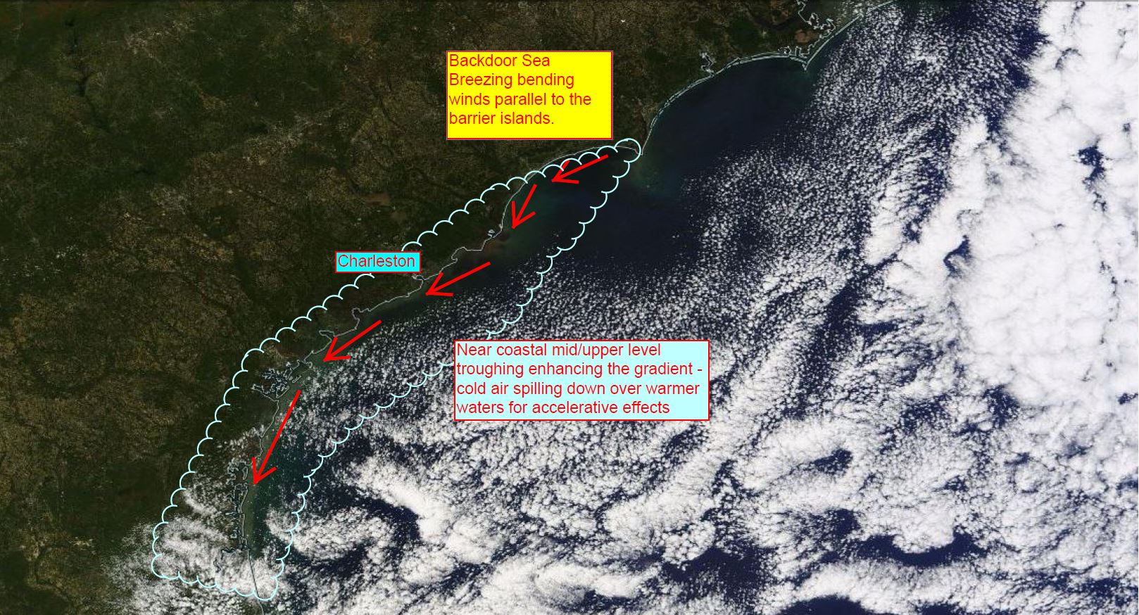
Many are well aware that our coastline is very fragile as air masses over warmer land and cooler waters interact with each other. In some cases, we have avenues of acceleration called Sea Breezes as these two air masses work to create a circulation or oscillation of air. There are various types and classifications of these coastal systems, but we’ll pick one in particular that consistently brings winds up to moderate or strong values. This coastal effect is a rather tricky one since it does not operate like a typical Sea Breeze model you have probably heard of. It involves cooler NE/ENE winds wedging down the SC coast and how it interacts with the environmental atmosphere and the warmer land. It’s called the “backdoor Sea Breeze”.
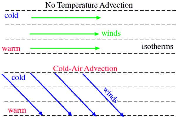
In order to understand how this Sea Breeze works, we must think of how High pressure to the north steers a sinking cool or cold air mass down the coast, and given its relationship to gravity, sinks downward.
Here is a simple diagram that shows the sinking of this air down at an angle due to winds driving it aloft. This is known as the cold air advection process.
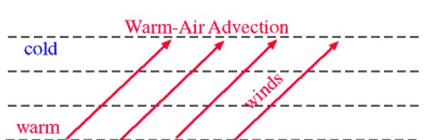
Generally speaking, NNE/NE winds along our coast are cooler by nature of where the air is coming from (the north). As the day heats up and land warms, we see the air “bending” or veering as it makes first contact with the warmer land, or usually the barrier island chain. Specifically, many beaches along our coast are affected by this wind field bending phenomena. Heats draws this rushing air inwards over the islands and steers it further inland. This is the point where the air warms, starts the evaporation process, and then rises inland as its buoyancy increases. This is known as the warm air advection process. We can associate these with “thermals” for those who are familiar with the term.
Without strong storming inland in many cases, we do not see a circulation of air. This type of setup is called an “oscillation”, or movement of air down and then up in an accelerated fashion. We can see this mainly as fair weather or cumulus clouds building inland.
Let’s see what this all looks like:
This shows the cumulus builds inland over Charleston, SC where the ocean is to the right roughly ~10 miles. Totally dry towards the ocean.
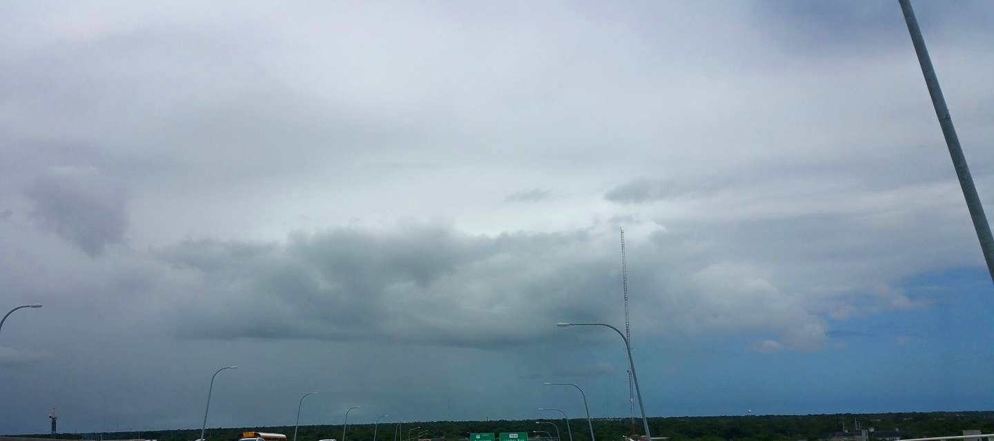
And in the summer time, these clouds can take on more convective or stormy characteristics. In these occasions, short wave troughs develop as clouding sinks to lower levels and creates convection where warm moist air and cool dry air mix. This intensifies and throws wind directions off – either squashing the oscillation altogether or scattering directions while causing localized showers or storms. The below picture came from my article on short waves: https://blog.weatherflow.com/what-is-a-short-wave-and-how-can-it-affect-winds/
Since the overall air mass is already sinking (from strong High pressure aloft), something has to give. As the pressure drops (Low pressure), warmer land starts allowing a faster rate of intake than the air is already moving into the coast – like a vertical venturi effect or squeezing of air. The air is then forced upwards as this bit of cooler moisture sinks and creates buoyant instability during warming and evaporation (lifting) inland. In other words, winds are “swooping down” over the beach while accelerating faster as a result of faster air movement from initial land contact to inland, where it swoops back up. The downward swoop would be where the pressure is dropping, so we see that as Low pressure aloft over the immediate coast. Sometimes, it can be kind of like a bottle of Champagne ready to pop as winds start North and slowly clock NNE…NE…and then pop! ENE winds zoom up quickly with the onshore leans. In some cases, we can see upwards of 15-20kts in acceleration within a 5-10 minute period, which catches many off-guard.
Here is a wind graph from April 21, 2013, where speeds exploded upwards once the direction leaned onshore. That was almost a 15 kt jump in averages within a 5 minute span!

This activity attracts nearby troughing from remnant offshore frontal boundaries like a magnet from afar at times… and can help to increase the local gradient as High pressure interacts with the newly developing coastal trough. You can see these as stratus cloud forms or some mid level type of clouding coming in from the ocean.
Check the following pictures where you can clearly see that thin layer of clouding/troughing lingering offshore (likely out over the warmer Gulf Stream that continues to feed it)..and the resulting directions that occur:
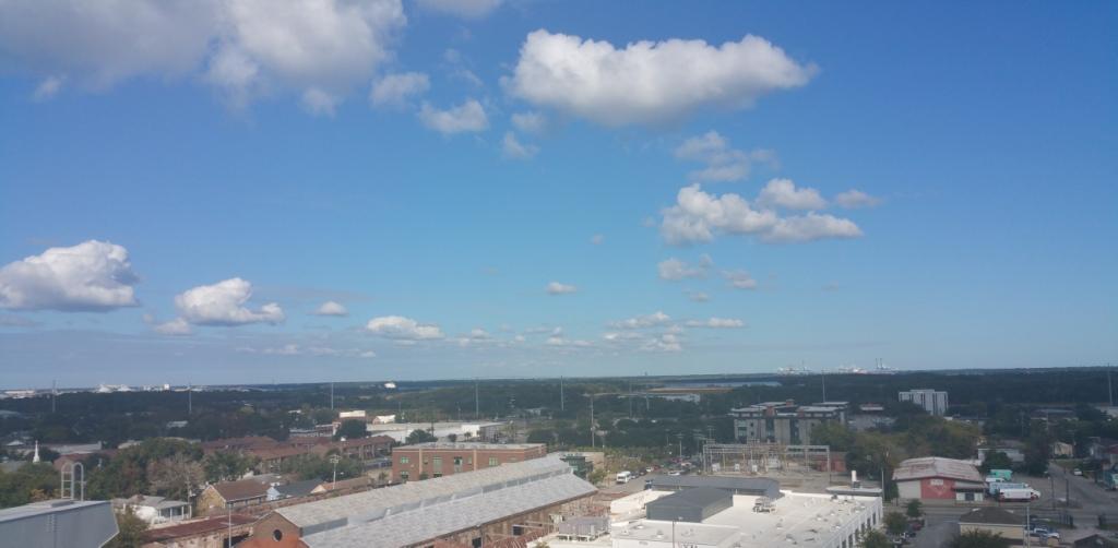
Here’s from about 20 miles inland looking toward the sea across the Ravenel Bridge in Charleston, SC on October 19, 2015 at 11:40AM
And the overhead shot from that day:
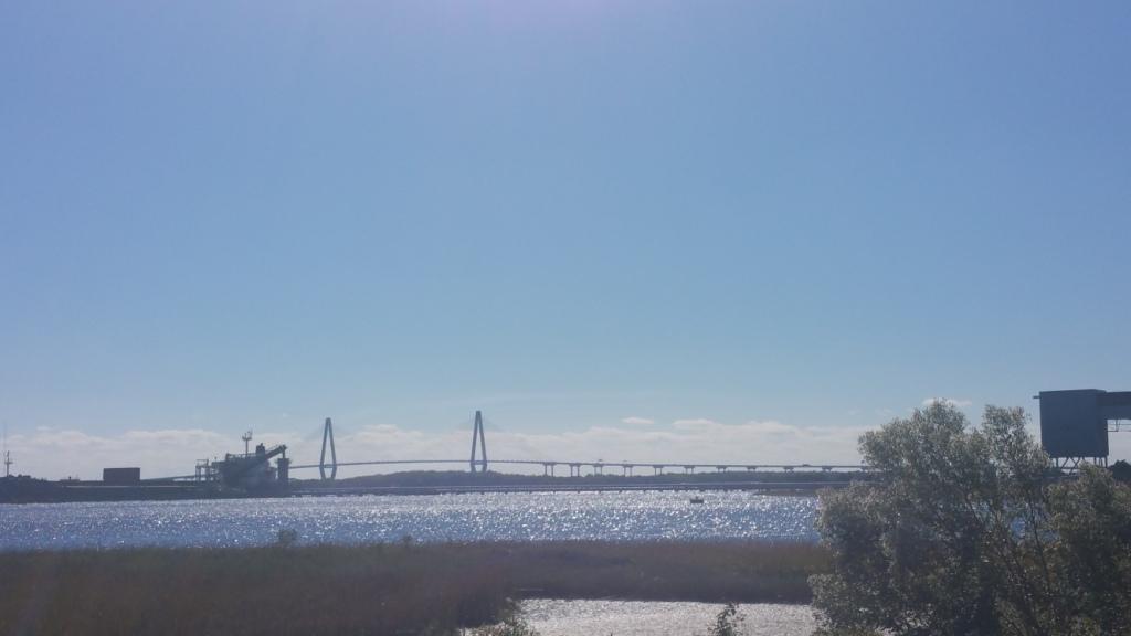
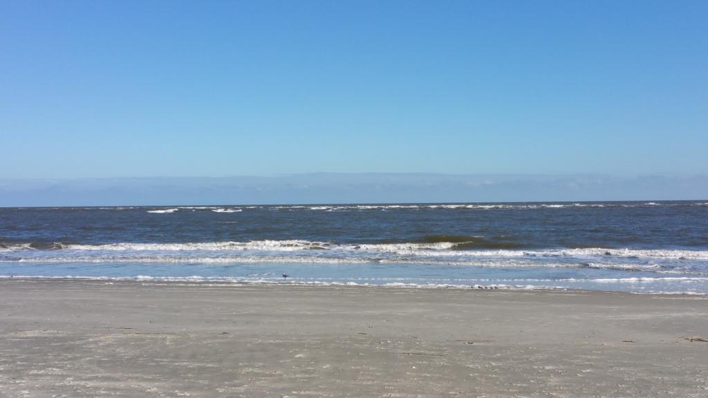
And the next day from Sullivan’s Island on October 20, 2015 at 3:45 PM – you can see the troughing offshore on the horizon.
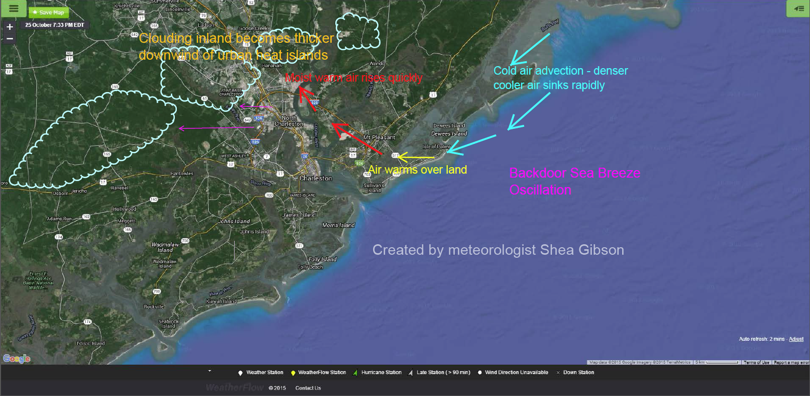
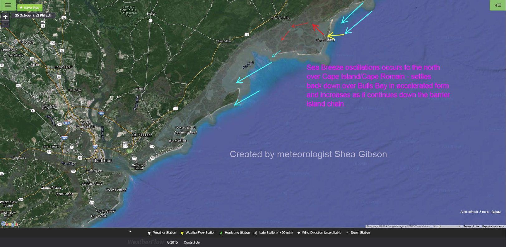
Some of the additional accelerative effects could be due to the open body of water to our north with an exposed land mass that all helps to create a “micro breeze” that quickly settles back down over Bulls Bay and rushes south. This might also explain how Charleston in particular sees higher speeds than most other beaches from Cape Island down through Georgia.
SO HOW DOES THIS WORK ALONG our beaches and do we know any details of what to expect? The answer lies in actual observations while riding on the water and from local sensors, we can see what occurs along our fragile coastline. Believe it or not you can gather LOTS of information while kiteboarding on the water. I find the kite’s physical tension coupled with the harness attached to the body provides very valuable information for how the winds consistently or inconsistently behave. Having the freedom to explore the coast broadens this knowledge. I’m sure many other kiteboarders may agree that what little topography we have along the beaches has a lot to do with what the winds are doing, and so do entire open stretches of beaches and coastal breaks or pools of water upwind.
We see that exposed sandbars help with accelerations in our experiences that could be called “wind rivers” offshore and near the beach. To this day, there is no scientific support for the term “wind river”, but the phenomenon does exist during these periods of winds. On several occasions, I (and others) have noticed that the winds are more onshore (Easterly) out beyond the sandbar..and become more side-shore (NE’rly) as we head in towards the beach. This makes it easier to get upwind on the outside, but harder to get upwind closer towards the beach. The tidal acceleration has a good bit to do with this as well, especially on an outgoing tide. However, there is absolutely a distinct shift..or “backing” of winds to the side-shore directions- and this could easily be due to the surface roughness guiding the surface winds in its direction. It’s almost as if the deeper waters are host to a less frictional ENE/EAST wind than the shallower waters, which tend to gain surface friction from increased shallow water chop.
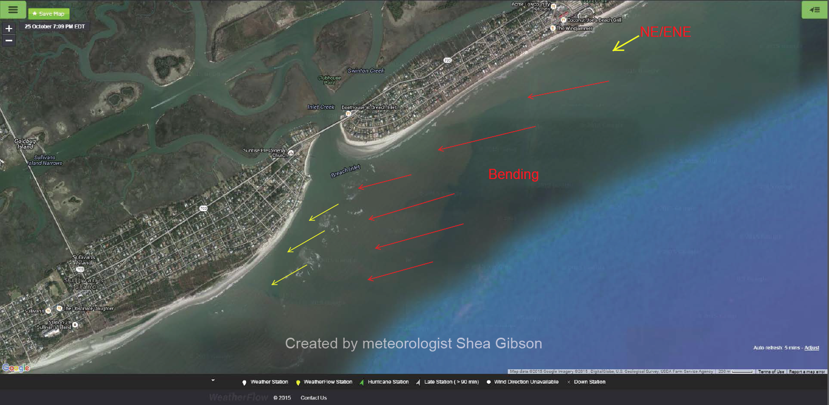
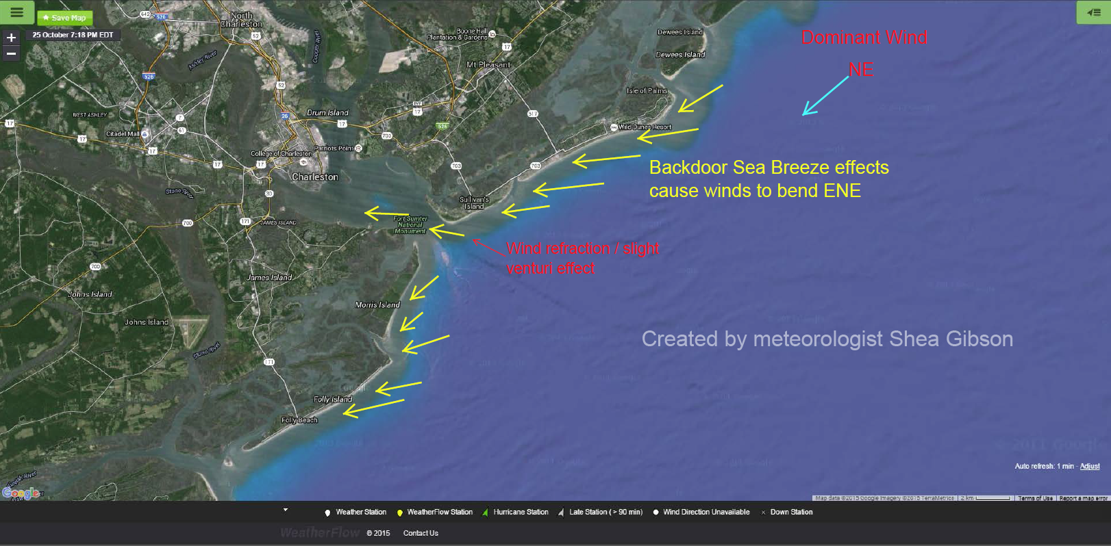
Here is a good example of what we might experience on any given NE–>ENE event. Isle of Palms is the island at the top, Breach Inlet then Sullivan’s Island to the left. Then yellow arrows represent the directions winds come from.
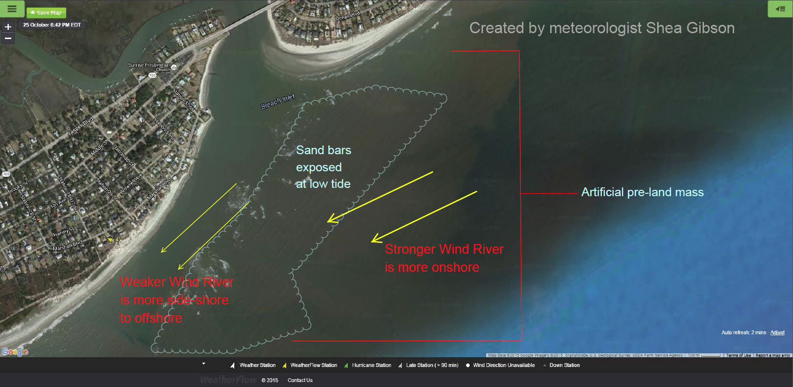
One important note: Once the sand bar becomes completely covered up by high tide, the wind direction pretty much becomes fairly uniform while the gradient weakens, resulting in the “drying up” of these wind rivers.
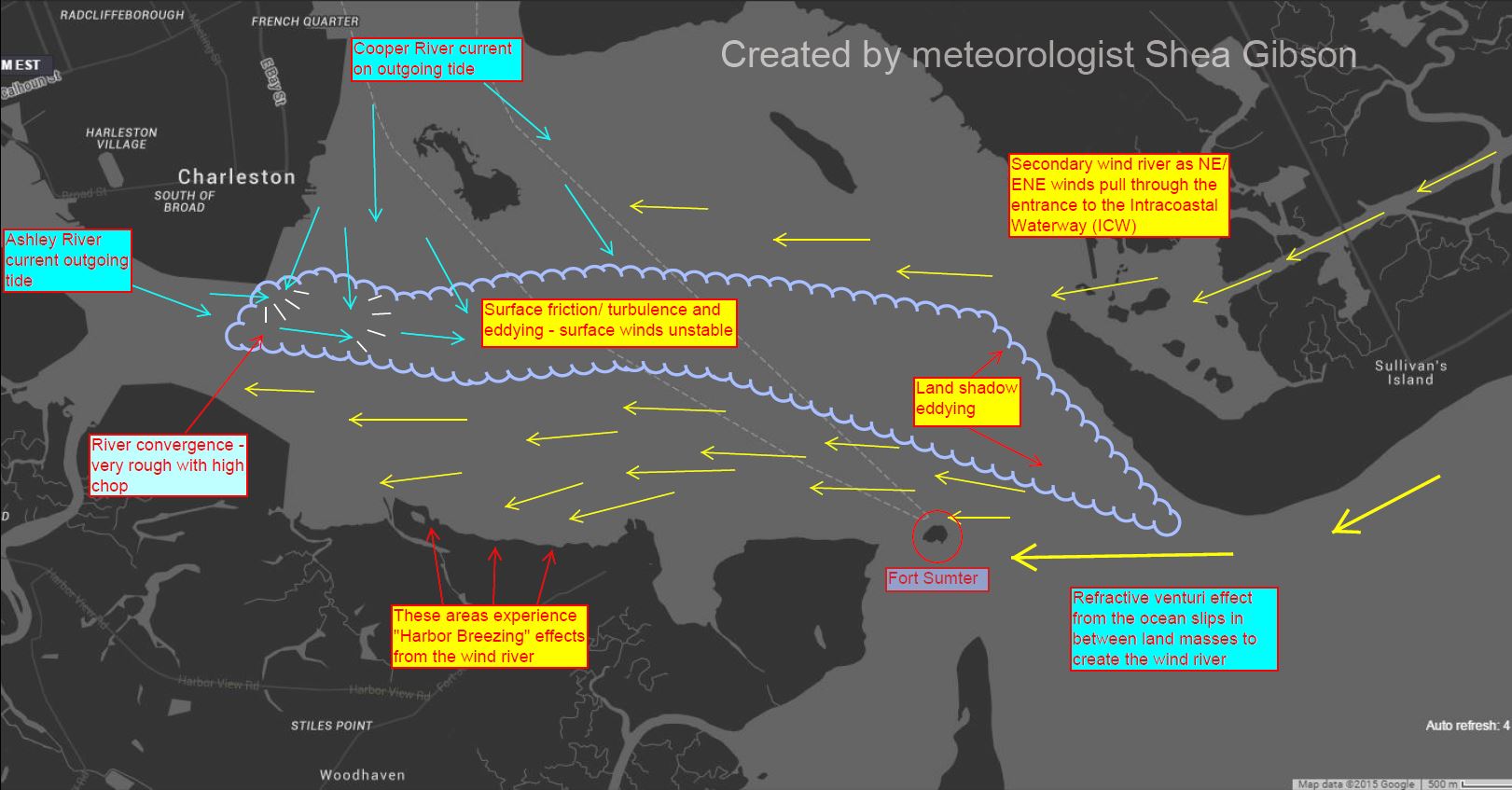
As we head into the Charleston Harbor, things get a bit more complex as land shadowing, river convergence and surface friction cause eddying and instability in the wind field. This divides the harbor into two sections – one for the main wind river pushing through in off the ocean…and a secondary wind river from the winds funneling down the Intracoastal Waterway. Here is a map of what is occurring on an outgoing tide. The wind rivers widen just a bit on an incoming tide as surface friction calms down.
So all-in-all, this article presents some newer material for the meteorological world as we continue to learn about our fragile coast. These Backdoor Sea Breezes are necessary to understand for many reasons…and extremely important to mariners, watersportsmen and the maritime community as a whole. As our coastal sensors, newer technologies and time on the water allow us to “see” more of what is going on, we may find even more of these nuances that we never thought existed.
Cheers,
Shea Gibson
WeatherFlow Meteorologist
SE Region/ East Coast
Twitter: @WeatherFlowCHAS