By WeatherFlow meteorologist Shea Gibson 4/18/21
Held annually in Charleston, this year’s Charleston Race Week 2021 weekend proved a bit difficult to pin down for winds due to unsettled weather lingering to the south along a stalled front. Saturday, April 10 showed a few UPs and DOWNs before meeting full forecast values in the mid-late afternoon. Sunday proved even trickier as what was believed to be a rather straight-forward gradual SSW Sea Breeze (ahead of a distant cold front) build came all at once for the morning offshore race course start – at least for an hour or so period before settling back down.
I was on the Zoom web-cast with Quantum Sails that morning at 7:30AM to go over the forecast for the Race Week watchers and things looked on track with general intuition and lots of agreement in model guidance for the setup. Here was the forecast initially written by myself the night before and later updated by fellow forecaster Hank Pomeranz that morning.

On radar, we could see a flare up of storms well to our south over the FL/GA border. The blob of convection was slowly pushing north, but we knew a few clouds would overstretch and the convection would fizzle out just to our south over the Atlantic Ocean. What we didn’t know was that this area of convection would send a significant outflow over our area that would affect the surface winds.
Generally speaking and ahead of cold fronts with Atlantic High pressure, we see light morning W’rly land breezes transition over to SW/SSW’rly Sea Breezes as the day heats up. In this case, this lob of convection crept northwards with somewhat of a outflow boundary charging northwards. This caused rippling as you see below – called “gravity waves“.
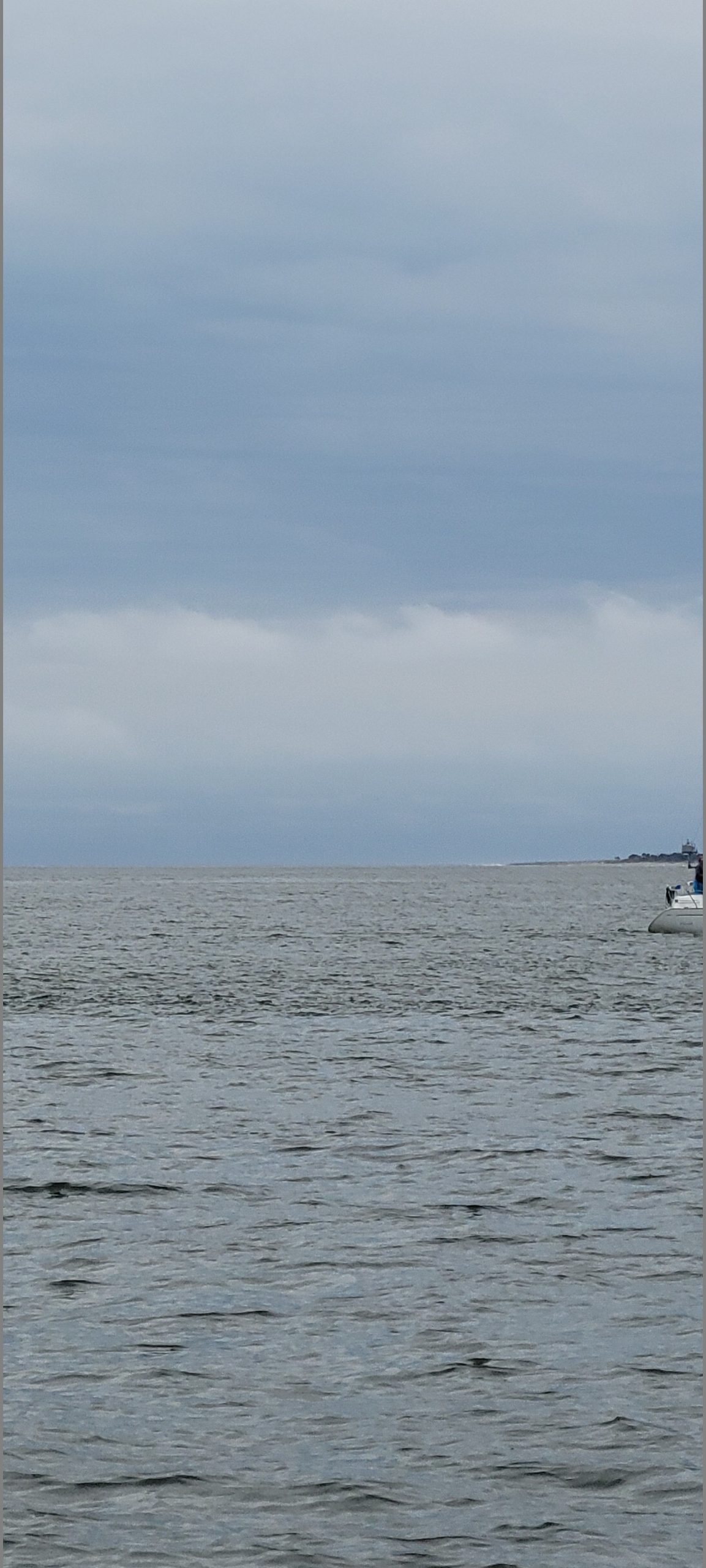
One thing to mention is that the winds aloft were right around 20-25 kts at ~3000ft per NOAA Aviation Weather (ADDS) that morning from 8:00AM ET – 11:00AM ET. These winds were part of what is called “low level jetting” that usually occur ahead of cold fronts. When the upper outflow clouds fanned out overhead, they were followed quickly by a lower level set of cumulus based rippling clouds, hence the gravity waves. Basically it was faster moving cool air colliding with a warmer layer over the area. Hence the gravity wave effects. Here is a pic of what we call Kelvin Hemlholtz clouding…or “wave clouds”. The pic does not do it justice and you can barely make it, but it was there.
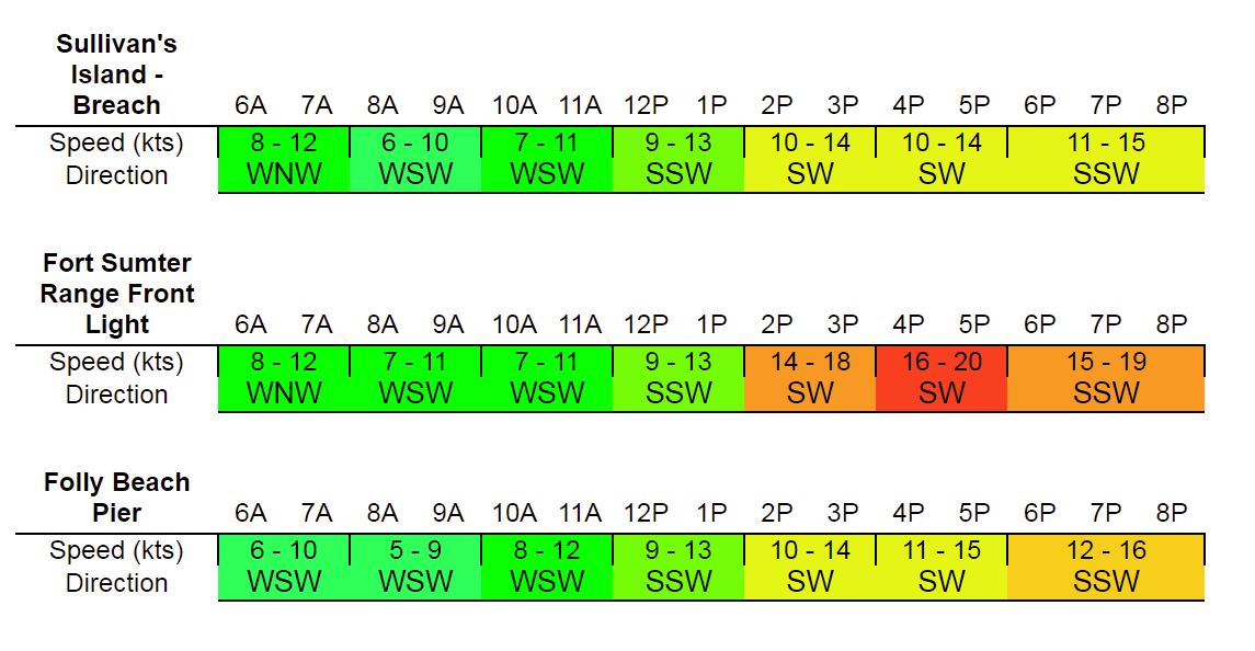
This lower layer of clouding mixed with two mid level layers basically forced the winds just aloft down to the surface. The result was a quickly increasing SW flow that met 18-20kts inside the harbor and offshore, making for a very interesting start! Gusts were well in the low to mid 20’s as well.
Here is Fort Sumter along the out Charleston Harbor….

And Folly Beach which represented what was going on along the beaches and also the Jetties.
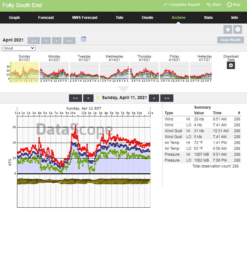
This elevated wind event lasted for about and hour and half, which made for good ground on the racers but it was burly out there beyond the jetty. On the way back in, the winds died and shifted Westerly to light values, so it was a slow finish for most. But…the sun eventually popped back out and the forecast met expectations for the rest of the afternoon. Just goes to show you how tricky these forecasts can be if one distant elements overshoots its position or runs interference. There sometimes is no way to see that coming unless in real time, which makes for planning and forecasting difficulties. However, we are all students of the trade and we learn going forward, so this goes into our tool belt for next time.
Until next time, everyone stay safe out there on the water!