by WeatherFlow meteorologist Shea Gibson
Ever wonder when you are at the beach that all of a sudden winds seem to come out of nowhere on a perfectly sunny day?
Well, the land-sea interface of the SE Region is a very sensitive atmospheric environment and has a few tricks up its sleeve. One of them is the “Sea Breeze”, which tends to be the dominant feature that shows the push and pull of land-based heat fluxing versus the cool-water based cold front formation moving onto shore. When we have large areas of High pressure over the Atlantic (in many cases a “Bermuda High”), we see a much more pronounced Southerly flow that increases – especially in the warmer months. Other times, these Southerly Sea Breezes will occur if the “other” variant dominant wind fades out and High pressure develops closer to the coast on a smaller scale. More about Sea Breeze basics in my blog here: https://blog.weatherflow.com/sea-breezes-in-the-southeast-region-part-i-basic-understanding/
NOTE: The term “Coastal Carolina Ridge” or “default coastal ridge” is just a general term used to describe an event that occurs naturally along the curvature of the GA/SC border coastline climate when one dominant feature runs its course, and then the typical Sea Breeze feature takes over (either for a small period or for the remainder of the day or night). In this case, was just a smaller period event, but definitely worth noting.
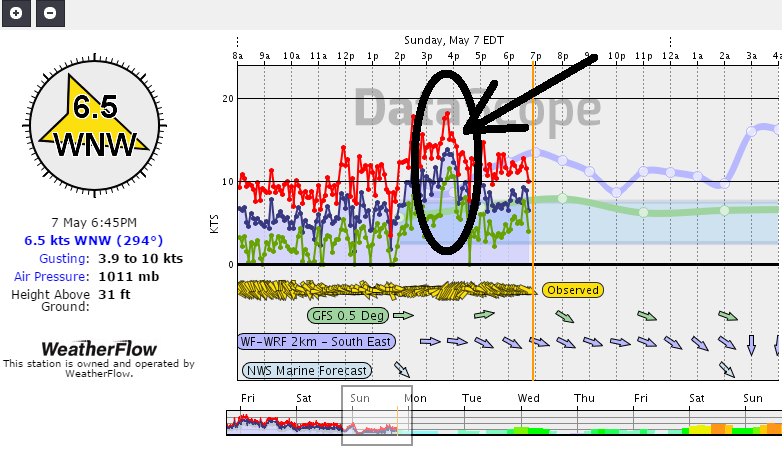
This event on Sunday, May 7th during the afternoon hours shows what happens when background winds (in this case Westerly winds) fall below a certain point while fading quickly as they head offshore.
Just another one of those tricky nuances along the coast we constantly watch for in our forecast efforts. Stay safe all!
Cheers!
Shea Gibson
WeatherFlow Forecasting Team
SE Region/ East Coast
New Station Projects/ Outreach
Twitter: @WeatherFlowCHAS
Facebook: Chucktown Wind Report