
Much of early October saw the Weatherflow iwindsurf.com/ikitesurf.com forecasts barely changing from day to day for Southern California and the San Francisco Bay Area. During that time marine layer clouds clogged the Bay Area and the Southern California bight much like June Gloom. The cause of this stagnant weather pattern was the Rex Block discussed in this blog from last week.
The present blog focuses on the southern part of the Rex Block: The Cut-Off upper low at ≈18,000 feet that was over the Southern California bight during that period and sometimes brought showers and thunderstorms to Southern California. It also sometimes sent fascinating Atomspheric Gravity waves rippling through the marine layer clouds. Incidentally, if you are a physicist… Atmospheric Gravity Waves are very different than Gravitational Waves.
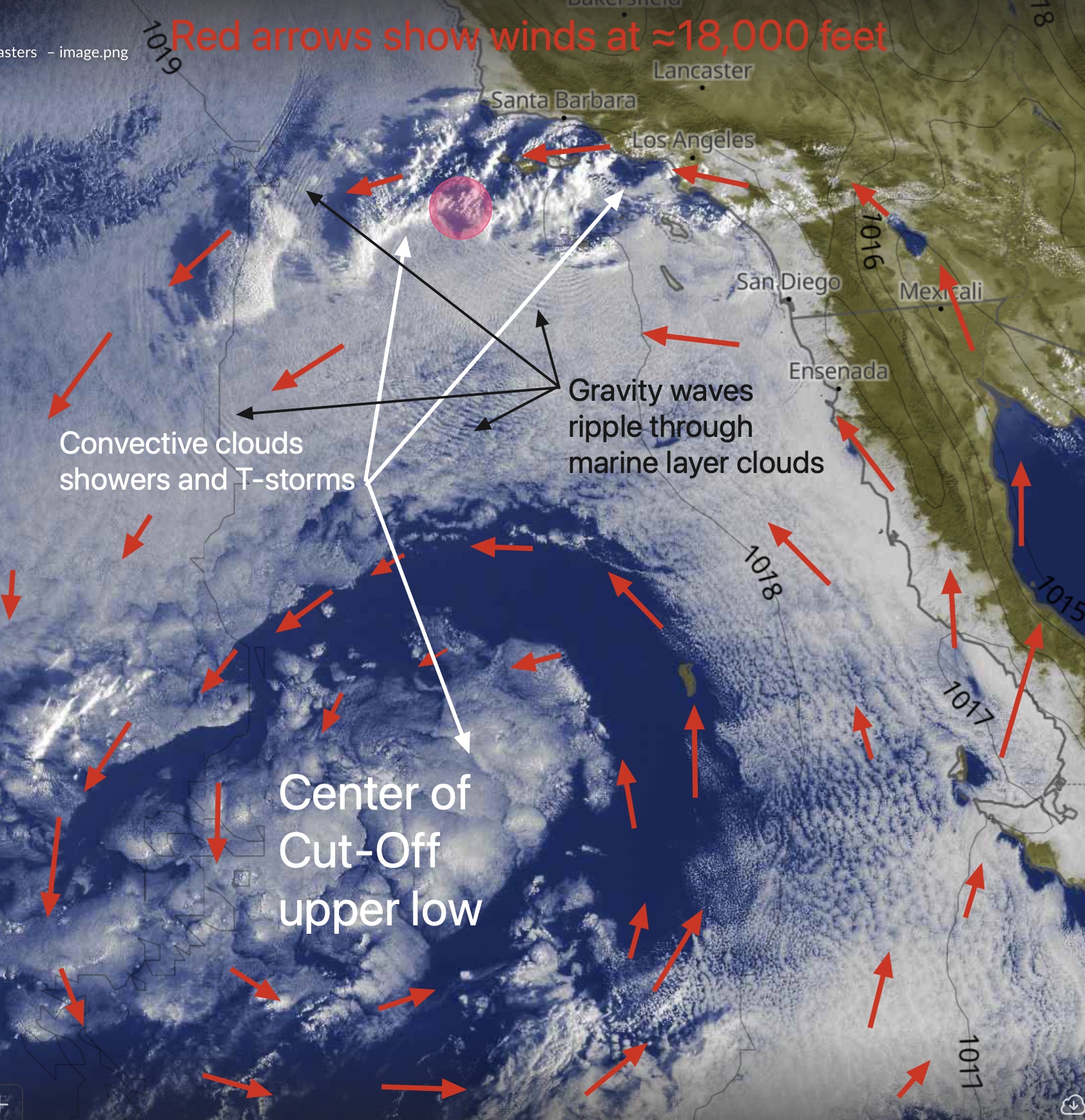
This image shows that Cut-Off upper low from a satellite perspective.
The flat-looking mass of clouds over the Baja and Southern California shorelines and extending way out into the Pacific are marine layer clouds.
The ugly-looking mass of clouds in the lower left of the image is the center of the Cut-Off upper low. Notice the intense convective activity in the center and how the marine layer clouds have been mixed out around the Cut-Off upper low. The red arrows show the upper-level winds circulating around the Cut-off low. Notice the convective clouds and showers being steered by the Cut-off low over the Santa Barbara area to past the Jalama area. Lastly, check out the Atomsperic Gravity waves rippling through the marine layer clouds near centers of convective activity.