Have you noticed that our San Francisco Bay Area forecast text has barely changed recently? Almost every day there is mention of the Central Valley thermal low over the coast and a chance of an eddy and largely absent NW ocean winds. Before you attribute the repeated forecast text to forecaster laziness consider the Rex Block.
The Rex Block meteorological phenomenon was discovered by Dr. Daniel F. Rex in the 1950’s for whom it was named. It is evoked anytime a forecaster is too lazy to write new text. (edit this out of the final draft)
(This old blog of mine talks about a Rex Block in a different situation.)
Here is NWS description of today’s Rex Block:
“A blocky pattern ie Rex block [blocking pattern where there is an upper level high located directly north of a closed low] pattern will remain along the West Coast this week, another reason for a near persistence forecast. The global models show the pattern will begin to slowly advance inland late this weekend and early next week, the westerlies trying to push the blocky pattern eastward. It’s at this point that the deterministic model output diverge in solutions. The upshot to this however is that the pattern is at least during the short term through the week preventing the development of (strong) offshore winds.”
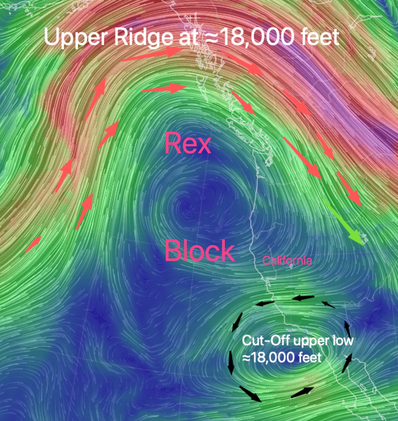
A Rex Block stops the typical progression of weather patterns from west to east. In this first image, we are seeing the current Rex Block. First, find California. Then notice the strong upper ridge winds at ≈18,000 feet. Then note the Cut-Off upper low just west of Southern California and Baja Norte.
This orientation of an upper-level ridge and low acts to block the movement of weather systems.
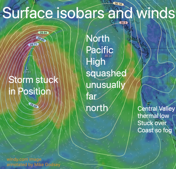
The next graphic shows some of the weather systems that are blocked this week.
Notice the storm way out in the Pacific north of Hawaii. This storm is positioned so that it is squashing the North Pacific High against the west coast and also holding it in an unusually northerly position for October.
Normally the NPH would be west of Baja by now and much smaller. At this point, you are probably wondering… if the NPH is near California where are all our NW ocean winds.
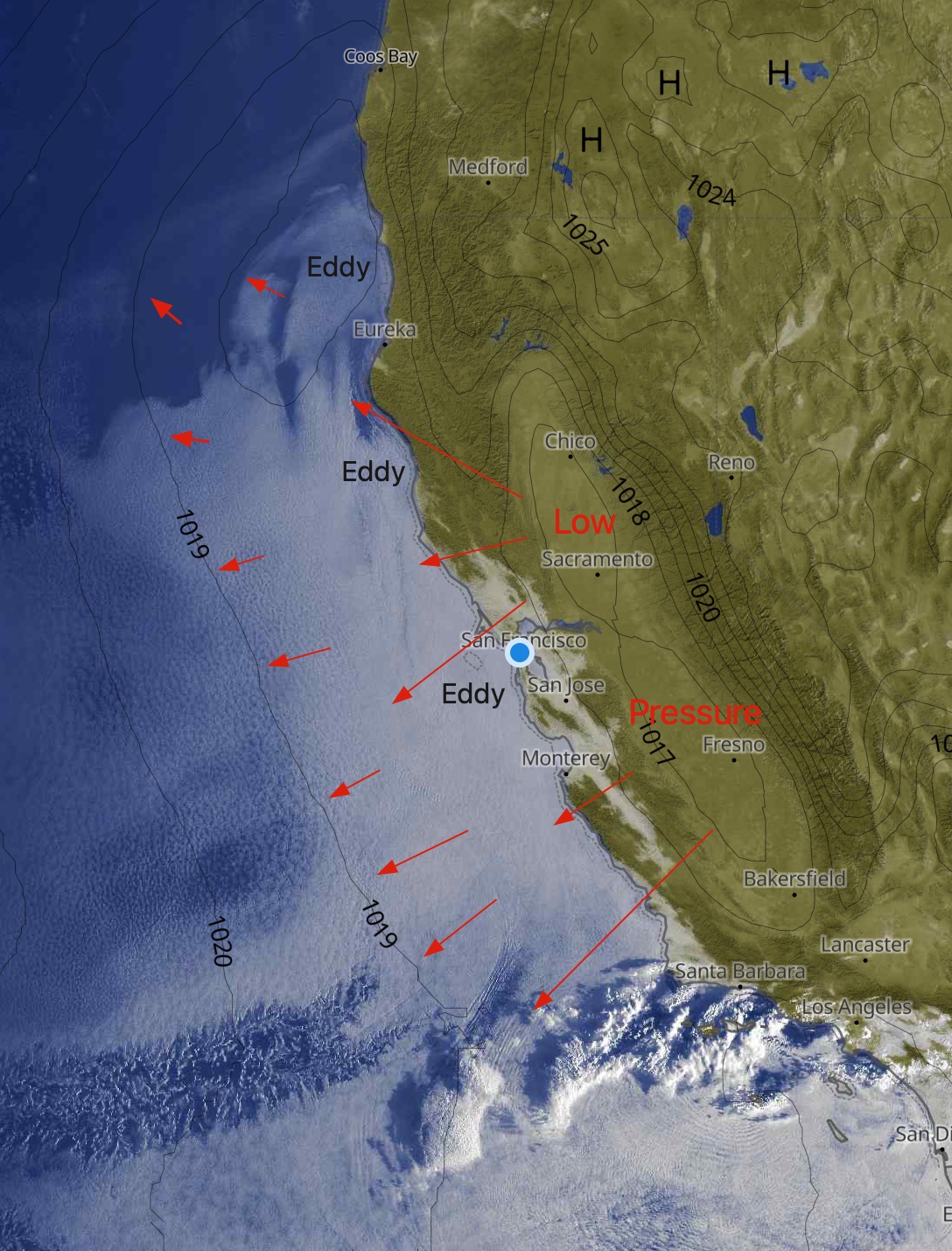
The upper ridge also heats up the Central Valley and Great Basin. This causes the Central Valley’s thermal low to expand over the coast as you can see in this third image. This in turn keeps the NW ocean winds away from our coasts. It also sets the stage for southerly coast winds and sometimes and counter-clockwise spinning eddy near San Francisco. Both of these factors in turn push marine layer clouds into the Bay Area each morning like it was a classic June Gloom day.
Since all of these players are mostly locked in position our weather and winds are not changing as much as normal in October.