 by Mike Godsey: Baja daily human forecast Questions about the forecast: Mail me mgodseywf@gmail.com
 Part one of this blog discussed the basic causes of the low-pressure trough that helps our El Norte winds flow down the Sea of Cortez. This blog focuses on the role of topography in shaping that low-pressure trough.
As water people our eyes are always turned towards the Sea of Cortez. But take a look behind you. Steep mountains the length of Baja with only a few gaps where strong El Norte winds curve through as NE 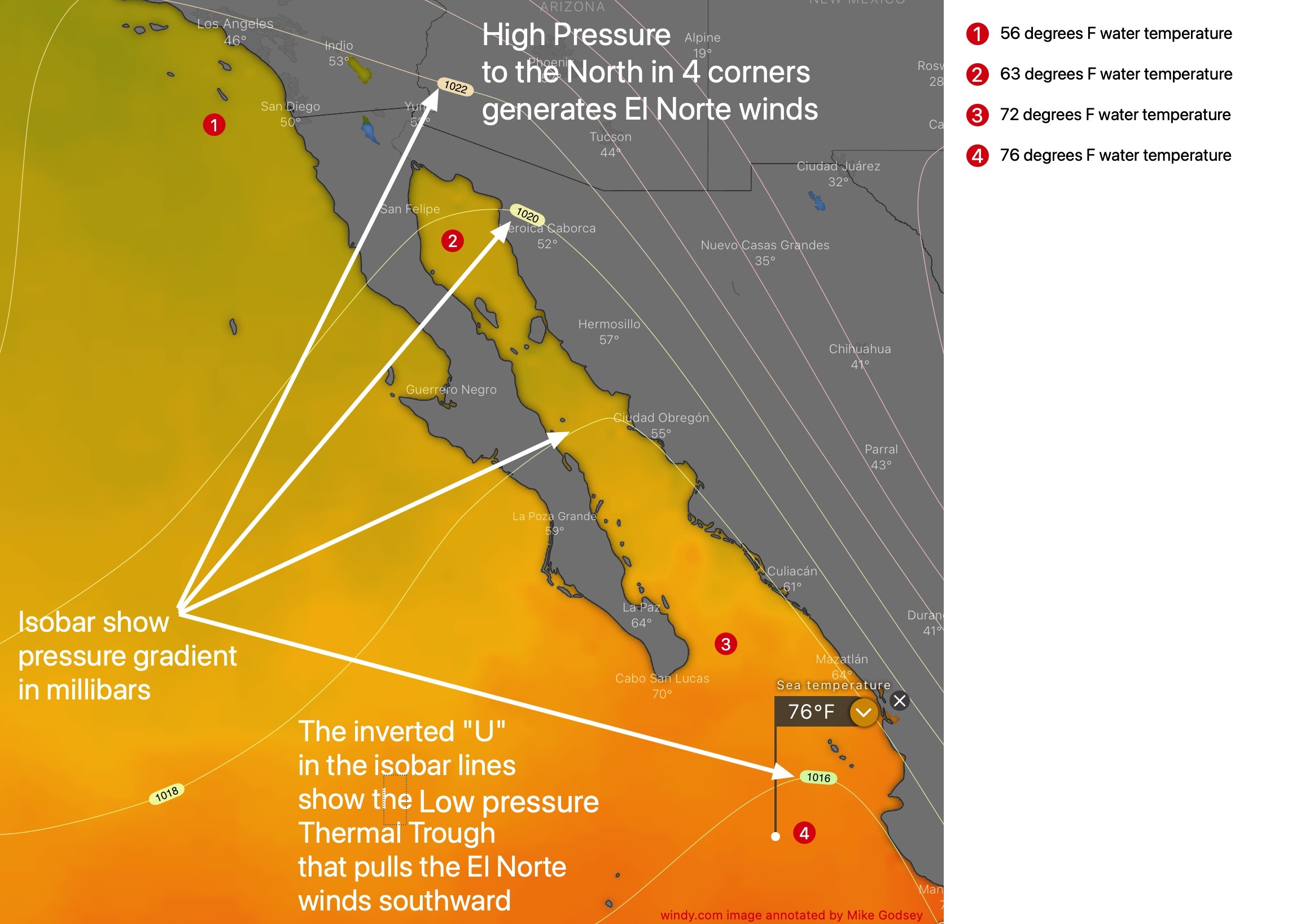 winds and blow dozens of miles into the Pacific.
Similar mountains are on the far eastern side of the Sea of Cortez on the mainland of Mexico.
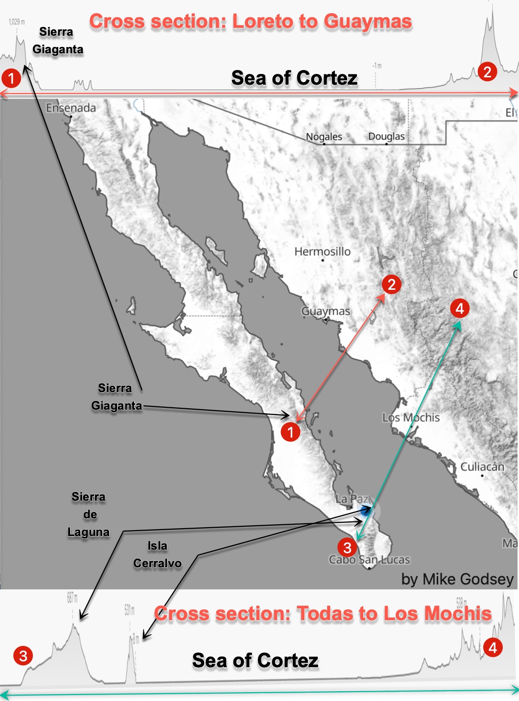
Looking at the cross-section 1 to 2 across Baja and the Sea of Cortez to the mainland you can see that the we are kiting or winging over a bowl of water with mountains making the sides of the bowl.
Looking a cross-section 3 to 4 you can see the same bowl but with Isla Cerralvo sticking out.
Predawn each morning chilly air from the mountains flows down towards the Sea of Cortez. Hence the weak westerly winds you feel when you awaken and see on our wind graphs. That chilly air is dense air so it creates a low-pressure zone along the shore which keeps any El Norte winds away from shore.
Then as the sun heats the land the pressure lowers locally.
Meanwhile, this bowl acts to partially contain the low-pressure trough south of Cabo created by the warmer waters to the south. This containment acts to increase the pressure gradient. While the mountains on either side of the Sea of Cortez funnel and accelerate the wind as it goes towards that low-pressure trough.
Every few weeks in the winter that trough moves northward into Southern California it weakens or even kills Sea of Cortez winds. That movement northward becomes more common in the Spring and Summer and the windy season dies away.