by Mike Godsey: Baja daily human forecast Questions about the forecast: Mail me mgodseywf@gmail.com
 I always talk about high pressure and our northerly winds. Mostly I labor over the location of high pressure in the Great Basin and 4 corners.
And sometimes I mention the winds of the North Pacific High that span much of the Pacific and reach Baja. So often I go on and on about how both impact Baja wind.
But you have to ask yourself… where do those thousands of cubic miles of fast-moving northerly wind from the high pressure go to?
The short answer is that the El Norte winds from the high-pressure flow towards the low-pressure trough that is commonly found over the Sea of Cortez and is especially strong south of Cabo San Lucas.
But what the hell is a low-pressure trough?
Answer…
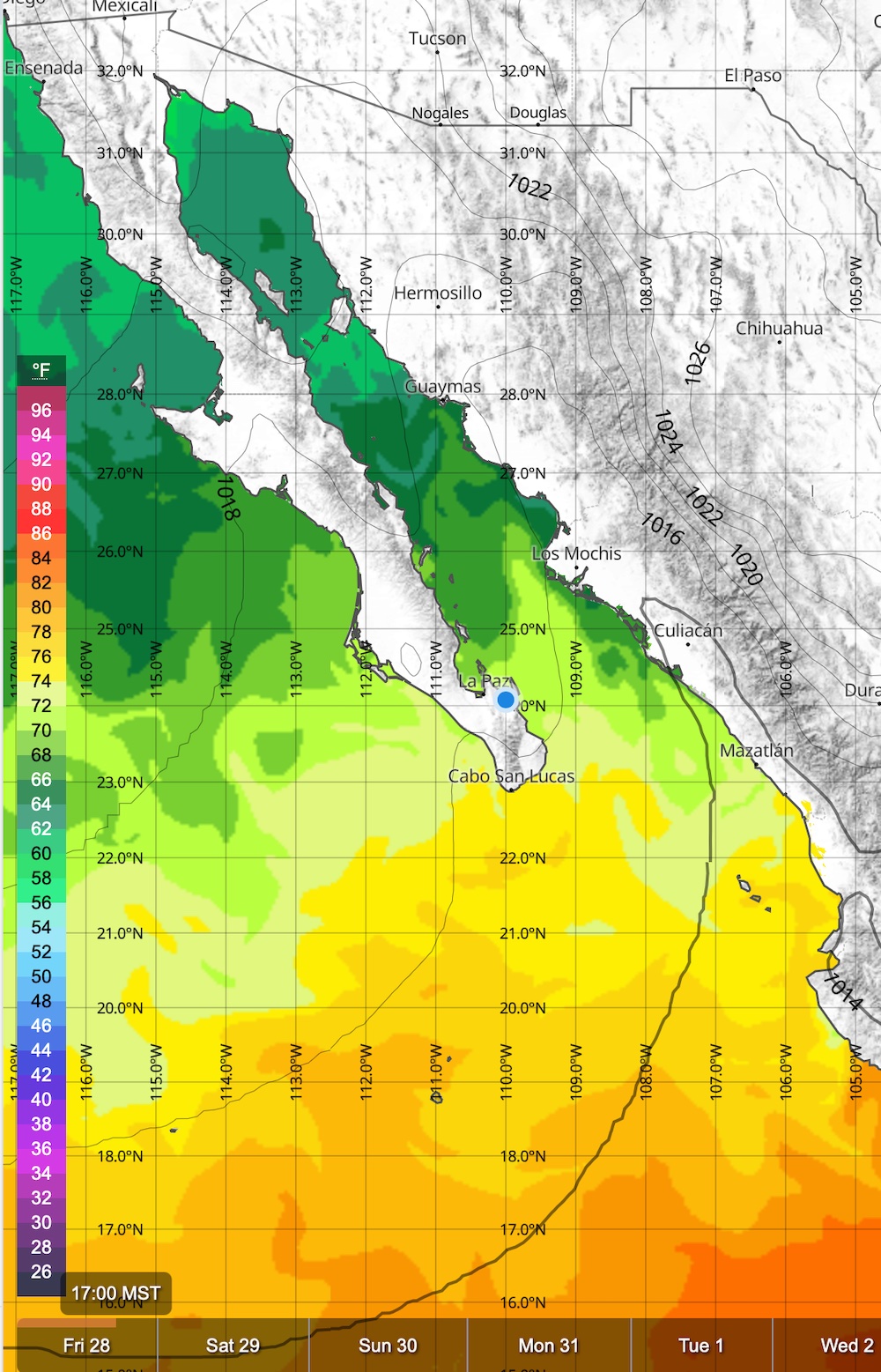
Looking at the first image notice the strong water temperature gradient from the chilly Northern Sea of Cortez and the hot tropical waters to the south. The warm water heats the water above it. And warm air is less dense and that in turn means lower pressure to our south. Hence a low pressure which is called a trough due to its dippy shape.
But there is more to this wind equation. See those mountains on either side of the Sea of Cortez. They also play a role in shaping our low-pressure trough that sucks the northerly winds past Baja’s East Cape.
Here is Part Two of this blog.