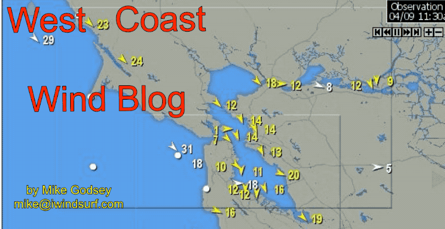
by Mike Godsey, mikeATiwindsurf.com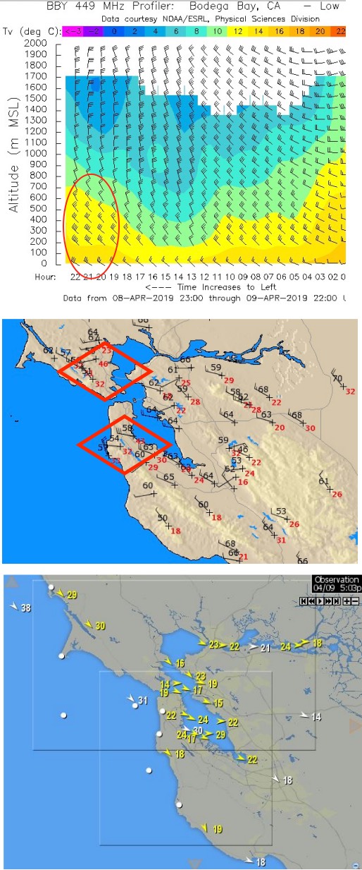
As you can see in my banner animation above lots of sites had strong wind yesterday. The day played out pretty much as outlined in my 2 recent blogs about convergence aloft and the two NPH’s merging.
This blog shows how the surface winds you see in the banner were related to the winds aloft.
The first image is from the Bodega 449 MHz profiler. Notice that the time axis goes from right to left.
I have circled the very strong afternoon NW winds in the 25 to 40-knot range that the profiler picked up from near the surface to 500 meters aloft.
As these winds hit the Bay Area’s complex topography a bit of their momentum is transferred to the surface winds which you experience as gusts, lulls and shifts.
The second image shows the gusts, in red, of the RAWS sensors about the greater Bay Area. Note the very strong gusts on sensors located on hilltops.
Typically these strong winds aloft will subside on the 2nd or 3rd. day of a big NW wind event. This occurs either because:
- The North Pacific High moves away from our coast or
- Because the convergence aloft shifts away from us or
- Because part of the NPH moves inland to our north creating NNE ocean winds and unfavorable NE winds just aloft over the Bay Area. Both of these events make it harder for the wind to curve into the Bay.
However, at this time it looks like a huge North Pacific High will squat over the waters between California and Hawaii for 4-5 days. It has a lot of support from an upper ridge and convergence stays fairly close to the west coast.