By WeatherFlow meteorologist Shea Gibson.
Besides being a great place to visit with more miles of beach than any other state in the US (663 miles to be exact), the title above actually eludes to a stagnant weather pattern that develops during the hotter months along the east coast of Florida. During the spring, the subtropical jet (a belt of upper level warmer air) starts to lift up into the United States to help turn the season. Bermuda High’s start to briefly park out in the Atlantic and place what is called a “ridge axis” over the northern to central FL east coast and keeps wind speeds lowered along the SE/ESE flows. As we get into the summer months, this pattern becomes more fixed (also known as a Bermuda-Azores blocking pattern). For eastern FL, many times we see haze and fogging , which are signs of stable air…instability is needed for stronger winds to develop. Other times we see cloud contamination overrunning the land and sea interface with nagging rains/showers throughout the day, which further squashes winds.
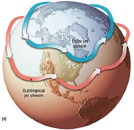
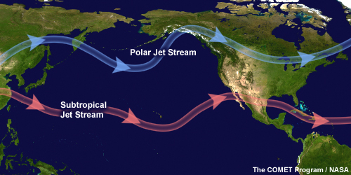
Here are examples of the subtropical jet stream (with the winter-time polar jet stream receding to the north).
The first thing we need to look at for evidence is that during these hotter months, the Gulf of Mexico tends to hold its own blocking pattern as High pressure nestles up into the northeast Gulf and parks for days at a time – and sometimes up to a week or longer. This is partly due to the curvature of land and heat fluxes/dryer air in that pocket of coastline. It is also partially due to the subtropical jet stream pulling up from the south and stretching across the northern part of the state (sometimes stretching frontal boundaries horizontally as they drop down along the northern Gulf). The central area of this High keeps mainly mild Sea Breezing along the western side of FL to areas such as Pensocola all the way down to Tampa Bay and further south. This High pressure also tends to bring a W/NW element northwards all the way up into the Carolinas to add to their nocturnal land breezing – and in many cases, they help provide good mid/upper level westerly convergences to fire off storming that helps bring GA/SC/NC Sea Breezes up in speeds. An occasional secondary lobe of Southern Appalachian High pressure is sometimes able to push that flow even higher.
Meanwhile, back on the east coast of Florida, there is a struggle as winds clocking around the NE Gulf High are keeping the builds down to central and south Florida while pushing a NW/N synoptic flow down the coast. At night during radiational cooling, this is increased…and also cross-cuts the Sea Breezes during the day. This sometimes great for the Gulf side if the Gulf High lies further west and their Sea Breezes are able to build off the onshore NW flows, but not so good for the Atlantic side of the state.
Here is a typical pattern where we see the Northeast Gulf High firmly in place. Notice this is at 0:00 (12:00am) for the night time values to show NW flow to east FL, W/WNW directions to GA/SC and W/WSW to Southeast North Carolina. This represents a solid summer nocturnal land breeze setup along SE Regional coastline.
Secondly, let’s take a trip out into the North Atlantic…where Bermuda Highs (large areas of stationary High pressure) park for days and up to weeks at a time during the north Atlantic blocking pattern. These Highs tend to stretch across the Atlantic, with their centers expanding outwards along what is called a “ridge axis”, or area of very weak winds. One important thing we have to understand about a ridge axis and surface wind directions is that not only is it an extension of the center of High pressure, it is a point of curvature. Winds below it come from the SE/SSE at a weaker flow up to the axis point, then South with a little more “umph”…and ultimately increase from the SSW/SW as we get away from it on the upswing to the north. Cold fronts dropping in to the SE Region come to die during their frontolysis (fizzling) stage as the opposing flow stalls them and breaks them up.
More on axis ridging here: https://blog.weatherflow.com/subtropical-ridging-effects-in-the-se-region/
Here is an edited WSI surface map from April 11, 2014 showing the details of ridge axis placement and wind directions (in yellow arrows). This is a little early in the season, but a good start.
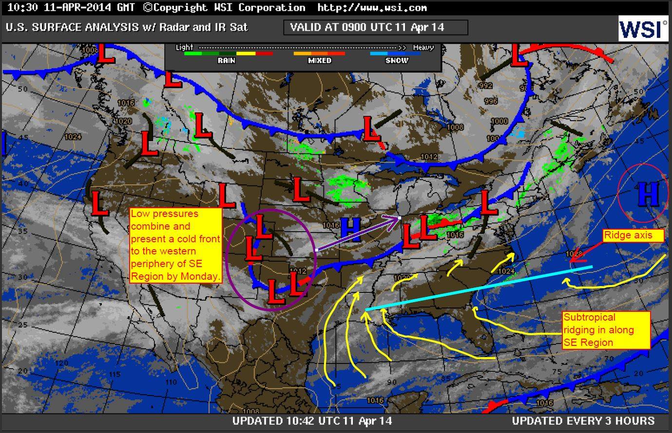
Notice how far north that High pressure is in the pic above…this changes in the warmer months as these High’s park over Bermuda. As a result, this ridge axis is forced southwards over northern to central Florida and can park for long periods of time. This coupled with the NE Gulf High pressures (opposing wind directions from the NW across land) creates a very weak setup for Sea Breezing along the eastern FL coast. The SE directional winds simply do not allow a healthy Sea Breeze convergence zone – or an area where storming takes place inland for proper storm outflow/return flow for Sea Breeze circulations to maximize. As winds straighten up along coastlines (SSE to Georgia and SSW/SW to South Carolina & North Carolina), we tend to see that issue correct itself as land heating/radiation and inland storm line-ups help to get that atmospheric wind wheel going.
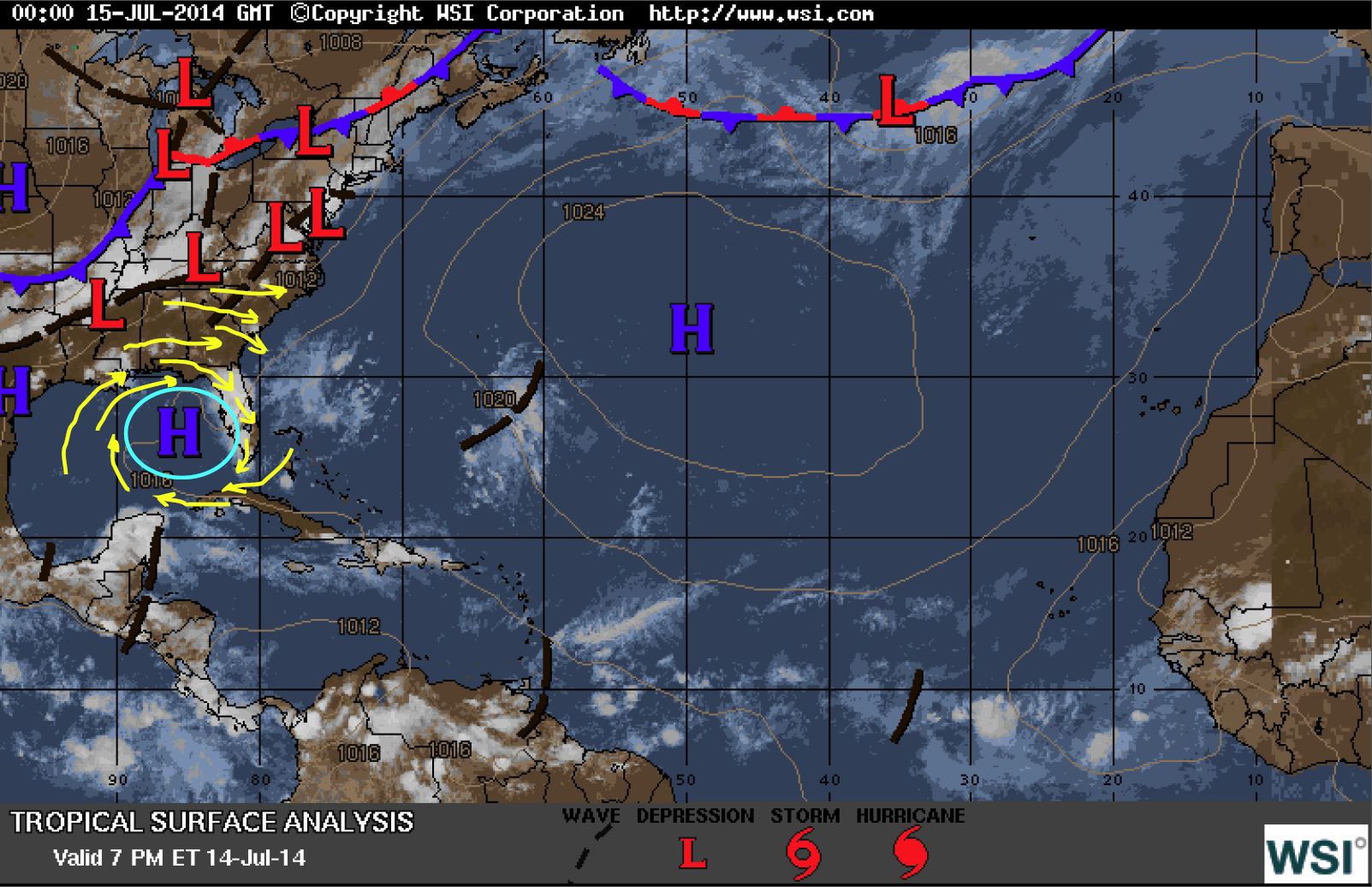
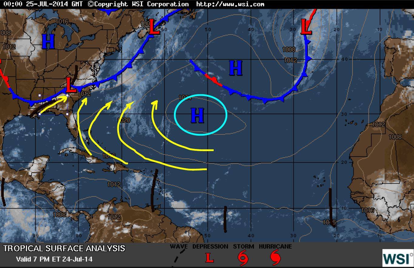
The more robust a Bermuda High is (1024 millibars in the least as a rule of thumb) and the weaker the NE Gulf High is, the better the chance for a build down the east coast of FL with the cutoff pushing further south. See below from July 25, 2014. The ridge axis is not drawn here, but you can see that it has dropped further south into southern FL, with central/northern FL seeing higher numbers along a S/SSE flow- with Sea Breezing pushing SE winds up a few notches where allowed.
Here are some typical summer patterns captured where you can see how the winds are being affected by this “ridging” process.
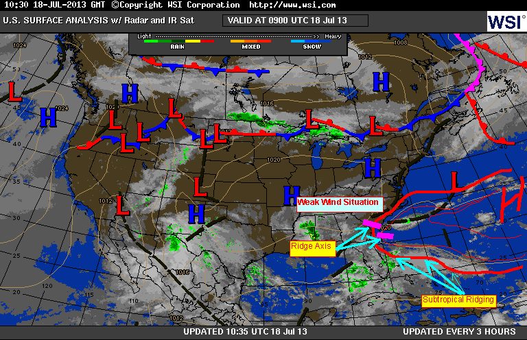
July 18, 2013
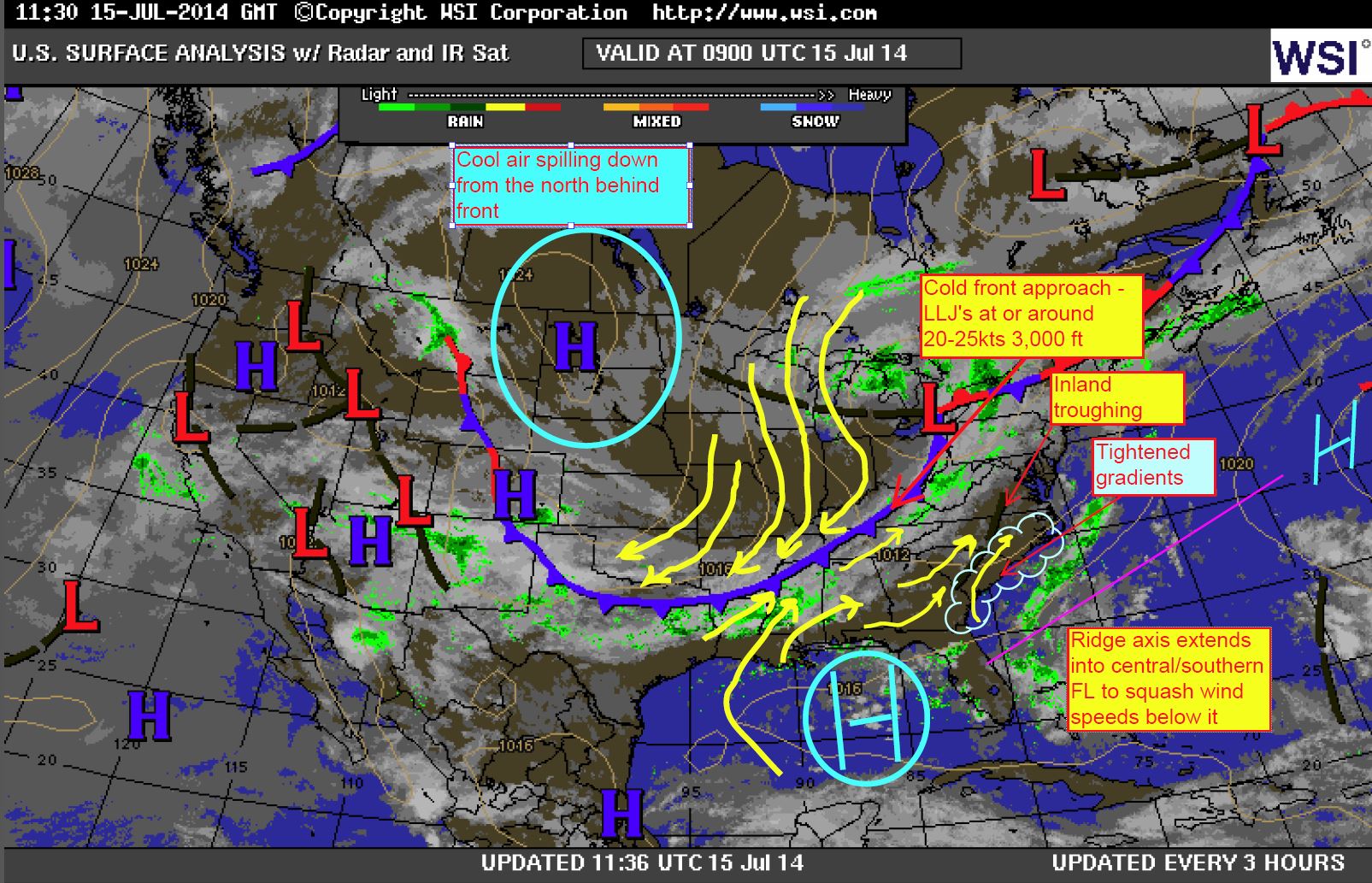
July 15, 2014 – notice the Gulf High (it did form as a secondary lobe as the day heated up)
July 28, 2014 where NE Gulf High shows cross-state directions cuts the flow off …with that SE ridge creeping up from the Caribbean.

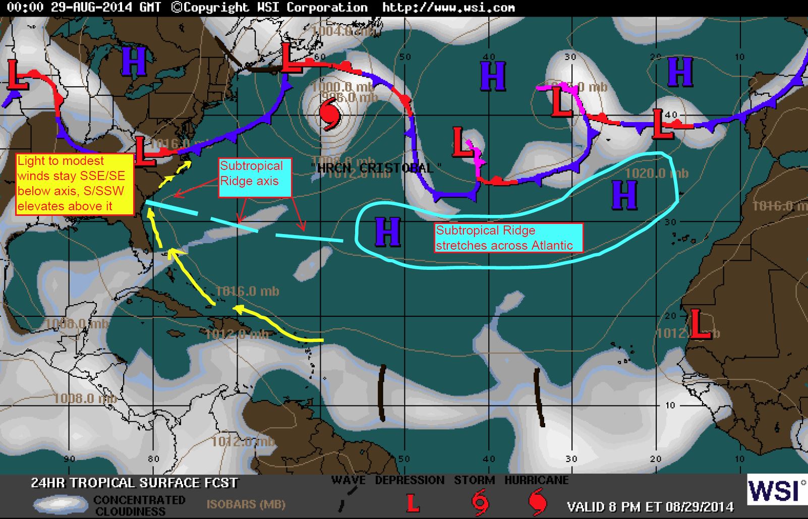
August 29, 2014 ridge axis drifts north and keeps all locales below it weak.
Thirdly, Florida is in what is called the Horse Latitudes (also “calms of Cancer”) specifically 30°N in the northern hemisphere and is extended up to 35°N. This means that it is typically an area of calm winds with fog and haze. One story of the name Horse Latitudes is believed to have come from ships that could not make it with hardly any winds for backing during the hottest months. As a result of such slow progress, supplies dried up and horses on the voyage died. They were then thrown overboard and were seen by following ships – kind of an eery thing to see for sure. Other theories say it was a ritual on the ship for a deck hand to work off debt with a parading ceremony of a straw horse being thrown overboard. Either way, let’s move on…
Florida sits right along and between what is called the Ferrel Cell and the Hadley Cell – these are where heated air currents at the equator rise and move away from the equator. As it reaches out towards the mid latitudes (Horse Latitudes), it starts to cool and sink… thus creating the subtropical ridge.
Vertical profile:

Side Profile with labels for wind directions:

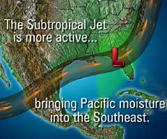
Lastly..and more scientifically for the real zen masters out there, the El Niño Southern Oscillation (ENSO) can effect the subtropical ridge placements as jetting pulses upwards from the Gulf and up to the northern Carolinas. La Niñas can allow for a more northerly axis for the ridge (and higher yield of Atlantic/Gulf tropical activity)….while ENSO neutral cycles and El Niños show flatter, more southerly ridges that park near or over central/northern FL (and weaker yields of Atlantic/Gulf tropical activities).
This is the pattern El Niño might normally follow for this warm season in its positive phase – with teleconnection possible to show quite a few atmospheric rivers (Pineapple Expresses) from the south and western Pacific across the Gulf and into the Atlantic.
The general idea here is that Florida’s east coast goes into their non-windy season as we get into the hotter months. It’s been accepted as “just the way it is” by many for decades and even centuries…but hopefully this helps answer some of the question as to why this occurs.
Cheers,
Shea Gibson
WeatherFlow Meteorologist
SE Region/ EC / Tropics
Outreach & New Station Projects
Twitter: @WeatherFlowCHAS