In Part 1 of this 3 part blog we saw how lingering
high pressure over the Great Basin kept the El Norte winds blowing for days rather than the typical 2-3 days.
But the question remains… why did that high pressure linger so long and stay so strong. Part 2 of this blog answers that question.
The answer to the lingering El Norte is far aloft and requires that we talk a bit into upper-level winds from about ≈18,000 feet to the jetstream level.
It always sees a bit weird to talk about winds miles aloft when our wings, masts and even kites are mere yards above the surface. But the winds from about ≈18,000 feet all the way up to the jetstream impact the surface winds in many ways.
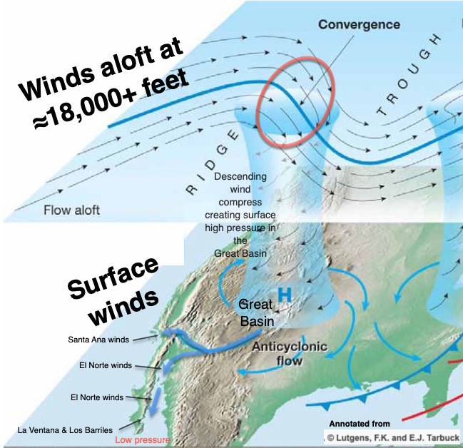
These upper-level winds form northward and southward extending loops.
First, these loops steer surface storms and surface high pressure mostly from west to east. Second, these loops also bring warmer to colder air to the surface. And third, these loops also strengthen or weaken surface storms and high pressure areas.
Looking at the first image note the winds aloft over the western USA. Especially notice the area where those winds converge together. When this happens more air is packed into a given volume. This increases the air’s density. Being relatively heavier this air descends towards the surface creating increasing pressure at the surface so there is a stronger zone of high pressure at the surface. In this case, this high pressure is over the Great Basin.
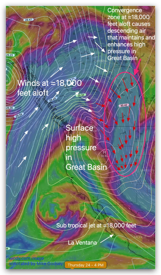
The next image shows the actual setup this week over the western USA and Baja.
The white arrows show the upper-level winds in a ridge over the west coast. The red arrows show the area where these winds converge. This convergence enhances the surface high pressure shown by the white isobar lines. Note how these lines are over the Sea of Cortez. This indicates a strong pressure gradient creating El Norte winds. This upper-level ridge stays locked in place during most of this week. Hence, the lingering El Norte winds. Also, note the upper-level winds of the subtropical Jet stream. Those winds could bring wind-killing clouds to Baja’s East Cape. And that is the topic of Part 3 of this blog.