In Part 1 of this blog, we saw how lingering surface high pressure over the Great Basin kept the El Norte winds blowing for days rather than the typical 2-3 days. In Part 2 we saw how an upper ridge can anchor that surface high pressure in place while increasing its strength. Now Part 3 looks at clouds and the El Norte winds.
Having high pressure in the Great Basin and a supporting upper ridge just insures strong El Norte winds are coming down open waters the length of the Sea of Cortez. Since there are thousands of cliffs, points and other terrain along the shoreline of Sea of Cortez the wind near shore will be very UP and Down and weak unless there is something to curve the winds outside to the launch sites.
That something is heating in the coastal valleys that creates a local pressure gradient that 1. Curves the strong wind outside to the beach and 2. Creates local sea breezes that enhance the large-scale El Norte winds.
And for this, coastal valley heating to happen we need lots of blue sky! So it is not enough to just forecast the wind we also have to try to forecast something as ephemeral as the cloud distribution. And this is something the models struggle to do on the micro-scale of a valley on Baja’s East Cape. This is critical since even a few clouds
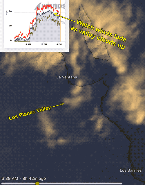
in the valley can cause a wind fade as you see in this first image from last week.
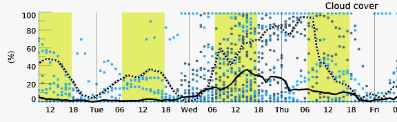
This next image show % of cloud coverage over the Los Planes Valley inland from La Ventana for this Wednesday and Thursday as projected by a bunch of models.
So I usually end up doing “bottoms up” forecasting when it comes to clouds and coastal valley heating.
That means looking at the cams along the coast, especially at Todas and looking at the satellite imagery and try to determine if the valley is likely to be clear in the afternoon. Yesterday, Monday, November 21 is a good example.
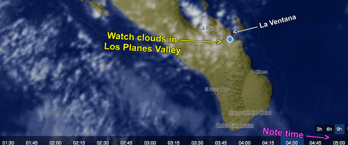
At dawn, there were lots of clouds in the La Ventana area and the valley. But look at this satellite animation from today and draw your own conclusions.
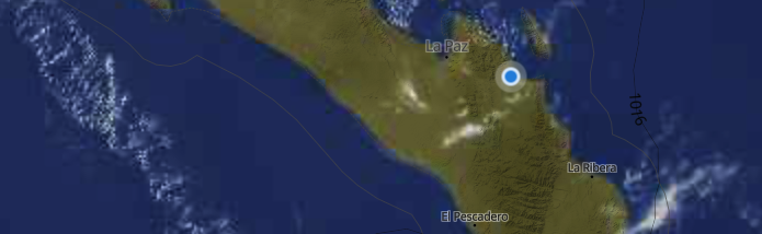
The satellite imagery for today, Tuesday, is a lot more promising at dawn. Notice the sparse clouds inbound from the west: